.jpg)
El Oro Province
The name still carries the shine, even though the mines are long quiet. El Oro - "the gold" - earned its title in the late sixteenth century, when Spanish colonizers forced Indigenous laborers into the hills around Zaruma to extract the ore that would cross the Atlantic in the holds of galleons. Today, the yellow wealth of Ecuador's southernmost coastal province travels a different route. Stand in Puerto Bolívar and you can watch it go: banana-laden ships pulling away from Machala, bound for kitchens in Rotterdam, Osaka, and Dubai. One commodity replaced another, and the province kept its name.
The Weight of the Word
The gold was real, and so was the cost. Philip II of Spain, ruling from Madrid in the late 1500s, thought enough of the mountain village to grant it the grand title "Villa de Sant Antonio del Zerro de Oro de Zaruma." The royal court wanted metal; the metal came out of tunnels dug by Indigenous people who had been enslaved for the purpose. Production peaked in the late sixteenth and seventeenth centuries, then shuddered to a halt in January 1749 when an earthquake collapsed the workings. A local rebellion followed, and the crown was forced to share some of the proceeds with the surviving miners before operations resumed. Spain kept importing El Oro gold until 1820, when independence finally cut the supply line.
Why the Province Exists
In 1882, a new republic trying to organize itself carved off a southwestern wedge of coast and called it El Oro. The first capital was Zaruma, the old gold town up in the hills. Two years later, the political center slipped down to Machala, on the muddy flatlands where commerce actually happened. Gold kept flowing, though now through private companies paying taxes to Quito rather than tribute to a distant king. Then came the bananas. As the mines' yields faded in the twentieth century, growers discovered that El Oro's climate - hot, wet, and reliable - produced one of the world's great bananas. The province converted itself from a mineral economy to an agricultural one, and Machala began calling itself the banana capital of the world.
The Year the Border Moved
In July 1941, Peruvian forces crossed into El Oro and occupied nearly the entire province. The Ecuadorian-Peruvian War was brief - weeks, really - but it left scars that the coastal towns still remember. The Rio Protocol of 1942, signed under pressure from neighboring states, formalized a border that Ecuador would dispute for the rest of the century. For the province named after its buried wealth, the 1941 occupation was a reminder that geography sits beside neighbors with their own ambitions. The Jambelí Islands, the fringe of mangrove coast, the lowland plains that grow the bananas - all of them nearly became someone else's territory.
Stone Trees and Shrimp Farms
Beyond Machala's docks and the gold hills of Zaruma, El Oro holds surprises. The Puyango Petrified Forest on the Peruvian border preserves Araucaria logs that fell more than 100 million years ago, turned to stone by volcanic ash and mineral-rich groundwater. The Jambelí archipelago strings along the Gulf of Guayaquil in a tangle of mangroves where Afro-Ecuadorian fishing communities have worked the tides for generations. Inland, the town of Piñas produces coffee so good it has won international cups. Shrimp ponds stretch across what used to be estuary, a second great export alongside bananas, generating billions of dollars and hard debates about where the mangroves used to be.
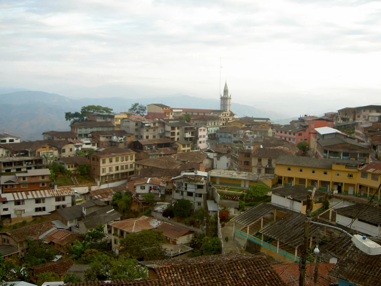
Who Lives Here Now
The 2020 projection counted about 715,000 people in El Oro, making it Ecuador's sixth most populous province. The 2010 census found the population mostly mestizo, with meaningful Afro-Ecuadorian and Montubio minorities reflecting centuries of Caribbean and lowland coastal culture layered atop Indigenous roots. In Zaruma, Republican-era wooden buildings still climb the steep hill; the town has been nominated for UNESCO World Heritage status for its timber-built mining architecture. Down in Machala, the pace belongs to the port: ship horns, cooling trucks, and the relentless churn of bananas moving toward the world's tables.
From the Air
El Oro Province occupies Ecuador's southwestern corner at approximately 3.48 degrees south, 79.82 degrees west. Nearest major airport is General Manuel Serrano Airport at Santa Rosa (SERO), with Jose Joaquin de Olmedo International at Guayaquil (SEGU) providing regional hub service roughly 110 nautical miles to the north. From cruising altitude, pilots can identify the Gulf of Guayaquil to the north, the Peruvian Tumbes Region to the south, and the Andean foothills rising sharply inland from the banana-plain coast. Puerto Bolivar's long container piers sit at the river mouth. Best viewing at 8,000 to 12,000 feet; mornings are often clear, afternoons build convective clouds over the Andes.
Nearby Stories
- Department of Tumbes 23 km away
- Puyango Petrified Forest 24 km away
- Saraguro People 32 km away
- Girón, Azuay 34 km away
- 2023 Guayas earthquake 40 km away
- Loja, Ecuador 43 km away
- Cerros de Amotape National Park 81 km away
- Las Vegas culture (archaeology) 111 km away