.jpg)
Cerros de Amotape National Park
Peru has exactly one navigable river on its Pacific coast, and it runs through here. The Tumbes River cuts across the Cerros de Amotape National Park and keeps flowing long after the surrounding country has turned to desert - a fact that says almost everything about why this particular 1,500 square kilometers of dry forest and low mountain exists as a protected area. Jaguars live here. So do American crocodiles. So does the mantled howler monkey, whose morning calls can carry for three miles through the moister forest sections. The park has 111 bird species, miradores that open onto valley views, hidden waterfalls, and archaeological ruins most visitors never see because they never get past the entrance gate. The park rewards those who do.
The Mountains and the River
The park covers more than 150,000 hectares - 1,515 square kilometers - of the Cordillera de los Amotapes in Peru's Northern Coast region, on the Ecuadorian border. Elevations run from 120 meters in the river bottoms to 1,538 meters on the ridgelines, which is not alpine terrain but is enough relief to create the microclimates that make the park biologically interesting. The Tumbes River is the geographic spine of the place. It rises in the Cordillera and flows west through the dry forest toward the Pacific, navigable where most coastal Peruvian rivers are shallow trickles or dry gulches. The surrounding country is arid. The river corridor is not. That contrast is the park's animating principle.
Dry Forest, Moist Forest, Jaguar
What makes Cerros de Amotape ecologically valuable is not one ecosystem but the transitions between several. The dry forest holds white-tailed deer, red brocket deer, and the Guayaquil squirrel - a species found almost nowhere else in Peru. The moister forests along the river support the mantled howler, the yellow-tailed monkey, and the white-fronted capuchin. Neotropical otters work the Tumbes River itself. Predators include the ocelot and the jaguar, both of which are hard to see but leave their tracks in the mud where the river narrows. The park sits in one of the only pockets of equatorial jungle on Peru's Pacific slope, and the biodiversity reflects a place where Amazonian, Andean, and coastal-desert species all push toward their geographic limits.
Birds and Crocodiles
The 111 recorded bird species in the park include hawks, parakeets, and owls in predictable abundance, along with specialized residents like the gray-cheeked parakeet, the black-headed spinetail, and the slaty becard. On the right day, looking up at the right moment, you might catch an Andean condor soaring across the ridgelines. The largest reptile in the park is the American crocodile, an endangered species whose range in Peru is now largely restricted to these protected rivers. They are both imperiled and dangerous, which is the double bind many apex predators face: rare enough to need protection, large enough to hurt you if you forget to give them their space. Lizards and smaller snakes work the forest floor and the sun-warmed rocks.
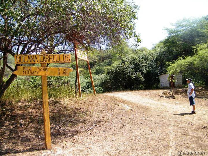
Trails into the Backcountry
Three trails provide most of the park's access. Sendero Cerro Amotape climbs to the top of the park's main mountain and rewards the difficulty with expansive views of the river valley below; the trail is challenging and sometimes poorly cleared, and you will want a map. Sendero El Salto is lighter traffic, passing through forest greenery to several miradores and ending at a hidden waterfall. Sendero Los Huacas is the longest of the three, about 8 kilometers round-trip over roughly four hours, with both wildlife and archaeological ruins along the way - a reminder that this dry forest was home to pre-Columbian peoples long before it was a national park. There are no stores or restaurants inside the park. Leave No Trace is the operating principle, and you carry out everything you carry in.
Getting There and Sleeping Rough
The nearest airport with good commercial service is in Piura, from which a bus takes you to Sullana, from which a taxi or arranged transport completes the long and not-cheap journey to the park entrances. Entry fee is roughly S/10 - about three US dollars - collected at the ranger stations. Camping areas sit near each ranger station: cleared tent sites with water, picnic tables, fire pits, and restrooms with showers. Do not expect RV support or anything beyond the barebones. The dry season runs May through October with daytime highs around 24°C and nights around 15°C, which is as close to perfect hiking weather as the Northern Coast gets. Wet season, November through April, turns trails muddy and the Tumbes River high. Come in the dry months, walk quietly, and the park gives up its jaguars and its crocodiles one rare sighting at a time.
From the Air
National park at 4.15S, 80.59W, straddling the Peru-Ecuador border in the Northern Coast region. Park elevations range 120-1,538m in the Cordillera de los Amotapes. Nearest commercial airport is Piura (SPUR) 80nm southeast; Capitan FAP Victor Montes Arias (SPTN, Talara) is closer at 50nm but smaller. Approach from the coast to see the transition from arid Pacific desert to the park's green river corridor. Best flown in the dry season (May-October) when clear skies reveal the ridgelines and the Tumbes River's path through otherwise brown country.
Nearby Stories
- Cabo Blanco, Peru 14 km away
- Alamor 20 km away
- Talara Refinery 23 km away
- Poechos Reservoir 36 km away
- Tumbes 42 km away
- Ayabaca province 55 km away
- El Oro Province 57 km away
- Malpelo Plate 790 km away