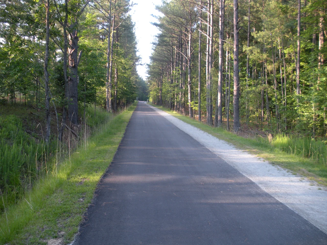

American Tobacco Trail
The trains stopped running in the 1980s, and for nearly two decades the right-of-way slept in the Carolina pines, rails rusting into ballast, until volunteers with a $2,500 grant decided that an abandoned railroad could become something more useful. Today the American Tobacco Trail runs 22.6 miles from the rural quiet of New Hill, north through Chatham County woods, across the Jordan Lake watershed, and into the heart of downtown Durham, ending across Morehead Avenue from the Durham Bulls Athletic Park. The route once belonged to the Norfolk and Southern Railway, whose predecessor built the line in 1906 to feed leaf to the American Tobacco Company's vast Durham complex. The cargo it carries now is human.
What the Trains Left Behind
The Durham and South Carolina Railroad built the spur in 1906, connecting the New Hope Valley to Durham so American Tobacco could move leaf by rail. Norfolk Southern acquired the line in 1957. By the 1970s, trucking had displaced rail for tobacco transport, and the line's working life was ending. In Chatham County, the U.S. Army Corps of Engineers began impounding Jordan Lake in 1981, eventually flooding part of the original right-of-way. After the Southern Railway and Norfolk Southern merged in 1974, the line became redundant, and Norfolk Southern began the formal abandonment process around 1979. Three counties of corridor sat unused, a ribbon of cleared land waiting for a second purpose.
A Grant, a Tunnel, and a Bridge
The Triangle Rails-to-Trails Conservancy formed in 1989 with the simple idea that abandoned corridors should not be abandoned. The first money was modest, a $2,500 grant, but Jon Parker and the volunteers who followed him built phase by phase. Leslie Kennedy and the NC Horse Council pushed for a tunnel under US Highway 64 so equestrians could keep moving through Wake County. Congressman David Price secured federal money to complete the Chatham section in 2010. The hardest piece was the I-40 gap in Durham. A pedestrian bridge over the interstate finally opened in February 2014, ten months late after construction errors forced a delay, finally stitching the northern and southern segments into one continuous trail.
Three Counties, Three Surfaces
The trail changes character as it moves. From New Hill at the southern end, the 6.5-mile Wake County section is gravel, popular with riders on horseback. The Chatham County middle, 4.7 miles managed by the town of Cary, splits into a paved lane and a parallel equestrian path. The northern 11.4 miles in Durham County is asphalt, 10 feet wide with loose gravel shoulders, open to walkers, cyclists, rollerbladers, and wheelchair users but closed to horses. Each transition feels like a shift in atmosphere, from quiet farm road to suburban greenway to urban commute. The Durham segment is also part of the East Coast Greenway, the spine of trails that aims to run from Maine to Florida.
Endings and Beginnings
The northern terminus is symbolic. The trail spills out across Morehead Avenue facing the Durham Bulls Athletic Park, the minor-league stadium that anchors the renovated American Tobacco Historic District, where the brick factories that once made Lucky Strike cigarettes have been turned into offices, restaurants, and apartments. The leaf shipped down this corridor for less than a generation. The trail has now outlived the railroad that built it. On weekend mornings the asphalt fills with commuters, fitness riders, and families pushing strollers past the old Southpoint mall and over the I-40 bridge that took so long to finish. The conservancy still meets, still advocates, still planning the next corridor.
From the Air
The American Tobacco Trail runs roughly north-south at 35.99 N, 78.91 W, between Durham and New Hill. From cruising altitude the corridor reads as a thin green line through Wake, Chatham, and Durham counties, crossing I-40 near The Streets at Southpoint. Nearest airport: Raleigh-Durham International (KRDU) about 10 nautical miles east. Best viewing altitude 2,500 to 5,000 ft AGL.
Nearby Stories
- Orange County Speedway 3.7 km away
- Tobacco Road 8.7 km away
- Haw River 15 km away
- Johnston County, North Carolina 18 km away
- Soul City, North Carolina 25 km away
- Chinqua Penn Plantation 29 km away
- North Carolina Aviation Museum 40 km away
- Cherry Hill Plantation 45 km away