Amrumbank West
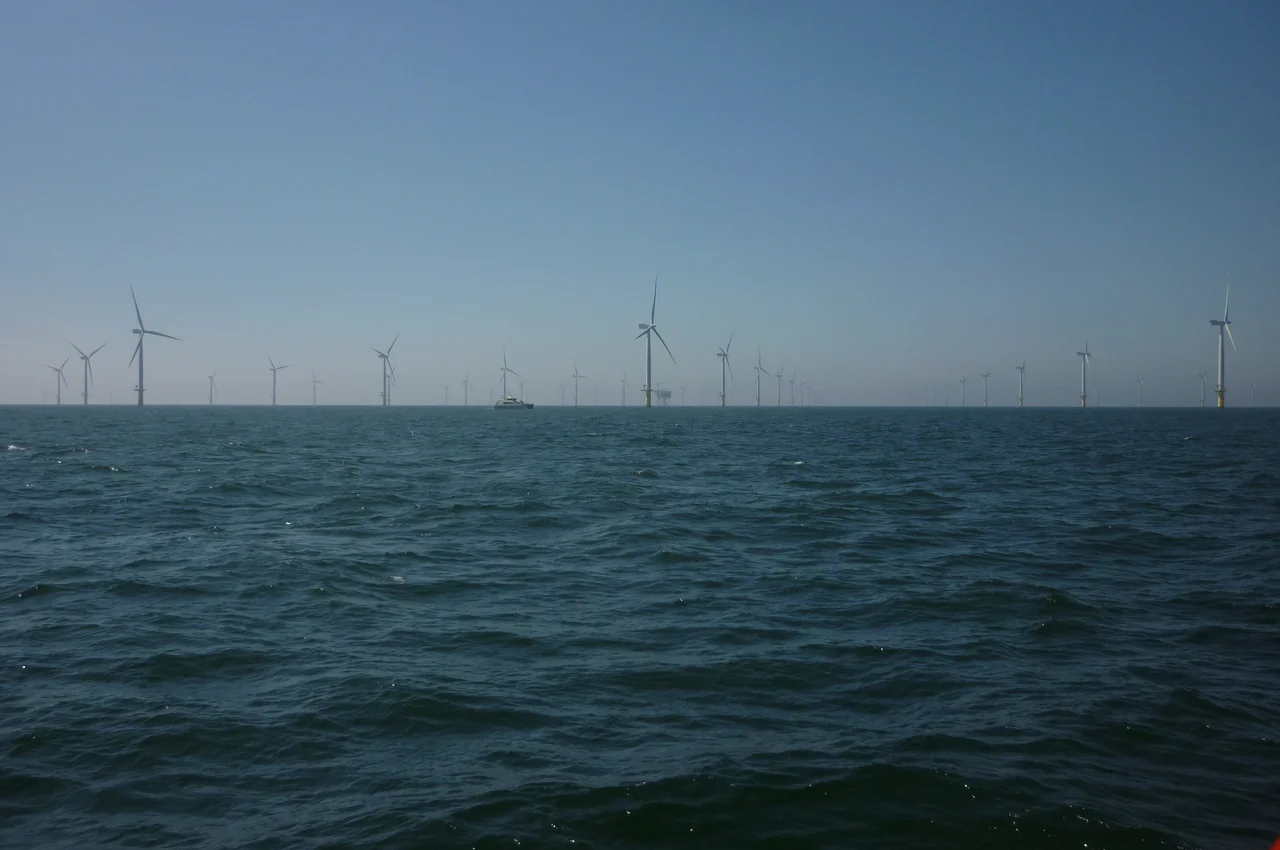
Out here, there is no shoreline to hide behind. Thirty-five kilometres north of Heligoland and eighteen southwest of the Amrum Bank, eighty white turbines turn in waters between nineteen and twenty-four metres deep, far enough from any coast that on most days they belong only to the sea, the gulls, and the maintenance crews who reach them by service vessel. Amrumbank West is the kind of place that looks simple from a passing airliner - a precise grid of slender towers, blades catching the low northern light - and turns out to be one of the harder engineering problems anyone tried to solve in the 2010s German Bight.
The Sandbag Problem
The seabed here is sand. Loose, mobile sand, the kind that scours away from anything solid the moment the current finds it. RWE's engineers first tried the obvious answer: dump a 2.4-metre layer of large stones around each foundation, a stone armour ring to hold the sea back. The problem revealed itself almost immediately. The turbine piles, six metres in diameter, had to be driven straight down through that armour and deep into the seabed beneath. The stones blocked the pile. So the team switched to something almost absurdly low-tech in concept: enormous sandbags. Two layers of geotextile containers, each empty bag 1.45 by 2.38 metres, filled to 80 percent capacity on the Danish island of Rømø with a cubic metre of sand. Each bag weighed 1,400 kilograms. Stacked underwater around the foundation rings, they could be punched through by the pile driver and would then close back around the steel.
Two Storms, No Damage
The North Sea decided to audit the design almost as soon as it was laid. In October 2013, the St. Jude storm tore across northern Europe and ran straight over the construction site. Two months later, Cyclone Xaver did the same, this time pushing a storm surge that flooded parts of the German and Dutch coasts. The seabed protection at Amrumbank West held both times. Starting in December 2013, the crews began driving the six-metre piles through the geotextile layers and into the seabed beneath, an operation more like surgery than construction - centimetre-precise on an open sea, with weather windows measured in hours.
Cables and Delays
Building the turbines turned out to be easier than getting their electricity to shore. The project ran fifteen months behind schedule, not because of the engineering on the water but because the high-voltage cable connection wasn't ready when the turbines were. Offshore wind has always had this awkward truth at its centre: a turbine that spins beautifully and produces nothing useful is a very expensive sculpture. By the time the first Siemens SWT-3.6-120 was finally installed in February 2015, the cabling delay had become its own case study in why grid infrastructure has to be planned years before the steel goes up. The full eighty turbines came online at the end of 2015, each one rated at 3.6 megawatts, each rotor 120 metres tip to tip.
Counting the Sea Wind
On a clear day from the cockpit, the farm looks like a constellation. The turbines are not perfectly evenly spaced - the layout follows the seabed contours and the prevailing wind, with the rows angled to keep one turbine's wake from spoiling its neighbour's harvest. The North Sea here averages something close to nine metres per second of wind at hub height, which is why this stretch of water, half a day from any major port, is worth the cables, the sandbags, the cyclones, and the fifteen-month delay. From the surface, on the rare calm afternoon, you can hear nothing but the rotors whispering and the gulls. From the air, you see the geometry: eighty white columns, all turning, feeding a grid that runs back under the sea to Büsum, then south, then on to the cities that never wonder where their lights come from.
From the Air
Located at 54.5227°N, 7.7048°E in the German Bight, roughly 35 km northwest of Heligoland. The farm covers about 32 km² and is visible as a regular grid of white towers from cruising altitude in clear weather. Nearest airport is Heligoland (EDXH) to the southeast; Sylt (EDXW) lies about 50 km north. Maintain at least 500 ft above turbine tip height (around 150 m above sea level) per German offshore navigation guidance; the wider Heligoland Bight is busy with shipping and other wind farms - Meerwind Süd|Ost and Nordsee Ost cluster nearby. North Sea weather changes quickly; visibility can drop within minutes.
Nearby Stories
- MV Pallas 14 km away
- Battle of Heligoland Bight (1914) 14 km away
- Gode Wind Farm 30 km away
- Heligoland Bight 30 km away
- SM UB-22 34 km away
- Tvindkraft Wind Turbine 158 km away
- SM U-20 (Germany) 193 km away
- Battle of Jutland 218 km away