Anama
The name is a linguistic puzzle. In Nheengatu, the lingua franca that once knit together the peoples of the Amazon, Anama can mean thick, dense, or the consistency of fermented drinks used in Indigenous festivals. It can also mean weaned. Or it might refer to Amazonetta brasiliensis, a small duck native to South American wetlands. Scholars Ermanno Stradelli and Octaviano Mello each offered different readings a century apart. Today Anama is a municipality of about 13,956 people on the Solimoes River in the Brazilian state of Amazonas, a place whose name carries the ambiguity of a language spoken by many different peoples over many different centuries and never quite pinned down.
A Rubber Town That Did Not Last
Modern settlement at Anama traces to the rubber cycle. When world demand for Hevea latex sent tappers and traders up every navigable tributary of the Amazon in the late 19th and early 20th centuries, this bend of the Solimoes became one more rubber farm among thousands. The sap moved downriver to Manaus, then by ocean steamer to factories in Europe and the United States. Then the bubble burst. Seeds of Hevea brasiliensis, smuggled out of Brazil in 1876, had been grown into Asian plantations whose yields undercut every Amazonian producer. When production collapsed, the farms went bankrupt and the workers who tapped the trees stayed on, becoming the first permanent residents of what would slowly grow into a town.
From Satellite to Municipality
For decades after the rubber economy folded, Anama existed as a poor satellite of neighboring Anori, its administrative parent. A 1981 constitutional amendment, Number 112, finally elevated the place to full municipality status. The boundaries settled into their current shape: Anori to the north and west, Beruri to the south, Manacapuru to the east. The territory stretches over 2,454 square kilometers, a respectable size by Brazilian standards but nothing out of the ordinary for the Amazon, where municipalities can rival small European nations. Within those lines today live about 22 communities, among them Arixi, Cabaca, New Brazil, Mato Rosso, and Nossa Senhora de Nazare. On an island locally called Chameleon, Indigenous communities of Ticuna and Kokama people keep villages named Sao Jose of Eware, Bom Jesus, Nova Esperanca and Santa Luzia.
The Weather of the Equator
The climate is equatorial. October runs hottest, averaging 33 degrees Celsius and occasionally pushing past 38. June is the coolest month and still manages an average of 24 degrees. Even what passes for winter here, with its mildest lows of 18 to 22 degrees, would count as pleasant summer in most of the temperate world. What actually varies is the rain. From November through March falls roughly 85 percent of the annual precipitation, turning the Solimoes into a wide inland sea that floods forest, fields and the outskirts of settlements. When the waters rise, canoes replace pickup trucks, and children paddle to school. When they fall, sandy beaches appear along riverbanks that were underwater months before. Life here is calibrated to a two-season year, wet and less-wet, with the floodwaters as the clock.
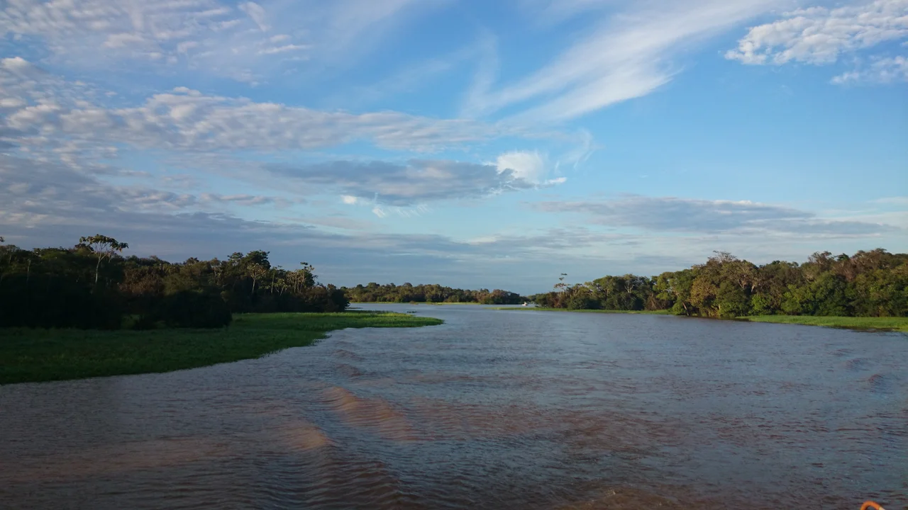
Anama Today
This is not a tourist destination in the way that Mamiraua or the Anavilhanas archipelago are. Anama is a working river town, most of its economy tied to fishing, small-scale agriculture, manioc flour processing, and trade with Manaus some 170 river kilometers downstream. The Solimoes at this latitude is a pale, sediment-heavy river rolling past forest whose canopy reaches 50 meters. Pink and gray river dolphins surface along the banks. Above the water, macaws and parrots cross in noisy pairs. Commercial boats pass regularly between Manaus and upstream cities, and smaller craft ferry people between island communities. For travelers willing to skip the guided-lodge circuit, places like Anama offer a plainer kind of Amazon encounter: the forest not as spectacle but as the ordinary backdrop to ordinary life.
From the Air
Located at 3.58S, 61.40W, on the Solimoes River in central Amazonas state. No dedicated commercial airport. Nearest significant field is Manaus/Eduardo Gomes International (SBEG) roughly 170 kilometers east. Access is mainly by boat from Manacapuru or direct from Manaus. Recommended cruise altitude 33,000-37,000 feet, viewing the broad Solimoes meandering through unbroken canopy. In the wet season (November through April), the floodplain shows as mosaics of open water and emerging treetops. Afternoon convective cells are routine; plan for deviations.
Nearby Stories
- Manacapuru 23 km away
- 2019 Amazon rainforest wildfires 47 km away
- Ariau Towers 71 km away
- Novo Airao 92 km away
- Matupiri State Park 151 km away
- Jaú National Park 154 km away
- Amazonas (Brazil) 177 km away
- Juma Sustainable Development Reserve 240 km away