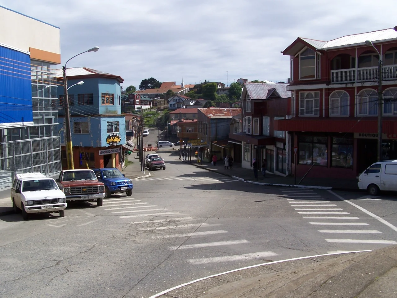

Ancud
The Spanish empire in Chile ended here, on a low headland above Ancud's harbor. At the Fuerte San Antonio, a stone battery still pointing its cannon out to sea, the royal flag flew longer than anywhere else in the country, and when it finally came down in January 1826, three centuries of Spanish rule over Chile came down with it. Today most travelers meet Ancud not as a last redoubt of empire but as the first town on Chiloé, the place where the bus from the mainland rolls off the ferry into a small, rain-washed port of fishermen, markets, and penguins offshore. Both stories are true.
The Crown's Last Stand
Ancud was built for war. Founded in 1768 as San Carlos de Chiloé, it became the fortified capital of the archipelago, raised as a bulwark against the foreign powers, Dutch, British, French, that prowled these southern seas. The Fuerte San Antonio, completed in 1770, anchored its defenses. When the rest of Chile won independence, royalist Chiloé held out, and Ancud became the empire's final fortress in the country. The Spanish flag last flew over Fuerte San Antonio on January 19, 1826. Four days later the great fortress of Callao in Peru also surrendered, and Spanish rule in mainland South America was finished. The garrison at Ancud had been, quite literally, the last to give up.
Capital for Two Centuries
For more than two hundred years Ancud was the head of the island. From its founding in 1768 it served as Chiloé's capital, and it kept that role well into the modern era, surrendering the title to Castro only in 1982. In the nineteenth century, after Chiloé finally joined Chile, the city took on a new mission: it became a staging point for the Chilean settlement of Patagonia, the launch pad from which colonists pushed south into the empty, storm-lashed channels and fjords of the far end of the continent. A garrison town turned gateway, Ancud has spent its whole existence facing outward, toward the sea and the frontier beyond it.
Rain, Wool, and Curanto
Chiloé is one of the wettest inhabited corners of Chile, and Ancud feels it. Rain falls on roughly two hundred days a year. Winters are cool and soaking, the July average hovering near 7.5 degrees Celsius with humidity around ninety percent; summers are mild and merely damp. That climate shapes the markets, where the Mercado Municipal stacks two floors of woolen knitwear, baskets, and carved wood against the cold. It shapes the food, too. This is curanto country, where shellfish and meat and potato breads are buried over hot stones and cooked in the earth, and where local cooks fold European baking into a dessert the islanders simply call kuchen, the German word for cake, a quiet trace of nineteenth-century immigration.
Penguins and the Open Coast
West of town the land gives way to wide, wind-scoured beaches and one of the island's great wildlife encounters. Off the coast near Puñihuil, small rocky islets shelter breeding colonies of penguins, and in an arrangement found almost nowhere else, two species nest side by side: the Magellanic and the Humboldt. Boats run out from the beach to circle the islets in season, threading past sea lions and cormorants and the occasional otter. After the markets and the fort, the penguins are the reason many travelers are glad they paused in Ancud rather than racing straight through to Castro and the south.
First Stop on the Island
For all its history, Ancud's everyday role is simple: it is the front door of Chiloé. The buses from Puerto Montt cross the Chacao Channel by ferry, the same narrow strait that armies once forced, and Ancud is the first town they reach, about two and a half hours from the mainland. From here the road runs on to Castro and the wooden churches, to Quellón at the island's southern tip, and out to the beaches and the penguin islets. It is an easy place to underestimate, a working port that looks unremarkable until you stand on the ramparts of San Antonio and realize you are standing where an empire ran out of ground.
From the Air
Ancud sits on the northern coast of Isla Grande de Chiloé at approximately 41.87°S, 73.83°W, near the western mouth of the Chacao Channel that divides the island from the mainland. The Fuerte San Antonio on the harbor headland and the open Pacific beaches to the west are the clearest landmarks from the air; the penguin islets of Puñihuil lie a short distance down the western coast. Mocopulli Airport (ICAO SCPQ) near Dalcahue, roughly 70 km south, is the island's main commercial field; Puerto Montt's El Tepual (SCTE) on the mainland is the regional gateway. Expect frequent rain, low cloud, and strong maritime winds; Ancud receives rain on about 200 days a year, so clear overflights are best attempted in the austral summer.
Nearby Stories
- Battle of Abtao 21 km away
- Monte Verde 29 km away
- Battle of Mocopulli 29 km away
- Valdivian Temperate Forests 47 km away
- Pumalín Douglas Tompkins National Park 92 km away
- 1687 Peru Earthquake 2943 km away
- The Nazca Lines: Art Made for the Sky 3024 km away
- West Antarctica 4237 km away