
Appomattox Court House National Historical Park Ruins
Most visitors to Appomattox Court House National Historical Park come for the McLean House, the reconstructed parlor where Lee surrendered to Grant on April 9, 1865. They walk the wagon road, photograph the rebuilt tavern, and leave. What they often miss are the ruins - the brick stubs and stone foundations scattered through the woods at the edges of the village, marking the houses, cabins, and outbuildings of the people who actually lived here. These ruins were added to the National Register of Historic Places on October 15, 1966. They are the quieter half of the park's story: not the surrender, but the village in which the surrender happened to occur.
Clover Hill Becomes a Village
Samuel D. McDearmon bought the 206-acre Clover Hill tract from Hugh Raine in 1846 and immediately set about making it the seat of the new Appomattox County. He carved off thirty acres for the courthouse and the village around it, then began improving the remaining 176 acres for his own residence. By 1851 he had spent more than $2,800 on a mansion house, the peak of his political and financial fortunes. He tried to sell the property in 1854; it took Jacob Tibbs two more years to buy 140 acres of it, including the mansion. Within a year of that sale, the assessed value of the improvements had fallen. The cycle of boom and decline that would mark this village had already begun.
The Old County Jail
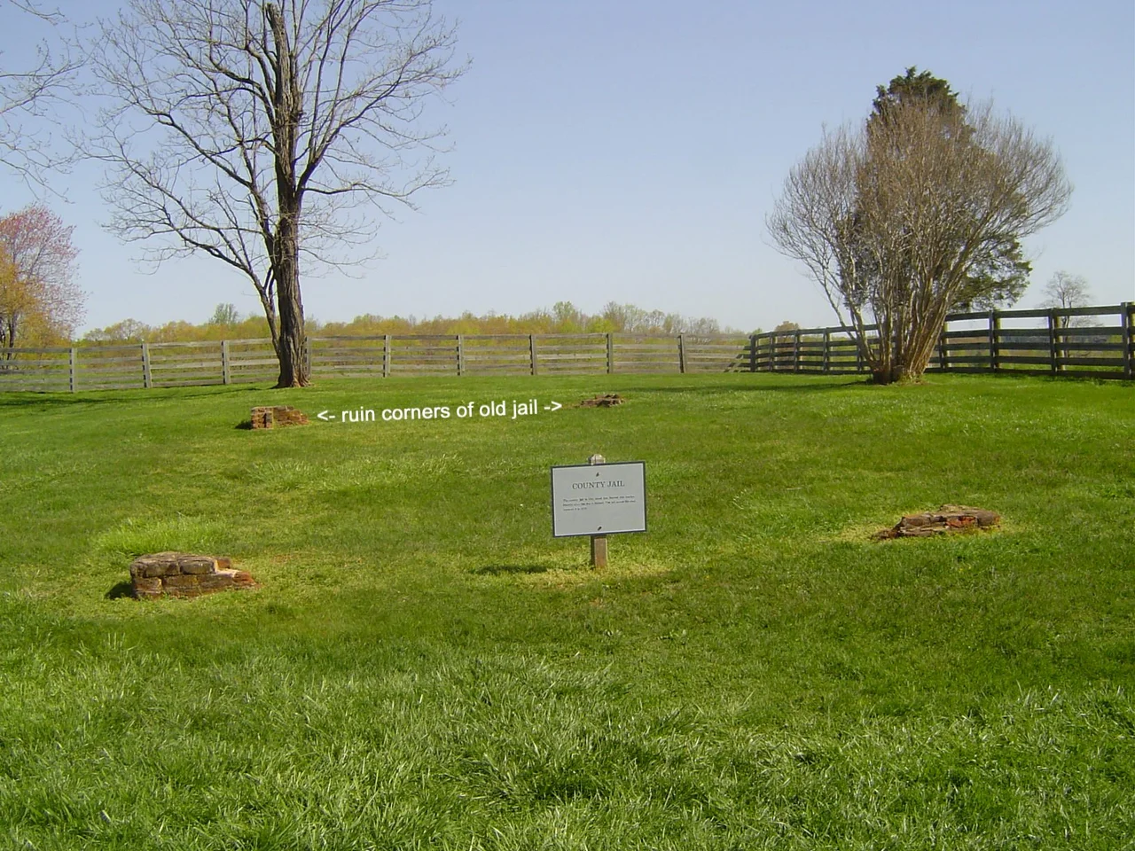
Among the surviving ruins in the park is the old county jail, a simple brick structure that served Appomattox County until the county seat moved to the railroad town of Appomattox in the 1890s. Built early in the village's life, the jail housed the small daily inventory of crime in a rural Virginia county: debt suits, fence disputes, the occasional drunkard. After 1865 it briefly held Union deserters and stragglers. When the seat moved west, the jail was abandoned. The brick walls weathered down over generations, leaving footings and partial chimneys that the National Park Service stabilized as part of the park's preservation.
Cabins and Tenant Houses
The ruins include the foundations of two tenant houses built by the Tinsley-Scott family, the cabin attributed to R.J.N. Williams, and the Coleman house with its outbuilding. These were the houses of small farmers, tenants, and farm workers - both free and, before 1865, enslaved. The Appomattox Court House park sits on land that was worked by enslaved people for decades before the surrender that helped end slavery. The ruins acknowledge a complicated truth: the village that became a symbol of national reconciliation was built by people whose freedom that reconciliation finally guaranteed. Slave cabins are explicitly named in the park's National Register categorization.
Sweeney Dam and the Mill Race
The Sweeney Dam ruin and its associated mill race are the most evocative remains. Sweeney's mill, fed by a damned-up tributary, ground corn and wheat for the village and its surrounding farms. The mill race - the constructed channel that diverted water to turn the wheel - is still traceable through the trees, a soft groove in the forest floor. The Sweeney family was one of the village's most prominent before the war; family members served in Confederate cavalry. The mill itself fell out of use in the late 19th century. Today the moss-covered dam stones and the gentle line of the race tell a story older than the surrender: this was a working agricultural village, not a monument.
What Ruins Teach
It is easy to visit Appomattox and see only the events of April 1865 - the meeting, the terms, the stacked arms. The ruins refuse that simplification. They remind visitors that for everyone else who lived in the village - the merchants, the jailers, the millers, the tenant farmers, the enslaved laborers - the war was one chapter in a longer story of building, working, and being buried in the same red clay. When the county seat moved to the railroad town in the 1890s, the village around the McLean House slowly emptied. Those buildings that survived were preserved or rebuilt. Those that did not became the ruins we walk past today, marking lives that the famous surrender story rarely names.
From the Air
Located within Appomattox Court House National Historical Park at 37.38 degrees N, 78.80 degrees W, in the rolling Piedmont of central Virginia. The park covers about 1,700 acres of preserved 19th-century village landscape, with ruins scattered through woods at the village edges. Nearest airports are Lynchburg Regional (KLYH) about 22 miles west and Farmville Regional (KFVX) about 25 miles east. Best viewed at 2,500 to 4,000 feet AGL in clear conditions.
Nearby Stories
- Battle of Cumberland Church 1.3 km away
- Red Hill Patrick Henry National Memorial 6.9 km away
- National D-Day Memorial 7.8 km away
- Smith Mountain Lake 9.1 km away
- Fork Union Military Academy 20 km away
- 2023 Virginia Cessna Citation Crash 38 km away
- Alleghany County, Virginia 52 km away
- Long Grass Plantation 60 km away