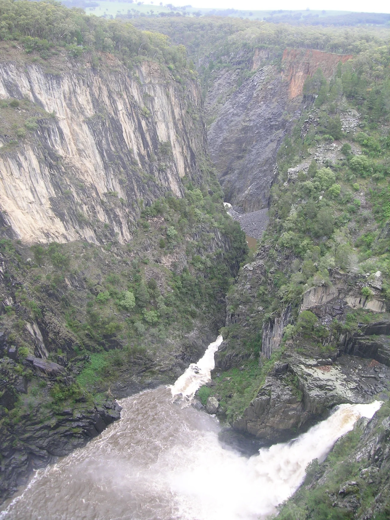

Apsley Falls
For most of its length the Apsley River wanders gently across the high, cold tableland near Walcha, giving no hint of what it is about to do. Then the ground simply ends. The river hurls itself off the lip of the plateau and falls some sixty-five metres into a chasm so deep and sudden that the first European to see it could only write that he was "lost in astonishment." This is the first of two great drops, the opening act in a string of waterfalls and gorges that ranks among the most spectacular country in eastern Australia. The plateau gives no warning; the gorge gives no mercy. Stand at the edge and the scale rearranges your sense of the land.
The Serpent's Gorge
Long before any map named this place, the Aboriginal peoples of the region understood the gorge as something made, not merely found. In their telling, the Rainbow Serpent carved this chasm in the Dreaming, then travelled on underground, slipping beneath the country to surface again twenty kilometres upstream at the Mill Hole on the Apsley River in Walcha. The falls and the high tablelands around them were a meeting place, ground that held meaning and gathering long before the first stockmen arrived. That older knowledge has not been left in the past: today a Rainbow Serpent mosaic marks the Mill Hole, made with the help of the local Aboriginal community, so that the story of how the river and its gorge came to be is told again where the Serpent is said to rise.
An Explorer Lost for Words
On 13 September 1818, the explorer John Oxley came upon the falls during his long trek across the tablelands and was stopped in his tracks. He called them "one of the most magnificent waterfalls we have seen," named them the Bathurst Falls, and gave the river its present name, Apsley. In his journal he confessed to being "lost in astonishment at the sight of this wonderful natural sublimity." It is easy to imagine why. A traveller who had spent weeks crossing rolling, open highland would have had no reason to expect the earth to drop away into a gorge of this depth. The plateau hides the chasm until the last moment, so that the falls arrive not as a gradual reveal but as a shock, the same surprise that visitors feel walking out to the lookout today.
A Stairway Carved by Hand
Reaching the foot of such a gorge was once a feat in itself. In 1902 three men, Ted Baker, Jim McMillan and "Wattie" Joiner, built a wooden stairway that zigzagged from the clifftop all the way down to the water's edge, every timber of it dressed by hand with axe and adze. That original stairway carried visitors until 1932, when it was condemned as unsafe and partly pulled down; the last of it was finally removed in 2020. The job of replacing it fell to the Walcha Lions Club, and in a fitting twist the steel staircase and viewing platform they built in 1961 were designed by Lindsay McMillan, son of the Jim McMillan who had helped build the first. The club's members poured 1,745 hours into the work, and the new lookout opened that October.
The Living Gorge
Today the falls anchor the Oxley Wild Rivers National Park, and the gorge teems with life that suits its scale. Wedge-tailed eagles, Australia's largest birds of prey, ride the thermals that rise off the warming cliffs, wheeling at eye level above the chasm. Kangaroos and wallabies move through the surrounding bush, echidnas shuffle along the tracks, and crimson rosellas flash through the trees in bursts of red and blue. A network of lookouts and walkways now traces the rim, including the sealed Oxley Walk, which crosses the river by footbridge, a bridge once washed away by flood and rebuilt, and leads past viewpoints that reveal the second, fifty-eight-metre fall and the sheer walls of the chasm beyond. Two centuries after Oxley stood speechless, the view still does most of the talking.
From the Air
Apsley Falls lies at about 31.050°S, 151.770°E, roughly 20 kilometres east of Walcha on the Northern Tablelands of New South Wales, just off the Oxley Highway within Oxley Wild Rivers National Park. From the air the defining feature is the abrupt transition from gently rolling tableland to a deep, dark gorge, where the Apsley River drops in two stages, about 65 metres then 58 metres, into a steep-walled chasm. The contrast between the open highland and the sudden cleft of the gorge is dramatic and easy to spot. Best viewed from 2,000 to 4,000 feet AGL to take in the gorge system. The nearest major airport is Armidale (YARM), about 35 nautical miles to the north; Tamworth (YSTW) lies roughly 45 nautical miles to the west. The tablelands sit above 1,000 metres elevation, so expect cool temperatures, and watch for strong thermals and updraughts along the gorge cliffs on warm afternoons.
Nearby Stories
- Captain Thunderbolt's Rock 23 km away
- New England National Park 39 km away
- Ebor Falls 70 km away
- Copeton Dam 98 km away
- Inverell Post Office 139 km away
- Parramatta Female Factory and Institutions Precinct 280 km away
- Manly, New South Wales 282 km away
- SS Elingamite: Gold, Fog, and a Captain Wrongly Blamed 1877 km away