Araguainha Crater
Two hundred and fifty-four million years ago, something the size of a small mountain slammed into a shallow sea in what is now central Brazil. The impact punched a 24-kilometer hole straight through Paleozoic sedimentary rock, vaporized itself on contact, and released enough energy to lift the ground beneath it back up into a granite dome while the walls collapsed outward to make a 40-kilometer ring. That ring is still there. It is still the largest known impact crater in South America. And it may have helped kill 81 percent of marine species on Earth.
Reading the Ring
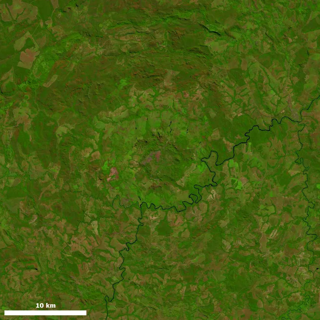
From the air, or from a satellite's elevation model, the shape is unmistakable - a bullseye pressed into the landscape on the border between Mato Grosso and Goiás states, between the villages of Araguainha and Ponte Branca. At the center sits an uplifted core of basement granite, Ordovician rock that should be buried under a kilometer of sediment but was instead slammed upward by the impact's rebound. Ringing that core is a zone of shocked granite and impact breccias - rock the shock wave crushed and partially melted. Beyond that rises another ring, six and a half kilometers across and up to 150 meters high, made of Devonian sandstones folded and tilted nearly vertical by the blast. Past those mountains lies an annular depression, then semi-circular grabens on the outer rim. The Araguaia River cuts straight through the whole structure, eroding it over the millions of years since.
The Evidence
For most of the 20th century, geologists who noticed the dome called it a crypto-volcanic structure. The 1971 reconnaissance by Silveira Filho and Ribeiro described lavas, breccias, and tuffs around the core and suggested ancient volcanism. Two years later, Dietz and French identified the telltale signatures of a cosmic impact: shatter cones, the distinctive cone-shaped fracture patterns that only form under the extreme pressures of hypervelocity impact; impact breccias with melted glass mixed into them; and shocked quartz, whose crystal lattice has been rearranged by pressures no volcano can produce. Brazilian geologist Álvaro Penteado Crósta led detailed petrological studies in 1981 and 1982 that confirmed the impact origin beyond doubt. A magnetic survey in 1994 added more evidence. The crater was real, the impactor was real, and whatever hit here left its fingerprint in the rock.
Dating the Catastrophe
Getting a reliable date on an impact crater is genuinely hard. The first radiometric effort, in 1992 by Deutsch and collaborators, used rubidium-strontium methods. Engelhardt and colleagues reported a detailed study of the uplifted core and proposed about 246 million years. Later work pushed that back to 244, then further refined it. The most recent dating by Tohver and colleagues in 2012 placed the Araguainha impact squarely inside the margin of error for the Permian-Triassic boundary - the moment 252 million years ago when the worst mass extinction in Earth's history erased 57 percent of biological families, 62 percent of genera, and 81 percent of marine species. Scientists usually call it the Great Dying. Whether Araguainha helped cause it is a real question.
The Oil Shale Hypothesis
The energy released by the Araguainha impact, by itself, is not enough to explain a global mass extinction. The crater is big - the biggest in South America - but the Chicxulub crater that ended the dinosaurs was four times larger, and some extinction events appear to have no impact connection at all. What makes Araguainha potentially relevant is not the direct blast but what it did to the rock underneath. Much of the local bedrock was oil shale, stratified sedimentary rock saturated with hydrocarbons. The impact would have released massive amounts of oil and gas from those shattered formations directly into the atmosphere. The resulting sudden global warming - methane and carbon dioxide on a geological scale, injected in a geological instant - might have tipped the Earth's climate system past a recoverable point. Tohver's 2013 paper on the seismicity and methane release from Araguainha laid out this mechanism in detail.
Visiting the Dome
The crater is remote by Brazilian standards. Reaching it means driving from either Goiânia or Cuiabá along unpaved state roads. The stretch between Ponte Branca and Araguainha cuts directly across the central uplift - you can stand on granite that was lifted from several kilometers deep by a 254-million-year-old explosion. The Araguaia River still threads through the structure, as it has throughout the entire period since the breccias first formed. As of 1999, local residents were not yet aware of what lay beneath their farms. That has changed. The Araguainha dome now appears on the IUGS Geological Heritage Sites list - one of the first 100 sites worldwide to receive that designation - which should help ensure that people working the land here understand that they are farming on top of a piece of planetary history, the largest crater in South America, and perhaps a scene from the worst day in the history of life on Earth.
From the Air
Coordinates 16.78°S, 52.98°W, on the border of Mato Grosso and Goiás states. The 40-km-diameter crater structure is best appreciated from altitude - recommended viewing 8,000-12,000 ft AGL to see the full ring pattern and central uplift. The Araguaia River cuts through the structure and provides ground reference. Nearest major airports are Cuiabá (SBCY) approximately 250 km northwest and Goiânia (SBGO) approximately 400 km east; the terrain in between is rural cerrado. Small regional airstrips serve nearby towns. Best visibility May-September during the dry season when the ring topography is not obscured by rain haze.
Nearby Stories
- Guiratinga 39 km away
- Mineiros 69 km away
- Serra Azul State Park 80 km away
- Jataí 116 km away
- Montes Claros de Goiás 136 km away
- Iporá 191 km away
- Central-West Region, Brazil 223 km away
- Mato Grosso do Sul 373 km away