Araguari
Before the railroad, this was Brejo Alegre - "happy marsh" - and the population could be counted in the low hundreds. Cattle in the surrounding ranches outnumbered the people who lived there. The village had a small chapel, a bakery, a couple of pharmacies, and a stream running down the middle that divided the settlement into two loyalties: Goias on one side, Minas on the other. When the Mogiana Railway arrived in 1896, everything changed. The village that became Araguari jumped from obscurity to regional hub almost overnight, and it has been climbing ever since - now one of the largest cities in the Triangulo Mineiro and one of the fastest-growing municipalities in Brazil. What made this corner of Minas Gerais matter was not what it had, but where it was: at the junction of the networks that connected coastal Brazil to its vast interior.
The Land Between Rivers
Araguari sits in the northern Triangulo Mineiro, the distinctive triangle-shaped wedge of western Minas Gerais bounded by three rivers. The Paranaiba forms its northern edge, marking the boundary with Goias. To the south lie the waters of the Rio Grande. The Jordao River runs through the municipality itself, a tributary of the Paranaiba. The municipality covers 2,774 square kilometers, most of it rural: cattle ranches, coffee, sugarcane, and the permanent crops that have made the Triangulo one of Brazil's most productive agricultural regions. The land sits between 940 and over 1,000 meters above sea level, high enough to give the city a pleasant annual average of 20.7 degrees Celsius. The rainy season runs November through April, the dry season May through October, and the elevation keeps temperatures moderate. One source counts 128 waterfalls and rapids within the municipality - a landscape shaped by the Paranaiba drainage cutting through the cerrado plateau.
From Arraial to City
Settlement began in the early nineteenth century as ranchers pushed into the interior. Brejo Alegre grew slowly around its small chapel - the Igreja Matriz of Senhor Bom Jesus da Cana Verde, built in colonial style with a cemetery behind it. Houses were tiled but unsealed, called casas de telhas ao vento - "houses with tiles to the wind" - drafty and simple. The center was divided by a stream, with the Goias bank on one side and the Minas bank on the other, a division that expressed the uncertain geography of a frontier settlement. In 1843, the arraial became a district with the formal name Santana do Rio das Velhas. In 1882 it was elevated to a vila - a town - and in 1888 it became a cidade, a city, under the new name Araguari. The small commerce at that time consisted of a bakery, a shoe store, two pharmacies, and general stores called vendas. And then the trains came.
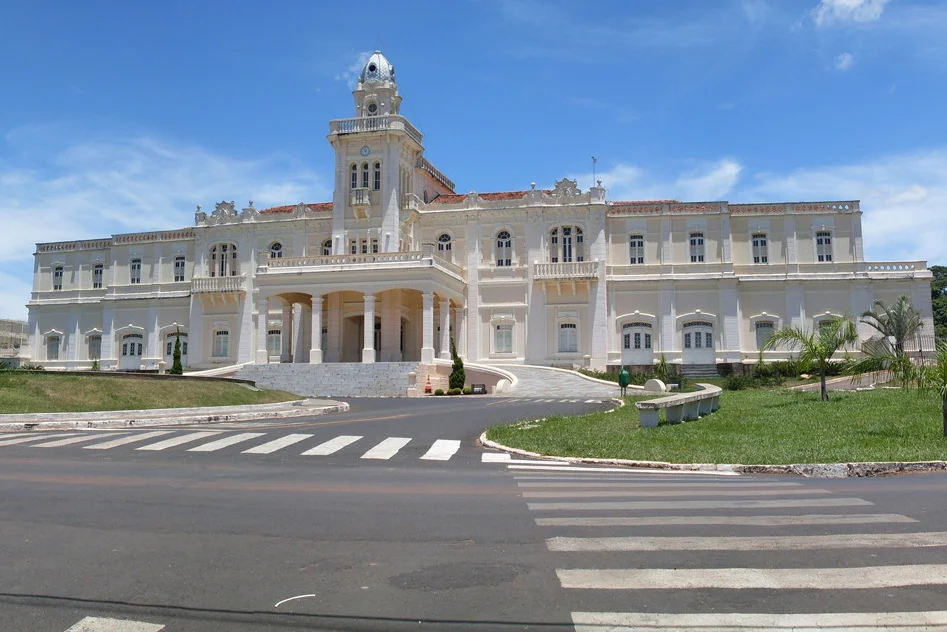
The Railroad That Built the City
The Companhia Mogiana de Estrada de Ferro extended its line to Araguari in 1896, and the effect was transformational. The Mogiana was one of the great coffee railways of southeastern Brazil, built to move sacks from plantation to port. Araguari became its northern terminus, the point where freight transferred to wagons for the journey deeper into Goias. In 1906, the line was extended as the Estrada de Ferro Goias, pushing further north and making Araguari not just an endpoint but a gateway. The city grew along with the rails. Today, the downtown still preserves traces of that era - commercial facades from the early twentieth century, the Cine Teatro in the city center, the old Cinema Odete. Bosque John Kennedy, an urban tropical forest covering 112,000 square meters, survives as a green island inside the city grid, a reminder of the cerrado that once covered this plateau.
Water, Power, and the Present
Modern Araguari's northern boundary runs along a string of hydroelectric complexes on the Paranaiba - Emborcacao and Miranda among them - whose dams have formed artificial lakes that now anchor regional tourism. Fishing, water sports, and lakeside recreation have filled in the gap between the city's industrial base and the agricultural economy of the surrounding ranches. Two more dams, Capim Branco I and II, were built in the same river system. By 2020, the municipality's population had reached 117,825, ranking among the top four cities in the Triangulo hierarchy. The city has grown faster than Brazil as a whole, a fact that says as much about Brazil's internal migrations - from northeast toward the industrial south, from small towns toward regional hubs - as about Araguari itself. The city that began as a drafty hamlet called Brejo Alegre now sits four hundred kilometers from Brasilia and six hundred from Sao Paulo, still on the rail line, still gaining ground.
From the Air
Located at 18.65 S, 48.19 W in the northern Triangulo Mineiro region of Minas Gerais, Brazil. Nearest airport is Uberlandia Airport (SBUL), about 40 km southwest, with Araguari itself served by a small municipal airfield. The terrain is the cerrado plateau at approximately 940-1,000 meters elevation, with the Paranaiba River valley cutting 300-500 meters deep to the north. Visibility is excellent during the May-October dry season. The hydroelectric reservoirs of Emborcacao and Miranda are prominent landmarks visible from 15,000 feet in clear weather.
Nearby Stories
- Itumbiara 37 km away
- Catalão 53 km away
- Ituiutaba 69 km away
- Patrocínio 90 km away
- Uberaba 95 km away
- Vazante 109 km away
- Frutal 116 km away
- Southeast Brazil 171 km away