Itumbiara
The name means "path to the waterfall" in Tupi, and the Portuguese-era settlers who chose it did not realize how literal it would become. Today, no waterfall runs here. A dam swallowed it. Since 1981, six turbines in the Itumbiara Hydroelectric Plant have spun steadily inside a concrete wall straddling the Paranaíba River, generating 2,082 megawatts and powering much of central Brazil. Above the turbines, a lake stretches across the old river channel, flooding forests and fields, swallowing waterfalls, turning a cattle crossing into one of the country's most productive fishing grounds. The path to the waterfall now leads to a reservoir.
Gateway to Goiás
Itumbiara occupies a border. The Paranaíba River runs here with authority, separating Goiás from Minas Gerais, and the city perches on the Goiás side looking south across the water at its twin, Araporã. For centuries, that river crossing was the reason Itumbiara existed. Back in the 1820s, engineer Inácio Pais Leme built a road linking Uberaba in Minas Gerais with central Goiás, and the port at the river became a tax post where state officials could charge tolls on the traffic moving between worlds. A chapel went up, dedicated to Santa Rita, and the settlement took her name: Porto de Santa Rita. When Pais Leme proposed renaming it after his road — Itumbiara, "path to the waterfall" — the state agreed. The waterfall in question was downstream at Cachoeira Dourada, forty kilometers away, a rush of water that would itself be drowned by another hydroelectric project decades later.
The Turbines Under the Lake
Construction on the Itumbiara dam began in November 1974 and the plant came online in 1981. Operated by Furnas Centrais Elétricas, it is the largest single facility in the Brazilian Furnas system and still ranks among the country's most significant power generators. The reservoir stretches for kilometers upstream, inundating land that once grew crops and grazed cattle. Its waters now feed grids across Goiás, Minas Gerais, and Mato Grosso do Sul. The city's relationship with the lake is complicated — residents were displaced, ecosystems transformed, waterfalls erased — but the electricity and the reservoir together rewrote what Itumbiara could be. The dam did not end the city. It rebranded it.
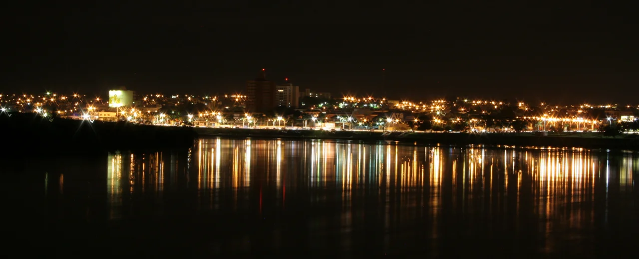
Where the Peacock Bass Run
If you want to understand how Itumbiara reinvented itself, follow the fishermen. Brazilian sport-fishing magazines now rank the reservoir as the country's second-best location for peacock bass (tucunaré), the aggressive freshwater predator that turns anglers into pilgrims. Entire weekends dissolve into boat trips across the lake's coves and flooded tributaries. The shoreline at the Beira Rio strip fills with fishermen cleaning tackle, comparing catches, arguing over lures. Water sports have followed. So have tourists headed for the Salitre Waterfall upstream, the Beira Rio Lighthouse that marks the reservoir's edge, and the Affonso Penna Suspension Bridge, a long steel span reaching across the river to Minas Gerais. The lake has become the engine of local recreation as surely as it is the engine of regional electricity.
The Japanese Farmers
Itumbiara's demographic story is a mixing, with the familiar Brazilian ingredients of Indigenous, European, and African populations — the intermarriage that produced the pardo majority across the interior. But Itumbiara also has something less common: a sizeable community of Japanese Brazilians, descendants of farmers who arrived in the 1930s looking for land to cultivate and found it in the fertile Goiás floodplains. Their agricultural knowledge transformed local production. Today, Itumbiara also stands out nationally for sending people in the other direction — its natives emigrate in unusually high numbers to the United States and Canada, a quiet pattern that puts the city in the same statistical category as Governador Valadares in Minas Gerais. The river that once marked the limit of the known world has become, for Itumbiara families, a starting point.
The Gateway Still
The city's economic success rests on its geography. Proximity to Minas Gerais and São Paulo makes Itumbiara a logistics hub for the agricultural wealth of southwestern Goiás, and the Ranking Connected Smart Cities survey placed it third in Goiás and eighth across Brazil's Central-West Region in 2021. BR-153, the Transbrasiliana Highway, cuts through town, as does BR-452 heading west to Rio Verde. The Republic Square downtown, laid out in 1934 as the city's first public garden and opened to the public in 1935, anchors a downtown that still has the feel of a river-crossing town — even if the river has become a reservoir and the waterfall has become a legend.
From the Air
Coordinates: 18.42°S, 49.22°W. Recommended viewing altitude: 4,000-7,000 feet AGL to appreciate the scale of the Itumbiara reservoir and the dam complex that divides Goiás from Minas Gerais. Nearest airports: Itumbiara Municipal Aerodrome (SWIB) offers general aviation; commercial service at Uberlândia (SBUL) approximately 125 km east. The reservoir is visible for many kilometers on approach; look for the long arm of water bending through the red earth.
Nearby Stories
- Araguari 35 km away
- Goiatuba 35 km away
- Ipameri 57 km away
- Ituiutaba 58 km away
- Catalão 65 km away
- Quirinópolis 93 km away
- São Simão, Goiás 110 km away
- Rio Verde, Goiás 148 km away