.jpg)
Quirinópolis
Jose Quirino Cardoso built a chapel, and eventually the whole town was named after him. It took almost a century. The settlement began in 1832 when a man from Minas Gerais named Joao Crisostomo de Oliveira rode in, claimed a vast stretch of land, and tried to keep everyone else out. He failed. By 1860 a village had formed, first called Abadia do Parnaiba, then Nossa Senhora da Abadia, then Rio Verde. Only in the twentieth century did the name Quirinopolis - honoring the chapel-builder - stick, and the municipality became official in 1943. The cattle came along with the name changes. Today there are nearly ten head for every human being.
The Herd
Quirinopolis counts 356,000 head of cattle against a human population of about 38,000 - roughly nine cows per person. The city is the third-largest beef producer in Goias state, and its dairies turn out 130,000 liters of milk a day. The surrounding land, mostly natural and artificial pasture stretching across 205,000 hectares, shapes everything. Soybeans and sugarcane have recently moved onto the croplands - 10,000 hectares of soy, 9,000 of sugarcane, 6,000 of corn - but cattle are still the economic heartbeat. A meatpacking plant called Frigosuper processes local beef. Two dairy cooperatives handle the milk. An alcohol distillery, Usina Sao Joao, feeds Brazil's ethanol economy with fermented sugarcane.
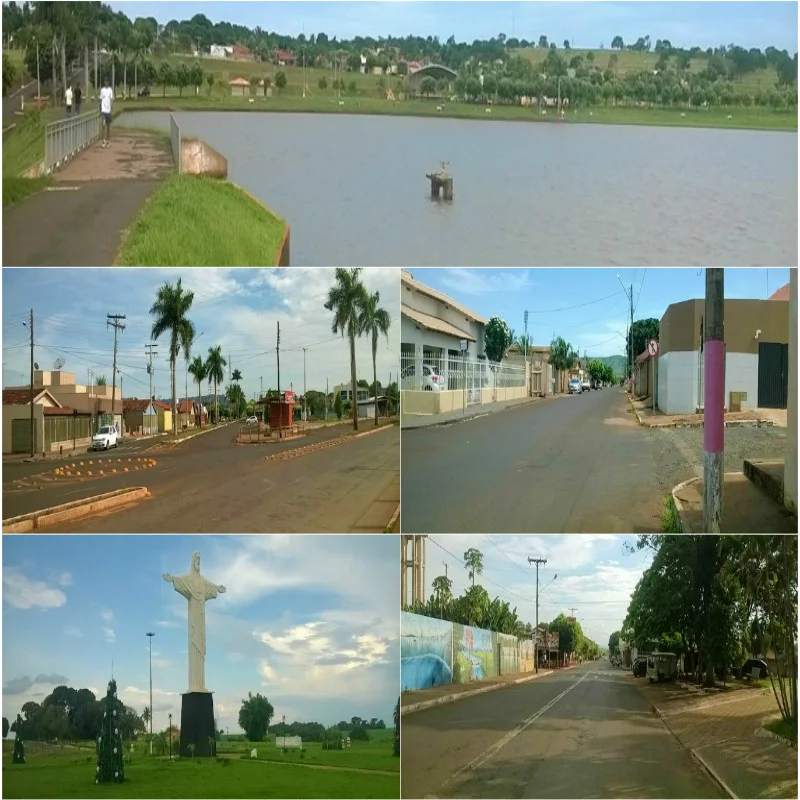
Sao Simao, the Reservoir
A short distance south of the city lies the Sao Simao reservoir, where a dam on the Paranaiba River forms the boundary between Goias and Minas Gerais. The Rio Preto, a tributary of the Paranaiba, flows through Quirinopolis and eventually empties into the reservoir's backwater. The Sao Simao Dam is one of the largest hydroelectric plants in Brazil, but for Quirinopolis the reservoir is more than a power source - it is a recreational anchor. People come to the Lago do Sol Poente for jet skis and motocross. They fish at the edges, where the old river channels meet the flooded forest. Cachoeira Sete Ilhas, a waterfall named for the seven islands that break its current, draws hikers into the wet green tangle of the surrounding cerrado.
Four Names, One Place
The sequence of names the town has worn reads like a slow revision. Abadia do Parnaiba, the first, suggested a Catholic institutional identity tied to a regional river. Nossa Senhora da Abadia, the second, doubled down on the devotional tone. Rio Verde - the green river - was descriptive, aligned with the agricultural character of the place. Quirinopolis came last and came differently: a town named not for a saint or a river but for a single man, Jose Quirino Cardoso, whose contribution was to build the first chapel. The shift from devotional to personal mirrored a broader change in Brazilian small-town naming. The people doing the work were beginning to be remembered alongside the institutions they served.
The Preserved Center
Quirinopolis has done better than most Goias municipalities at keeping its historical streetscape intact. The streets are tree-lined. The squares are full of flowers, lawns, and ornamental plants. A cultural center, said to be the second largest in the state, anchors the downtown. The small airfield on the edge of town is being expanded into a regional airport, part of a broader infrastructure push across the southern Goias interior. None of this is dramatic in the way a coastal resort or a mountain town might be dramatic. It is the quiet preservation of a landscape where the economy has stayed close to the ground - cattle, milk, soy, a reservoir, a waterfall - and where the buildings have been allowed to age without being erased.
The Sudoeste Plateau
The city sits on the plateau of southern Goias at roughly 550 meters elevation, in cerrado country - the Brazilian savanna that covers much of the central interior. In the dry season from May through September, the horizons stretch flat and clear, the sky enormous. The Rio Preto cuts through on its way to the Paranaiba. Neighboring municipalities - Gouvelandia, Cachoeira Alta, Paranaiguara - share the same geography and the same rhythms: pasture, herd, harvest, season. The name Quirinopolis honors a chapel-builder whose name would otherwise be lost to local memory. The town continues, as it always has, mostly in the business of cattle.
From the Air
Coordinates: 18.45 S, 50.45 W. Southern Goias at approximately 550 meters elevation, cerrado plateau. Local airfield currently being expanded into a regional airport. Nearest major commercial airports: Goiania/Santa Genoveva (SBGO) 290 km northeast, Uberlandia (SBUL) 250 km east. Visual landmarks: the Sao Simao reservoir forming the Goias/Minas Gerais border to the south, the Rio Preto flowing through the city, Cachoeira Sete Ilhas waterfall. Clear-air visibility typically excellent during dry season (May-September); significant horizon visibility due to flat cerrado topography.
Nearby Stories
- São Simão, Goiás 41 km away
- Goiatuba 61 km away
- Ituiutaba 61 km away
- Rio Verde, Goiás 61 km away
- Itumbiara 75 km away
- Jataí 82 km away
- Paraná River 162 km away
- Mineiros 189 km away