,_County_Down_(geograph_5699662).jpg)
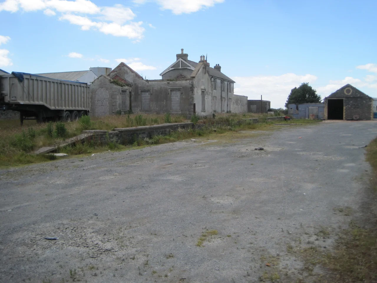
Ardglass Railway Station
Herring did this. The Downpatrick, Killough and Ardglass Railway opened freight services on 31 May 1892, and what it was built to carry was fish - boatloads of silver darlings landed at Ardglass harbour and rushed inland to a hungry industrial Belfast by way of Downpatrick and Comber. The Balfour Lines, named for the Chief Secretary for Ireland who pushed them through Parliament, were meant for impoverished western regions of Ireland that the rest of the railway network had passed by. Ardglass was the one exception - the only Balfour Line ever built in what is now Northern Ireland, eight miles of branch that the government subsidised because a County Down fishing port had built a national reputation faster than it had built a railway.
Arthur Balfour and the Light Railways Act
Ireland in the 1880s was poorer than London understood. The Conservative government of Lord Salisbury, with Arthur James Balfour serving as Chief Secretary for Ireland from 1887 to 1891, decided the answer was infrastructure - and specifically, railways to places that ordinary commercial railway companies would never build. Balfour pushed the Light Railways (Ireland) Act through Parliament in 1889, providing state funding for branch lines into economically underdeveloped regions. The Act's lines became known as Balfour Lines. Most ran into the rural west of Ireland - Donegal, Kerry, Connemara. Ardglass was the one Balfour Line built in Ulster, and the case for it rested entirely on herring. The County Down fishing fleet had been growing fast through the 1880s, and Ardglass Harbour was the busiest landing port on the east Irish coast. What it lacked was a way to move the catch inland fast enough to reach Belfast markets before the fish spoiled.
Macneill's Branch
The Downpatrick, Killough and Ardglass Railway Act passed in 1890. The Belfast and County Down Railway absorbed the new branch into its existing system, and the BCDR's chief engineer Sir John Benjamin Macneill - one of the most accomplished Irish civil engineers of the Victorian era, a former pupil of Thomas Telford - took on the construction. The line ran eight miles from Downpatrick South Junction south to Ardglass, with intermediate stations at Ballynoe, Killough, and the Downpatrick Racecourse. Construction was completed in time for freight services to start on 31 May 1892. Passenger services followed quickly, on 8 July of the same year. A short tramway extended from the end of the railway line through Ardglass village - along Downpatrick Road, Bath Street, and Quay Street - to a point near the northeast end of Ardglass Harbour Pier, where the fish was loaded directly from boats to trains.
Herring Trains and Halt Days
For thirty years the herring business sustained the line. Boats landed catches in Ardglass; trains carried them north to Downpatrick, then on through the BCDR network to Belfast and beyond. Local passenger traffic was secondary - a useful supplement, never the main business. The single-track route was initially divided into two operational segments managed by the staff-and-ticket system, with signal boxes at intervals to manage train movements safely on the single line. Two later halts were added for local convenience: Bright Halt opened on 12 October 1925, and Coney Island Halt on the coast in 1929, named after the small offshore island visible from the line. The tramway link to Ardglass Harbour Pier itself, however, was already falling out of use by the mid-1920s as motor lorries took over the short-haul movement of fish. In 1926 the Ballynoe signal box was decommissioned, consolidating the line into a single operational section. The Killough signal box, which had never actually functioned as a block post, closed at the same time.
Decline of the Herring
Two forces ended the line. The herring fishery itself, which had built Ardglass into a port of national reputation, began a slow contraction in the years between the world wars as overfishing depleted the Irish Sea stocks and as the centre of British fishing shifted northward to Scotland. The other force was the motor lorry, which by the 1930s could move fish from Ardglass harbour to Belfast as fast as the train and without the awkwardness of two transfers. The Belfast and County Down Railway itself, the parent company, struggled financially through the depression and post-war years. Passenger numbers on the Ardglass branch dwindled. The station closed to passengers in 1950, by which time it had been taken over by the newly-formed Ulster Transport Authority - the public body that absorbed Northern Ireland's bankrupt private railways. Freight services ended not long after. The tramway to the harbour was lifted. The fishing industry that justified the line outlasted the line by decades, but never again on the scale that had once required a branch railway.
The Roofless Buildings
The station buildings still stand at Ardglass, mostly roofless and derelict as of recent surveys. The trackbed has been lifted and parts of the route are now footpaths or have been built over. Ardglass itself remains a working fishing port, smaller than it was at its Victorian peak but still active - prawn boats and scallop dredgers replacing the herring fleet that built the railway. The harbour pier where the tramway once delivered fish wagons is now mainly used by yachts. Down the coast at Killough, the village that the Balfour Line served halfway along its route, the small Georgian streetscape remains largely intact, with little to indicate that trains once ran along the back of the village. Walking the route today - past Ballynoe, past Killough, into the outskirts of Ardglass - is to walk a piece of Ulster industrial history that was always anomalous: the only state-subsidised light railway in what would become Northern Ireland, built for a fishing trade that had already begun to slip away from the County Down coast before the rails were even finished rusting.
From the Air
Ardglass Railway Station site lies at 54.263N, 5.612W on the east coast of Northern Ireland, in the village of Ardglass, County Down. From the air the village sits on a small headland between Ardglass Bay to the north and the open Irish Sea to the east. The disused trackbed runs roughly northwest toward Killough and Downpatrick. The active fishing harbour is the most prominent feature, with the pier extending east from the village. Cruising altitude 2,000-3,000 ft gives a good view of the wider County Down coast, including the Mountains of Mourne visible to the south. Nearest airport: Belfast City Airport (EGAC) approximately 25 nm north-northwest; Belfast International (EGAA) about 35 nm northwest. Coastal weather can change quickly on this exposed east-facing shore.
Nearby Stories
- Lisburn 4.8 km away
- Ballywalter 5.9 km away
- Pasages (steam trawler) 10 km away
- Silent Valley Reservoir 11 km away
- St Patrick's Isle 14 km away
- Castlebellingham 28 km away
- German submarine U-246 33 km away
- German submarine U-1051 35 km away