
Argolis
Somewhere in the northeastern Peloponnese, the road from Athens crests a ridge and the Argolic Gulf opens below — deep blue and startling in the afternoon light. The peninsula that spills south from here is called Argolis, and it packs more of Greek history into a single region than most countries manage across their entire territory. Mycenae dominated the Bronze Age world from a hilltop above the plain. Epidaurus perfected the acoustic theatre. Nafplio, cupped between castle-topped headlands, served briefly as Greece's first modern capital. And Argos — old, unglamorous, and proud of it — has simply never stopped being inhabited, not for seven thousand years.
Where Legends Took Root
The Argolic plain is flat and pale gold at harvest, framed by the limestone ridges of the Peloponnese. Homer called the warriors who sailed to Troy 'Argives,' using this region's name as shorthand for all Greeks — which tells you something about the weight Argolis carried in the ancient imagination. Mycenae, perched on its triangular hill near the northern edge of the plain, ruled much of the eastern Mediterranean from roughly 1600 to 1100 BC. Its Lion Gate, its beehive tombs, and the shaft graves where gold death masks were found have made it one of the most excavated sites in the world. South of Mycenae, the smaller citadel of Tiryns — its walls so massive that later Greeks assumed giants had built them — guards the approach to Nafplio. Both sites are now UNESCO World Heritage properties, and together they anchor what archaeologists call the Mycenaean heartland.
Stages and Sanctuaries
Epidaurus, tucked into a valley on the eastern edge of Argolis, built a theatre in the 4th century BC that seats fourteen thousand people and still delivers a whispered voice to the back row without amplification. Scholars and architects have been trying to explain the acoustics ever since — the limestone seating, the circular orchestra, the precise geometry — and the theatre remains the standard against which every other Greek venue is measured. Ancient Argos, meanwhile, cut its own theatre into the hillside beneath the Larissa acropolis; at twenty thousand spectators, it was actually larger. The sanctuary of Hera at the Heraion, northeast of Argos, was one of the most venerated in Greece, its site already sacred before the Bronze Age citadels rose and long after they fell. These are not museums frozen in time. Epidaurus still stages classical Greek drama each summer, and Argos holds cultural performances in the ancient theatre through the warm months.
Fortresses Above the Gulf
Nafplio is Argolis at its most visually dramatic. Three fortresses guard a natural harbour at the tip of a small peninsula — the Venetian-built Palamidi on the bluff above the town, the Bourtzi on a tiny island in the bay, and the older Akronafplia wedged onto the headland. The Venetians controlled Nafplio twice, losing it to the Ottomans in 1463 and recapturing it in 1686. When Greek independence was won in the 1820s, Nafplio became the new state's first capital; Ioannis Kapodistrias, Greece's first governor, was assassinated on the steps of a church here in 1831. The town's neoclassical architecture, its cobbled lanes, and its position commanding the Argolic Gulf make it perhaps the most handsome small city in the Peloponnese. From the 857 steps of the Palamidi (locals insist on 999, a number that sounds better), on a clear day, you can see the entire drama of the Argolic plain laid out below.
Coast and Hidden Coves
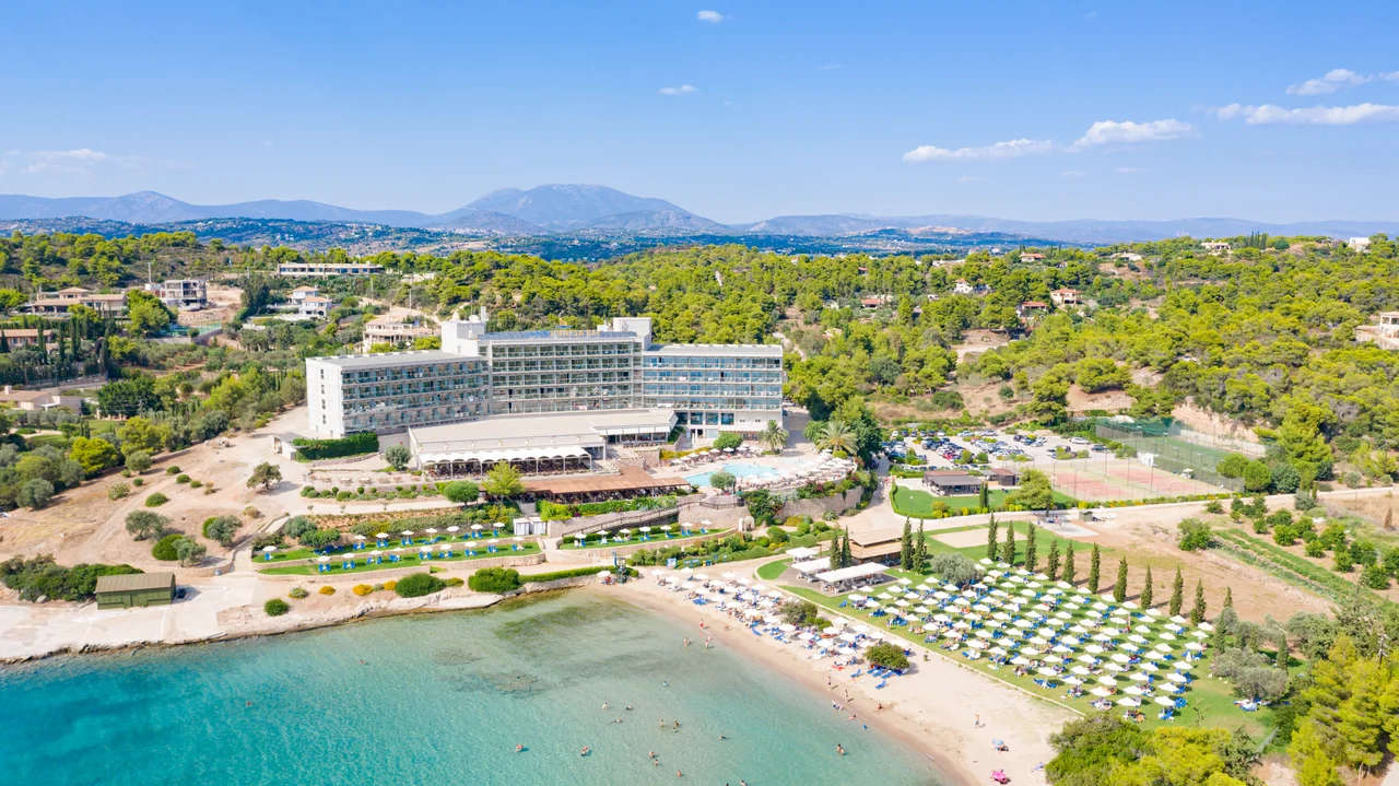
Argolis is not only ruins. Its coastline runs from the busy beaches near Tolo, where day cruises depart for nearby islands, to the quieter shores of the eastern arm of the peninsula around Porto Cheli, favored once by the Greek royal family for its clear water and relative seclusion. Hidden beaches cut into the limestone cliffs are sometimes accessible only by boat or narrow trail. Farther south, the small village of Ermioni sits at the end of a pine-wooded promontory. Ancient Lerna, near the modern town of Myli at the western edge of the gulf, is remembered in mythology as the site where Heracles killed the Hydra — and in archaeology as one of the oldest settled sites in all of Greece, with traces of habitation going back to the Neolithic.
Travelling the Region
Argolis is easy to reach from Athens — the A7 motorway connects the city to Corinth and then south through the Peloponnese, delivering visitors to Argos in under two hours and to Nafplio shortly after. Buses from Athens's Kifissos station reach Argos, Nafplio, and Epidaurus regularly. Within the region, a car gives the most flexibility, particularly for reaching Mycenae, the Heraion, and the quieter coastal villages that infrequent local buses serve only a few times a week. The regional bus network, Ktel Argolidas, covers most major towns. Argolis stays mild through winter, but the summer heat can be fierce on the open plain; the classical sites are best visited in the early morning or late afternoon when the light is gentle and the tour groups have thinned.
From the Air
Argolis lies at approximately 37.67°N, 22.83°E on the northeastern Peloponnese. Approaching from the north at 8,000–10,000 feet, the Argolic Gulf appears as a long narrow inlet pointing south. The flat agricultural plain of Argos is visible to the northwest, with the rocky ridge of Mycenae catching the light above it. Nafplio's small peninsula and the island fortress of Bourtzi are identifiable at the southern end of the plain. The nearest major airport is Athens International (LGAV), approximately 100 km northeast; a secondary option is Kalamata International (LGKL) to the southwest. Visibility is typically excellent in summer; winter haze can reduce it over the plain.
Nearby Stories
- Villa of Herodes Atticus 3 km away
- Sicyon 3.5 km away
- Battle of Megalopolis 4.5 km away
- Hermione: The City at the Edge of the World 7.5 km away
- Agia Lavra 7.7 km away
- Megara 13 km away
- Agistri 13 km away
- Teuthis 15 km away