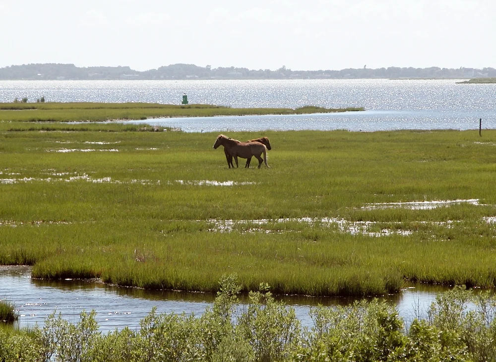

Assateague State Park
Cross the Verrazano Bridge over Sinepuxent Bay on Maryland Route 611, and you arrive at the only state park in Maryland with ocean surf. Assateague State Park is two miles of barrier-island dunes wedged between two sections of Assateague Island National Seashore, all of it at the north end of the long, narrow island that runs 37 miles into Virginia. The Verrazano Bridge is not the famous one - that one is in New York, and this one carries less traffic in a year than the New York span carries in a busy weekend. But it is the only road onto the Maryland District of Assateague, and the wild horses come up to it. A driver paying the entrance fee at the gatehouse may see a band of ponies grazing twenty feet from the booth.
The Bridge to a Wild Beach
Assateague State Park covers about 825 acres on the north end of the barrier island. To the north, the federal land of Assateague Island National Seashore. To the south, more federal land. The state park sits in the middle, bracketed by the National Park Service on both sides - an unusual arrangement that grew out of how the federal and state governments responded to the 1962 Ash Wednesday Storm. The state of Maryland had bought a portion of the island in 1956, intending to develop a state park. The storm of 1962 leveled the development that private interests had begun further south on the island; Congress moved in 1965 to designate the surrounding land as a National Seashore, but the state retained its earlier holding. The result is two miles of state-managed beach surrounded by federally-managed wilderness. The state park has more developed amenities - flush-toilet restrooms, hot showers, a marina, a camp store - while the National Seashore has the longer, wilder beach. Most visitors do not notice the boundary.
Camping in the Dunes
The state park offers about 350 campsites for tents and RVs, divided between oceanside and bayside loops. The oceanside sites sit behind the primary dune, with the sound of surf carrying through the canvas walls all night. The bayside sites face Sinepuxent Bay, with sunsets over the salt marsh and a higher mosquito population in summer. The campground includes hot showers, flush toilets, a camp store, and electrical hookups for RVs - the modern conveniences that the National Park Service campground a few miles away does not provide. Reservations open six months ahead and the summer weekends fill within an hour. Bayside campers wake to the sound of feral horses grazing through the campsites, eating the marsh grass and the unattended snacks; the state park rules require all food to be locked up, but the horses still raid coolers. Park rangers ticket campers who leave food out, not because they want the income but because horses who learn to scavenge become dangerous.
The Surf and the Wildlife
Two miles of lifeguarded beach on the Atlantic side make Assateague State Park one of the most popular swimming beaches in Maryland. The water is the cooler Atlantic, not the warmer Chesapeake; the waves are real surf, not the small breakers of the inland bays. Surfers and bodyboarders share the beach with swimmers; the lifeguards patrol from Memorial Day weekend through Labor Day. Behind the beach, dune crossings on raised boardwalks protect the fragile vegetation that holds the sand in place. The marsh and bay side of the park hosts shorebirds, wading birds, and the wild horses that move freely across the entire island. The piping plovers that nest in the dune scrapes are protected by closures during the April-to-August breeding season. The Friends of Assateague State Park, a nonprofit volunteer group, helps the Maryland Park Service maintain the trails, run education programs, and monitor visitor impact on the wildlife.
The State and the Federal Park
From the air, the boundary between the state park and the National Seashore is invisible. The dunes look the same. The horses graze across both. The piping plovers do not check ranger uniforms before choosing nesting sites. But on the ground, the two parks operate under different rules. The state park charges its own day-use fee, which is not reciprocal with the National Seashore's vehicle entrance fee. Pets are allowed in the state park campground but restricted in the National Seashore. Beach access for over-sand vehicles begins outside the state park boundary. The two parks share a marina, share emergency response, share their volunteer corps - the Friends of Assateague Island works across the federal-state line. For most visitors the boundary is academic. For the park staffs, it is the line where their authority ends. A few times a summer, a runaway tent or a wandering child will cross the line and trigger a coordination call. The horses, meanwhile, keep grazing.
Maryland's Only Ocean Beach Park
Maryland has thirteen miles of Atlantic coastline. Most of it is at Ocean City, which is privately owned developed beach. The rest is on Assateague Island, where the only public access is through the state park and the national seashore. The state park is the only Maryland state park with an ocean beach. For inland Marylanders - Baltimore residents, Hagerstown teachers, Frederick farmers - this is the place a family heads to when they want to swim in real surf without paying for a hotel in Ocean City. Day-trippers from Annapolis or Washington can reach the gate in three to four hours. Summer weekends back the entrance line up onto Route 611. The mainland visitor center at the bridge runs orientation videos. The horses ignore the line. The state park accommodates over a million visitors a year. For most of them, the day at Assateague is the closest they will come to a wild ocean beach. The state park is the gateway. The horses are the reason they come back.
From the Air
Assateague State Park sits at 38.23 degrees north, 75.14 degrees west, on the north end of Assateague Island just south of the Ocean City Inlet. Ocean City Municipal (KOXB) is 4 nautical miles north on the mainland; the state park boundary is clearly visible from the air as the small developed strip of campground and parking between the National Seashore boundaries. Sinepuxent Bay separates the island from the mainland; the Verrazano Bridge crossing is the only road in. Pattern altitude of 1,500 feet AGL gives a clean view of the dune line, the surf, the marsh, and the developed campground. Watch for active Restricted Areas near Wallops Flight Facility 25 nautical miles south during launches.
Nearby Stories
- Bethany Beach 5 km away
- University of Maryland Eastern Shore 9.2 km away
- SS Marine Electric 27 km away
- Accomack County, Virginia 28 km away
- USS General G. W. Goethals 48 km away
- Adkins Arboretum 59 km away
- SS India Arrow 71 km away
- USS Atik 462 km away