
Avşa Island
Every summer, a small island in the Sea of Marmara undergoes a quiet kind of invasion. Avşa — pronounced *aav-shaa* — has just over 3,000 permanent residents, fishermen and vintners and the people who keep the lights on through the gray months. Then the ferries start running in earnest, and the population explodes to more than 50,000. Istanbullus flood in for the sandy coves, the fish restaurants along the quay, and the particular pleasure of being somewhere that feels far away without actually requiring a flight. What they find is an island that resisted the tourist machine just long enough to keep its character intact.
The Island with Two Names
Official Turkey calls this place Türkeli. Nobody else does. On the ferry timetables, in the mouths of the people who live here, in the GPS coordinates of every boat captain who has ever anchored in its coves, the name is Avşa — derived from the island's ancient Greek name, Ἀφησιά, Afissia. The persistence of the old name says something about the island itself: it is a place that has absorbed centuries of arrivals without entirely surrendering what it was before.
The island is shaped like an hourglass, its narrow waist dividing two distinct zones. The west coast holds the main town — also called Avşa — with its ferry port, its cluster of restaurants, and the Lunapark funfair that announces itself as pure summer-holiday kitsch. The east coast is quieter, centered on the village of Araplar (officially Yiğitler), where a marina shelters smaller boats and the pace drops another notch. A ridge of hills no higher than 200 meters runs along the middle, low enough to cross on foot but high enough to give views of the neighboring islands on a clear afternoon.
Wine and the Vine
Avşa is the only island in the Marmara group with a working vineyard open to visitors. Bortaçina sits somewhere in the island's quieter interior, offering wine-tasting paired with meals — a small but genuine pleasure on an island where most of the drinking happens at fish restaurants with plastic tablecloths and sea views. The island lacks free-standing bars, which is either a disappointment or a feature depending on your temperament. What it has instead is the unhurried ritual of a long dinner, with local wine and grilled fish and the sound of the ferry coming in across the water.
This is, by Marmara standards, the buzzy island. The others — Marmara, Paşalimanı, Ekinlik — either have fewer facilities or made a deliberate choice to develop less. Avşa took the other path in the 1970s and became the budget resort of the archipelago. The crowds it drew were almost entirely Turkish; Avşa never attracted the Western package-tour trade that shaped resorts elsewhere on the Aegean. That insularity is part of what makes it feel like the real thing rather than a performance.
Water's Edge
The beaches are the point. Sandy, numerous, strung around the island's coves like beads on a cord, they range from the broad public strands near the main town to quieter inlets that reward a scooter ride or a short scramble. The hills above are low enough to walk without difficulty — the whole island fits inside a leisurely afternoon on foot — and the coast offers views across to Paşalimanı to the west and the small uninhabited island of Eşek to the east.
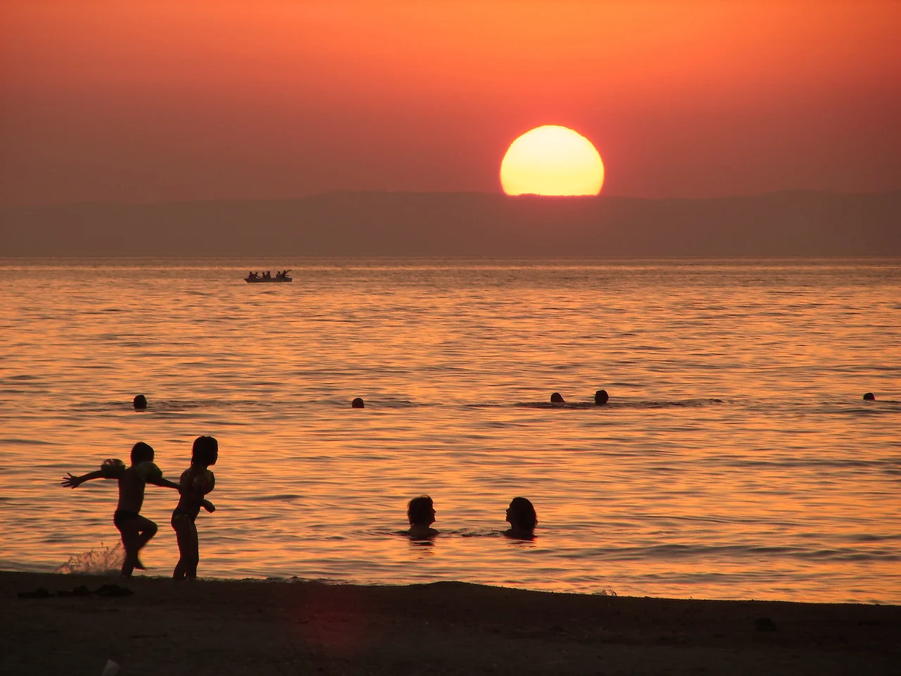
The sea itself is the Sea of Marmara, a body of water with its own peculiar character: warm in summer, calmer than the Aegean but not quite Mediterranean in temperament, and perpetually framed by the silhouettes of other islands and the distant Turkish mainland. From the marina at the island's north tip, sunsets come in long and slow, the light catching the water between Avşa and the outline of Marmara Island to the east.
Getting There and Getting Around
There are no airports in the Marmara Islands. The ferry is everything. Gestaş car ferries run twice daily from Erdek on the mainland — the closest mainland port, about two hours by sea — threading through Balıklı on Paşalimanı before continuing to Marmara Island, and returning via the same route. The ferry is based at Avşa, which means the rhythm of the island's day is organized around its arrivals and departures. Foot passengers can also travel from Istanbul by high-speed ferry to Bandırma, then bus to Erdek.
On the island itself, buses and dolmuşes fan out from the main square by the ferry port. Roads vary in condition, and scooters are the island's preferred vehicle, though the potholes require respect. The distance between the main town and Araplar on the east coast is only 2 kilometers — walkable, though the road is narrow and the sun at midday can be punishing. Most visitors quickly learn the island's pace: slow, warm, and organized around meals.
Neighboring Islands
From Avşa you can see, or easily reach, the rest of the Marmara Archipelago. Ekinlik lies to the north, a small island about 3 kilometers long whose ferry stops only twice a week. It was once a Greek community called Koutalis, a resupply station for sailing ships, and the writer Yaşar Kemal — one of Turkey's most internationally recognized novelists — reportedly used it as the inspiration for the fictional Ant Island in his tetralogy *An Island Story*. There is not much to do on Ekinlik today beyond a walk along the south shore road, but the quiet has its own appeal.
Paşalimanı lies to the west, low-lying and rural, accessible by ferry and best explored by bicycle. Marmara Island itself is larger and more rugged, with quarry workings in the hills and a deeper history that stretches back to ancient Greece. The ferry connects all of these in a single circuit, making the archipelago navigable without much planning — which is exactly how most people prefer to move through it.
From the Air
Avşa Island sits at approximately 40.51°N, 27.51°E in the southern Sea of Marmara, about 76 nautical miles southwest of Istanbul. At 3,000–5,000 feet the island's hourglass shape is clearly visible, with the main settlement on the west coast and the smaller village of Araplar on the east. The ridge of low hills running north-south (maximum 200 m) divides the two sides. Nearest airport is LTBG (Bandırma Airport), approximately 35 km northeast on the mainland — from Bandırma, ferries connect via Erdek to the island. LTFM (Istanbul Airport) serves as the major gateway, with ferry or ground transfer to Erdek as the onward route. Visibility in the Marmara is generally good in summer; light haze can reduce contrast between the islands and the sea in afternoon hours.
Nearby Stories
- Zeleia 5.6 km away
- 2025 Istanbul Earthquake 10 km away
- 1766 Marmara Earthquake 11 km away
- Battle of Aegospotami 44 km away
- Battle of Melantias 56 km away
- Uzunköprü Bridge 64 km away
- Selymbria 65 km away
- Green Mosque of Bursa 81 km away