Baliem Valley
You arrive by plane because there is no other way. Forty minutes out of Jayapura, the coastal humidity drops behind you, the Jayawijaya range rises on either side of the turboprop, and then suddenly the terrain opens into a long green corridor eighty kilometers end to end. Wamena Airport comes up fast. On the ground, at 1,800 meters of altitude, the air is noticeably thinner and noticeably cooler than the coast. The first thing any visitor is told, by the tour guides who meet every arriving flight, is that the trails here have no signs. The second thing is that almost no one in the villages speaks English. The third is that you should hire a guide anyway - not for safety, exactly, but because without one the landscape stays illegible.
Gateway, but for What
Wamena is the valley's only town of any size, and every trek begins in it. From here, guided itineraries stretch from a half-day walk to the bridge over the Baliem River to thirty-day expeditions deep into the territories of the Lani, Dani, Yali, and even - eventually - the Asmat. The town itself is functional: bank, post office, small hotels, three big markets, bicycle rickshaws called becaks that work as informal taxis. Prices are higher than anywhere else in Indonesia because everything arrives by air freight. A cold beer is not available at any price, because the Baliem Valley enforces a regional prohibition on alcohol. Kopi Wamena, the local coffee grown on the surrounding slopes, is what you buy instead.
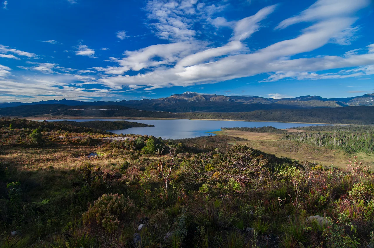
Trails Without Maps
The path you walk today may not exist next month. Landslides during the wet season routinely take out long sections of trail, and detours involve bushwhacking through secondary forest until you pick up the route again on the other side. Many treks climb from 1,800 meters at Wamena to over 3,000 meters at the passes between valleys, and the day's walk typically involves descending to a river crossing at the bottom of one valley before climbing over the ridge into the next. The trail from Wamena to Ungurruk takes three or four days on the standard routes. One variant goes down Mount Elit on makeshift wooden ladders for four consecutive hours - a stretch that turns genuinely dangerous in rain. Southern valley routes can run eight to ten days through villages, jungle, and high muddy plateaux where there is no map, sometimes no trail, and nobody to ask.
The Market and the Bridge
If you never leave town, spend a morning at the main market. The produce section alone is a study in Papuan agricultural diversity - sweet potatoes in half a dozen varieties, winged beans, taro, the local crayfish called udang selingkuh which translates, unhelpfully, as 'cheating shrimp.' Beyond the produce, the market sprawls into a full open-air shopping mall: clothing, canned goods, auto parts, farming tools, cheap electronics. Please ask before photographing. The bridge over the Baliem River just beside the market is where locals come to bathe, wash clothes, fish, and dig gravel, and where Dani and Yali families from remote villages arrive to sell vegetables and buy manufactured goods. On market days, you can watch an hour of this traffic and understand the valley's economy better than a government report would explain it.
Drinking Water and Other Cautions
Water from natural springs upstream of any human settlement is generally cool and generally safe - but this is your responsibility, not your guide's. Carry a backpacker's filter, or boil. Wamena city water is not safe without treatment. Hotels and restaurants supply boiled and filtered water; bottled water comes in half-liter to twenty-liter sizes from small local purification facilities. The altitude will affect you - mild headaches and shortness of breath are normal for the first twenty-four hours, and the cool nights can surprise anyone expecting tropical heat. Night walking in Wamena feels safe in practice, but stay alert and avoid flashing expensive items. Respect local customs. Ask before entering a honai, the circular thatched house that is the traditional Dani dwelling, and never photograph sacred objects without explicit permission.
Why People Come
Eighty-seven years ago, Richard Archbold's expedition flew over this valley by accident and saw a Neolithic civilization of two hundred thousand people farming sweet potatoes in a landscape nobody outside New Guinea knew existed. The valley was not erased by the subsequent decades of contact. Christianity arrived. Indonesian administration arrived. Tourism arrived, in small numbers, after the region opened up in the 1980s. But the Dani, Lani, and Yali still farm the same valleys, still build the same honai, still hold the Baliem Valley Festival each August. A trek here is not a trip to a theme park of the past - the valley is living, modernizing, and complicated. It is, however, one of the few places left on Earth where the distance from airstrip to stone-tool agriculture is measured in hours, not centuries.
From the Air
The Baliem Valley is centered near 4.02 S, 138.90 E in Highland Papua. The valley floor sits at about 1,600-1,800 m, runs roughly 80 km east-west and 20 km north-south, bounded by peaks exceeding 3,000 m. Wamena Airport (WMX / WAVV, 1,660 m elevation) is the only scheduled-service field in the valley. Flights from Jayapura's Sentani Airport (DJJ / WAJJ) take roughly 40 minutes across the Jayawijaya range. Smaller grass and dirt airstrips serve remote villages - most are privately operated by Susi Air, MAF, and similar operators. All operations are VFR, weather-dependent, and typically morning-only. From the air, look for the Baliem River snaking through the valley floor and the distinctive geometric fencing of Dani sweet-potato gardens.
Nearby Stories
- Mapenduma Hostage Crisis 36 km away
- Nduga Hostage Crisis 58 km away
- New Guinea Highlands 99 km away
- Foja Mountains 121 km away
- Trigana Air Flight 267 141 km away
- Lake Sentani 160 km away
- Mamberamo River 257 km away