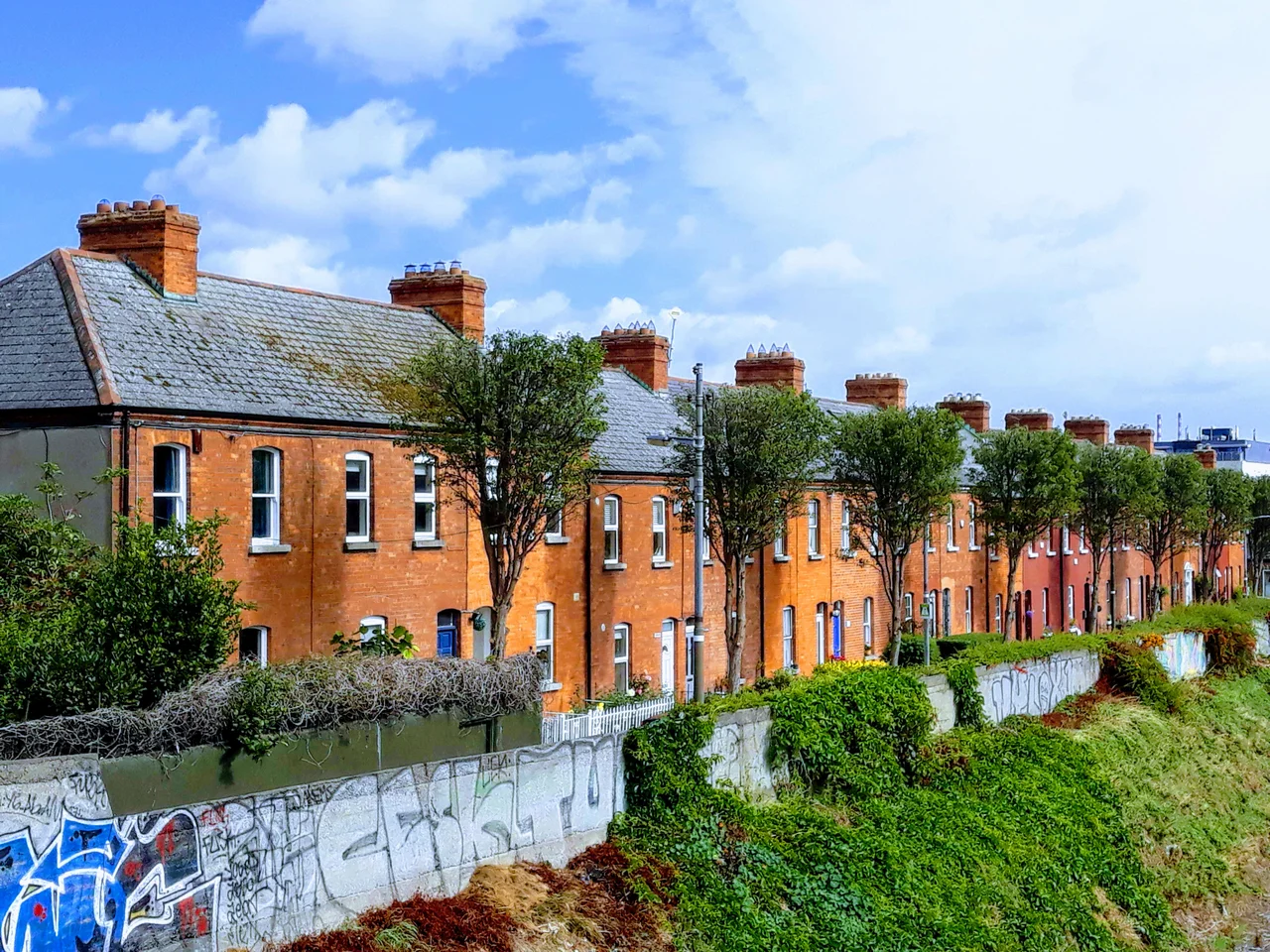

Ballybough
In 1605, three MacDonnell brothers from Ulster fled south as the English plantation of their home province got under way. They came to a stretch of marshy ground between the River Tolka, the future course of the Royal Canal, and the sloblands of the Liffey estuary on Dublin's northern edge. The land was so wet that locals called it Mud Island, and so neglected that the Crown did not bother claiming it. The MacDonnells built mud huts there, elected one of their own as 'King of Mud Island,' and held the place for the next two and a half centuries. Eventually the brothers' descendants acquired their plots by squatters' title - they had simply outlasted any reasonable challenge. Modern Ballybough sits on the same patch of marsh, drained and built over but still recognisably the cross-roads of every story Dublin tells about itself: Viking battles, sectarian killings, tenement rebellion, and the city's only Jewish burial ground from 1718 to 1900.
The Kings of Mud Island
Mud Island's monarchy was a real institution. The islanders elected their king, often but not always from the extended MacDonnell family. Two of the more famous ones were Art Granger and 'Grid Iron' MacDonnell. The Irish Builder described the place sourly in 1870 as a low marsh that had been 'under the influence of the sea' until embankments cut it off. The 1911 Irish Times ran a series of interviews with descendants of the original families, recording memories of smugglers, highwaymen, and robbers who had used Mud Island as a base for raids on the Drogheda Road. Newspaper crime reports from earlier decades confirm the substance of the stories: this was a hard place to police, run by its own internal rules, deliberately ignored by city authorities who preferred not to look. King's Avenue, just off Ballybough Road, still carries the title in its street name. Land reclamation in the nineteenth century eventually folded the island back into the mainland and the kingdom dissolved.
The Bridge and the Slaughters
Ballybough Bridge - now Luke Kelly Bridge, renamed in 1985 for the Dubliners singer who lived nearby - has stood in various forms since 1313, when the mayor John Le Decer built the first wooden crossing of the Tolka here. Floods quickly destroyed it; rebuilding continued through the centuries. Some historians believe the Battle of Clontarf in 1014, in which the High King Brian Boru defeated a Norse-Leinster alliance, was fought in the immediate vicinity of the bridge, near a feature known as the Fishing Weir. In 1534 it was the site of another bloody engagement: Silken Thomas's rebellion against Henry VIII brought his forces here against a Crown garrison, and the resulting fight left, in the words of one chronicler, 'great slaughter of Englishmen' at the bridge and in nearby Clontarf. The current concrete bridge dates from 1937, replacing the medieval stone structure that had survived in various forms for over six hundred years.
The First Jewish Cemetery
Ballybough Cemetery, on Fairview Strand, was the first Jewish burial ground in Ireland. In 1718, Captain Chichester Phillips of Drumcondra Castle signed a forty-year lease with four men whose names record the history of Dublin's small Sephardic community: Alexander Felix, Jacob de Porto, David Machado de Sequeira, and Abraham Meirs. The Jewish population of Dublin at the time was concentrated in Annadale, north of the Tolka. For 182 years - through penal restrictions, brief emancipations, the famine, and the early years of mass migration from the Russian Empire - Ballybough remained the only Jewish cemetery in the city. A new ground opened at Dolphin's Barn in 1900. The last burial at Ballybough took place in 1908. The cemetery is still there, a small walled enclosure on a busy street, with stones inscribed in Hebrew and English, a reminder that Dublin had a tiny Jewish presence two centuries before most Dubliners realised it.
1916 and After
Like much of north inner-city Dublin, Ballybough fought through the Easter Rising and the War of Independence. The Irish Citizen Army seized a factory at Annesley Bridge in 1916 and held it for a day. The 2nd Battalion of the IRA engaged British forces at Ballybough Bridge during the War of Independence. The RIC barracks on Fairview Strand was attacked. One of the conflict's final incidents played out on Bayview Avenue, in an IRA ambush of British soldiers conducting a raid. The single most notorious atrocity of the war happened a few hundred metres north, in Croke Park - Bloody Sunday, 21 November 1920, when Auxiliaries opened fire on a crowd attending a Gaelic football match, killing fourteen civilians including the Tipperary player Michael Hogan. In 2020, the bridge that links Jones's Road to Russell Street, which used to be called Clonliffe Bridge, was renamed Bloody Sunday Bridge in their memory. The Bombing of Dublin in May 1941 - a German attack widely believed to have been navigational error - damaged parts of Ballybough, killing residents and leaving hundreds displaced.
Behan and Kelly
Two voices of twentieth-century Dublin grew up in Ballybough's streets. Brendan Behan, the playwright and memoirist of Borstal Boy and The Quare Fellow, was born on Russell Street and learned the city in its pubs and lock-ups. He was a student at O'Connell Schools on North Richmond Street, founded in 1828 by Edmund Rice and the Christian Brothers. Luke Kelly, the rough-voiced lead singer of the Dubliners folk group, lived nearby and is remembered in the bridge that now bears his name. The stonemason Edward Smyth, whose sculptural figures decorate the Custom House, the Four Courts, the Bank of Ireland on College Green, and the Chapel Royal in Dublin Castle, lived in Ballybough during a working life that helped give Georgian Dublin its sculpted face. Edmund Rice himself, founder of the Irish Christian Brothers, spent time in the area. So did Matt Talbot, the labourer and reformed alcoholic whose grave in Glasnevin still draws pilgrims. Ballybough has produced and harboured an unusually high proportion of the people Dubliners now name their bridges after.
From the Air
Ballybough sits at approximately 53.357 degrees N, 6.250 degrees W on Dublin's inner Northside, immediately south of Drumcondra and west of Fairview, with Croke Park - the GAA's national stadium - on its northeast border. The River Tolka runs through the district from west to east, passing beneath the modern Luke Kelly Bridge. Dublin Airport (EIDW/DUB) lies 7 km north, and arrivals into runway 28R cross the area at low altitude. Best viewing altitude 2,500-4,000 ft. The most visible landmark from the air is Croke Park's roof, with the spire of St Agatha's Church on William Street North marking the local parish centre. Maritime Irish climate, frequent low cloud.
Nearby Stories
- Wicklow Mountains 12 km away
- Mornington 14 km away
- German submarine U-1051 16 km away
- Abbey of Kells 18 km away
- Irish Military Intelligence Service 20 km away
- HMS Manners (K568) 37 km away
- Templemore 42 km away
- Irish Sea Bridge 43 km away