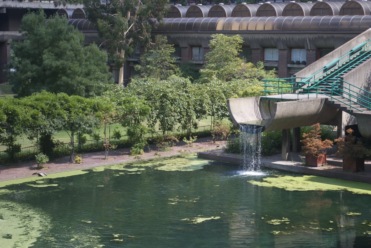

Barbican Estate
There is a layer of bedrock under London that, if you cut through it cleanly, reads like rings in a tree. At the Barbican Estate, three of the rings happen to be the foundations of a Roman fort built around the year 120 AD, the burial ground of the medieval London Jewish community, and the ash of the Cripplegate ward after it was effectively obliterated by German bombs in 1940. On top of all of that, between 1965 and 1976, the City of London built two thousand flats in the most uncompromising brutalist landscape in Britain. It is now home to about four thousand people.
Where the Word Came From
The estate's name is older than the buildings by nearly two thousand years. Around 120 AD the Romans built the principal fort of Londinium roughly where the Museum of London now stands, on the corner of London Wall and Aldersgate Street. Around 200 AD the city walls were extended to incorporate the fort, which became a grand fortified entrance known as Cripplegate. There appears to have been a watchtower - a specula - just outside the wall at this point, which the Normans later called the Base Court, from which we get the modern word bailey. The Low Latin word barbecana meant a fortified outpost, and the Norman watchtower at this spot gave the area its name long before any developer thought of putting concrete towers here.
A Hidden History
Beneath the green squares and concrete walkways lies one of the most poignant layers of London's history. The land where most of the residences and the central square now stand was, in the thirteenth century, the cemetery of the London Jewish community. Records show the burial ground had been expanded several times by acquisition between 1268 and 1290. In 1290, Edward I expelled all Jews from England, and on 12 July 1291 he granted the cemetery to the Dean of St Paul's, an ecclesiastical authority. Archaeological excavations on the site before the Barbican was built revealed what remained, and the findings were published by the Jewish Historical Society of England in 1961. The estate is built directly above the graves of a community that English law had forced to leave.
Out of the Blitz
By 1951 only forty-eight people lived in the entire Cripplegate ward, down from many thousands before the war. The Luftwaffe had erased it. Discussions about what to do with the wreckage began in 1952, and on 19 September 1957 the Court of Common Council of the City of London resolved to build a new residential quarter. The architects were Chamberlin, Powell and Bon, who had already designed the nearby Golden Lane Estate. Where Golden Lane was social housing, the Barbican was something stranger - a private, market-rent estate owned by a local authority but explicitly aimed at affluent City professionals. Promotional brochures from the 1960s and 1970s pictured executives in three-piece suits, advertising the perfect address for international businesspeople. Right to Buy under the Housing Act 1980 turned almost all the flats private.
Names from English History
The estate's fourteen terrace blocks are named after figures connected, more or less, with this corner of London: Bunyan Court for John Bunyan, the Baptist preacher; Defoe House for Daniel Defoe, novelist and spy; Frobisher Crescent for the Elizabethan privateer Martin Frobisher; Ben Jonson House for the playwright; Thomas More House for the lawyer-saint executed at the Tower a short walk south; Mountjoy House for Christopher Mountjoy, the French wig-maker who rented a room to William Shakespeare in his Cripplegate house. Of the four residential towers, three rise to forty-two storeys: Cromwell, Lauderdale, and Shakespeare. The fourth, Blake Tower, was originally a YMCA building and was converted to flats in 2015. When completed, they were the tallest residential towers in London. They held that title until the Pan Peninsula development on the Isle of Dogs eventually overtook them.
How the Buildings Work
Walk around the Barbican and you are walking on a podium. The whole estate is built on a raised pedestrian deck, with vehicles relegated to a lower level and most circulation taking place on highwalks - elevated walkways one to three storeys above the surrounding streets. There is no through traffic. Public car parks sit at the periphery. Most homes look inward onto a central landscape of lakes, fountains, terraces, and a community-run wildlife garden, with St Giles-without-Cripplegate, the medieval church that miraculously survived the Blitz, sitting in the middle of the ponds. Heating and cooling come from Citigen, a central district heating system that supplies the whole complex more efficiently than individual flats could manage, without the chimneys and outdoor units that would clutter the carefully composed exteriors.
Listed and Loved
In September 2001 the Arts Minister Tessa Blackstone announced that the Barbican complex would be Grade II listed. The decision came as some politicians and developers were still flirting with the idea of pulling down brutalist 1960s and 1970s buildings wholesale. The listing made clear that the Barbican was now protected: a site of special architectural interest for its scale, its cohesion, and the ambition of the project. From the air, the estate reads as a great structured rectangle in the City of London, the lake catching light, the three towers casting long shadows. From the ground, depending on the weather and your mood, it can feel like the future you were promised or the future you were warned about. Either way, four thousand people call it home, the wildlife garden quietly thrives, and St Giles still stands in the middle of the ponds where the Romans, the medieval Jewish community, and the Blitz once left their layers.
From the Air
Located at 51.5192 N, 0.0939 W in the City of London, 1.4 miles north-east of Charing Cross. From altitude, look for the geometric block of three tall residential towers and stepped terraces just north-west of Liverpool Street, with the Barbican Centre and its lake at the centre. St Paul's Cathedral is a short distance to the south. Nearest airports: London City (EGLC) approximately 4 nautical miles east-south-east; London Heathrow (EGLL) approximately 15 nautical miles west. Best viewed at 1,500 to 3,000 feet.
Nearby Stories
- Stevenage 5.7 km away
- Malling Abbey 5.7 km away
- 1952 Farnborough Airshow Crash 7.7 km away
- Ingatestone Hall 8.2 km away
- Hellfire Caves 9.1 km away
- The Carrington Event: The Solar Storm That Could Happen Again 9.8 km away
- Bletchley Park 16 km away
- Castle Hedingham 23 km away