
Barrio Puerto
Everything in Valparaíso started here, on a flat sliver of land squeezed between the steep hills and the water. In 1536 the Spanish conquistador Juan de Saavedra came ashore near what is now Plaza Echaurren, named the bay after his hometown in Spain, and the city grew outward from that landing like a stain spreading across a map. Barrio Puerto, the port neighborhood, is the oldest ground in town, the strip running between Plaza Wheelwright and Plaza Sotomayor where sailors, merchants, and stevedores have crossed paths for nearly five centuries. Walk it today and you read the whole story of a city in its peeling facades and its salt-bleached stone.
Where the City Was Born
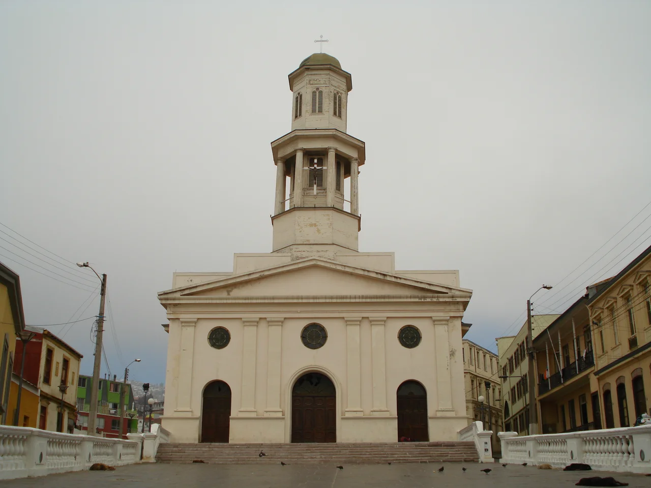
The Puerto is the seed from which all of Valparaíso sprouted. The hills came later, climbed by elevators and clung to by tin-roofed houses, but the plan, the flat land at the water's edge, came first. Here stood the customs houses, the inns, the chandleries that supplied passing ships. The Iglesia de la Matriz, the city's oldest church, anchors the quarter's narrow lanes, its bell once the loudest sound for blocks. Cobblestones still rise and fall over ground that was, in places, reclaimed from the sea itself. To stand in the Puerto is to stand on the foundation of a port that international sailors once nicknamed Little San Francisco for its rough energy and its fortune-seeking crowds.
The Mercado Puerto
For generations the Mercado Puerto, built in 1924, was the neighborhood's stomach. Its iron-and-glass halls rose near the spot where Saavedra had landed centuries before, and after a 2002 restoration its arcades filled with seafood restaurants serving the morning's catch, congrio and machas and the cold white wine of the central valley. Then came the 2010 earthquake, one in a long line of quakes that have repeatedly remade this seismic coast. The market emptied. The shaking that has flattened churches and cracked facades here for centuries did not spare the Puerto's grandest civic room, and the loss was felt as a kind of grief for a place that had fed the neighborhood's working people.
Faded Glory, Stubborn Life
Honesty about the Puerto means admitting its hard decades. When the Panama Canal opened in 1914, ships stopped rounding Cape Horn, and Valparaíso's golden age as the Pacific's leading commercial port drained away. The Puerto, closest to the docks, felt the decline most sharply. Businesses and families moved uphill or out of the city, and the quarter gained a reputation for crime and neglect. Yet people stayed. The neighborhood's brothels, bars, and boarding houses had always belonged to the men who worked the sea, and that gritty, lived-in character never fully faded even as the money left.
A Quarter Trying to Turn the Corner
In 2003 UNESCO inscribed the historic seaport of Valparaíso as a World Heritage Site, an acknowledgment that this improvised, vertical, slightly chaotic city was an exceptional witness to the early globalization of trade. The recognition gave the Puerto new purpose. In 2016, under a program to revive the city's heritage neighborhoods, residents painted the facades of shops and historic buildings and threw a street festival of food and music. Renewal here has come in fits and starts rather than sweeping transformation, and the Puerto remains a neighborhood of contrasts: scaffolding beside ruin, a freshly painted wall beside a boarded window, the smell of frying fish drifting over stones laid before anyone alive can remember.
The Edge of the Working Port
What sets the Puerto apart from Valparaíso's prettier postcard hills is that it never stopped being a port. The cranes and container stacks of the modern harbor crowd right up against the old neighborhood, and the rhythm of loading and unloading still sets the pace of the day. Plaza Echaurren, near where Saavedra first stepped ashore, remains a gathering point, ringed by old cafes and the comings and goings of dockside life. From here the hills rise in every direction, laced by the famous funicular elevators that have hauled residents up the slopes since the 1880s. The Puerto is the hinge where the flat working waterfront meets the vertical, painted city, the place where Valparaíso has always touched the sea.
From the Air
Barrio Puerto sits at 33.037°S, 71.630°W, at the western, sea-level end of Valparaíso's historic quarter on Chile's central coast. From the air the neighborhood reads as the dense flat grid pinned between the curving working port to the north and the amphitheater of hills rising steeply to the south. The nearest field is Viña del Mar Airport (SCVM), a Chilean Navy base about 16 km north with only occasional civilian use; the small Rodelillo airfield (SCRD) lies just southeast above the city. The main gateway is Santiago's Comodoro Arturo Merino Benítez International Airport (SCEL), roughly 110 km inland to the east. Recommended viewing altitude is 1,500 to 3,000 feet AGL for a clear read of the port, the plaza, and the hillsides; coastal fog and the marine layer often soften mornings before clearing by midday.
Nearby Stories
- Battle of Papudo 24 km away
- Casa de Isla Negra 28 km away
- Battle of Chacabuco 31 km away
- Battle of Maipú 38 km away
- Aconcagua 94 km away
- Constitución, Chile 237 km away
- Santa Olga 278 km away
- 1687 Peru Earthquake 1982 km away