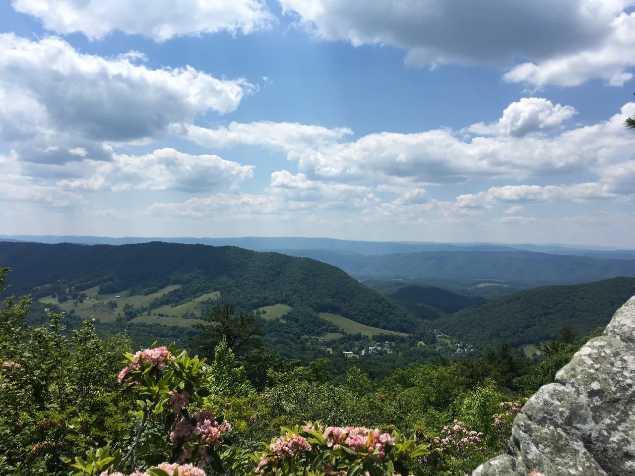

Bath County, Virginia
Drive every mile of paved road in Bath County, Virginia, and you will not encounter a single traffic signal. The county is the only one in Virginia that can say this, and it intends to keep the distinction. There are not enough cars or intersections to justify a light, and there have not been since the county was established in 1790. Bath has 4,209 residents spread across 535 square miles of central Allegheny mountain country - the second-least-populous county in the Commonwealth. Eighty-nine percent of it is forest. Most of the rest is hot springs, golf courses, and the kind of two-lane roads that thread along ridgelines without anywhere obvious to put a signal.
Named for an English Spa
Bath County was created on December 14, 1790, from parts of Augusta, Botetourt, and Greenbrier counties. The new county was named for the natural mineral springs in its territory, which prompted comparisons to the English city of Bath - the Roman-era spa town in Somerset that had been famous for its hot mineral waters for nearly two millennia. The English Bath had been a fashionable destination for the British aristocracy throughout the eighteenth century. American settlers in this corner of the Shenandoah Valley borrowed the name partly out of aspiration, partly because the chemistry of the local springs really did remind them of what they had heard about the European originals.
Who Settled Here
Before the county was formed, the area was settled in the early 1700s by families with ancestry principally in England, Scotland, Germany, Wales, Ireland, and France. The English settlers came from a particular set of counties - Derbyshire, Hampshire, Wiltshire, Gloucestershire, Northamptonshire, parts of Sussex, Dorset, Somerset, Norfolk, Suffolk, Surrey, Kent, and Lincolnshire - which is a more specific list than most American counties can produce about their early settlers. Like much of the Shenandoah Valley, Bath had a large share of residents descended from Scots-Irish immigrants and German farmers, both groups that had moved south from the Pennsylvania back country. By 1800, most county residents were subsistence farmers, with smaller numbers of artisans and shopkeepers. The mountains were rough, the soil thin, and the springs were already drawing visitors who needed somewhere to stay and eat.
The Homestead Era
The springs, more than any other resource, defined the county's economy. Thomas Bullitt built his lodge in 1766 - 24 years before the county itself existed - and it has hosted vacationers ever since. The modern Omni Homestead Resort traces to the J. P. Morgan-led rebuilding of the 1890s, but the underlying business is one of the oldest continuously operating tourism enterprises in the United States. The Homestead remains the county's major employer. Lake Moomaw in the southern part of the county draws campers and anglers. Douthat State Park covers six percent of Bath's land area. The George Washington National Forest, which covers 51 percent of the county, provides recreation while sheltering the Cowpasture and Bullpasture River watersheds. The Nature Conservancy owns the Warm Springs Mountain Preserve, more than 9,000 acres protecting some of the most ecologically significant habitat in the Central Appalachians.
Sam Snead's Backyard
Sam Snead, the PGA Tour champion who won 82 official tournaments - a record that stood until Tiger Woods tied it in 2019 - was a Bath County native who lived in or near Hot Springs his entire life. He served for decades as the Homestead's golf pro, and his presence helped make the resort's Cascades Course one of the best-known golf venues in the South. Other Bath County natives include the soprano vocalist Custer LaRue, the computer scientist Dan Ingalls - who eventually became president of the Homestead - the NPF pitcher Jailyn Ford, and the NFL tight end John Phillips. Creigh Deeds, the state senator who narrowly lost the 2009 Virginia gubernatorial race, represents the county in Richmond. For a county of about 4,000 people, the export rate of notable residents has run higher than the math should allow.
Bath County's Big Battery
Hidden in the mountains east of Warm Springs is one of the most powerful things humanity has built: the Bath County Pumped Storage Station, a hydroelectric facility operated by Dominion Energy and FirstEnergy. With a generating capacity of just over three gigawatts, it is one of the largest pumped-storage power stations in the world, and effectively serves as one of the planet's biggest batteries - pumping water uphill when electricity is cheap and letting it run back down through turbines when demand is high. The two reservoirs sit on either side of a 1,260-foot vertical drop. Visitors who drive through Bath County have no idea most of this is happening behind the ridges. The traffic-signal-free, 4,209-person county is the home of an essential piece of the eastern U.S. electrical grid - and most residents prefer to talk about the springs.
From the Air
Located at 38.06 degrees north, 79.74 degrees west, in the Allegheny Mountains on the western edge of Virginia, bordering West Virginia. The county is mostly forested with two major valleys (Warm Springs / Hot Springs and the Cowpasture). Best viewed from VFR altitudes of 5,500 to 8,500 feet AGL. The closest airport is Ingalls Field (KHSP) at Hot Springs - a high-elevation public airport at 3,793 feet MSL. Greenbrier Valley (KLWB) is about 25 nautical miles southwest. The northwestern corner of the county is within the U.S. National Radio Quiet Zone affecting the Green Bank Observatory. Watch for mountain wave, rotor activity, and morning valley fog.
Nearby Stories
- Natural Chimneys 4.7 km away
- Highland County, Virginia 6.9 km away
- Spice Run Wilderness 6.9 km away
- Frontier Culture Museum 8.8 km away
- The Greenbrier Bunker 13 km away
- Washington and Lee University 16 km away
- Amherst, Virginia 24 km away
- Webster Sycamore 28 km away