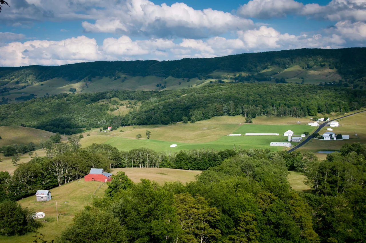

Highland County, Virginia
When 60,000 people arrive in March for the Highland County Maple Festival, they outnumber the year-round population of the entire county by 27 to 1. Highland is Virginia's smallest county by population - 2,232 residents at the 2020 census - spread across 416 square miles of high mountain country where the average elevation is the second-highest in the state. Locals call it "Virginia's Switzerland." Henry Ford, Thomas Edison, and Harvey Firestone came through in 1918 looking for the same thing the modern visitor finds: ridges, valleys, narrow roads, and a quietness that has not changed much in a century.
Carved from Bath and Pendleton
Highland County was created on March 19, 1847, when the Virginia General Assembly carved it out of Bath County to the south and Pendleton County to the north (Pendleton is now in West Virginia). The motivation was distance: the western frontier settlements were too far from the existing county seats to function efficiently, and the recently built Staunton-Parkersburg Turnpike had created a new economic axis. The new county was named for its lofty elevation. The highest point in the county reaches 4,545 feet in the Allegheny Mountains along the western border. The lowest sits at 1,625 feet near the Cowpasture River. Between those two extremes lies a Ridge-and-Valley landscape oriented northeast-to-southwest, where five distinct valleys - the Alleghany, Bluegrass, Monterey, Bullpasture, and Cowpasture - run between mountain ridges of similar pattern.
Where Two Watersheds Begin
Highland County is one of the few places in the eastern United States where you can drive between two distinct major watersheds in about ten minutes. South of Monterey, the county seat, water flows into the James River and eventually into the Chesapeake Bay via Richmond. North of Monterey, water flows into the South Branch Potomac River and eventually into the same Chesapeake Bay via Washington. The village of Hightown, west of Monterey on U.S. Route 250, sits exactly on the divide - the headwaters of the Jackson River, a James tributary, rise on the south side of Main Street, and the headwaters of the South Branch Potomac rise on the north. Hightown also gets its name from being one of the highest villages in the county at about 3,300 feet.
The Battle of McDowell
The Civil War turned Highland County into strategic ground because of the Staunton-Parkersburg Turnpike. Whoever controlled the road controlled the movement of supplies between the Shenandoah Valley and the Ohio. Union and Confederate troops spent a miserable winter in 1861 holding opposing high-elevation positions along the road - the same campaign that produced the Battle of Camp Allegheny in December. On May 8, 1862, the Battle of McDowell took place at the village of McDowell, in the southeastern corner of the county - the first Confederate victory of Stonewall Jackson's Shenandoah Valley campaign. The National Park Service considers the McDowell battlefield the best preserved of all the Shenandoah Valley battlefields. The Highland County Museum and Heritage Center at McDowell tells the story of the battle alongside the broader story of the county.
Maple Syrup and the Maple Festival
Highland is one of the only counties in the southern United States with the elevation and climate to support a maple syrup industry. The sugar maples here produce the sap that drives the Highland County Maple Festival, held the second and third weekends of March every year since 1958. The festival opens sugar camps to public tours, serves stacks of pancakes drowned in local syrup, and brings in over 60,000 visitors - which has been designated a Local Legacy by the Library of Congress. The county's permanent population is otherwise sustained mostly by cattle grazing - 36 percent of the land is in agricultural use - and by wool production. The mountainous terrain leaves only a small fraction of land suitable for row-crop cultivation, so the agriculture that works here is the kind that works on slopes: grazing, sheep, and trees.
Frontier Designation
Highland County is one of just 50 counties east of the Mississippi River - excluding Minnesota - that the federal government designates as frontier. Population density: 5.59 people per square mile in 2010. There is no Interstate highway in the county. There is no public airfield. There is no railroad - though one was chartered in 1892 to connect Monterey to the C&O line in Augusta County, the venture never broke ground because the mountains were too steep and the traffic too limited to justify the investment. The only general patient-care medical facility is the Highland Medical Center in Monterey. The Recorder, a regional newspaper covering Bath, Highland, and the surrounding region, publishes from offices in Monterey and in Mitchelltown across the county line in Bath. All of Highland is within the U.S. National Radio Quiet Zone, which adds additional limitations on cellular service. The frontier designation is bureaucratic. The frontier experience is real.
From the Air
Located at 38.35 degrees north, 79.56 degrees west, in the Ridge-and-Valley Allegheny country of west-central Virginia, bordered by West Virginia to the north (Pendleton County) and west (Pocahontas County). The county features ridge-parallel valleys running northeast-southwest, with elevations from 1,625 to 4,545 feet. Best viewed from VFR altitudes of 7,500 to 10,500 feet AGL. The closest public airports are Ingalls Field (KHSP) at Hot Springs about 20 nautical miles south and Shenandoah Valley Regional (KSHD) at Staunton about 25 nautical miles east. Highland County itself has only one private airfield south of Monterey. CRITICAL: The entire county is within the U.S. National Radio Quiet Zone - check NOTAMs for any restrictions on aircraft radio transmissions before transiting. Watch for mountain wave and turbulence.
Nearby Stories
- Pearl S. Buck Birthplace 4.3 km away
- Sinks of Gandy 4.9 km away
- Frontier Culture Museum 5.1 km away
- Helvetia, West Virginia 5.4 km away
- Natural Chimneys 6 km away
- Bath County, Virginia 14 km away
- Yew Mountains 20 km away
- Orkney Springs Hotel 28 km away