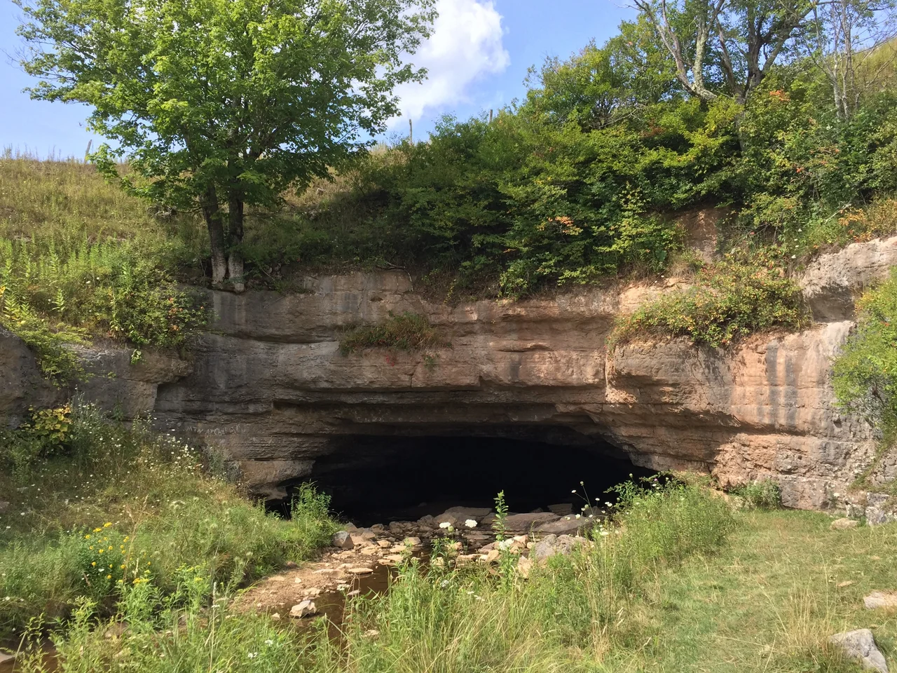

Sinks of Gandy
Gandy Creek does not flow over the ridge between Allegheny and Rich Mountains. It flows under it. For roughly 3,000 feet, the creek disappears into a low ledge of limestone in a wide meadow, travels through a passage that opens to 100 feet wide in places, and emerges on the other side of Randolph County Route 40, near a spur of Yokum Knob. The Sinks of Gandy are not the longest cave in West Virginia, nor the most decorated, nor the most famous. They are simply a place where a creek has been doing what creeks rarely do for at least the last few thousand years - taking a shortcut through a mountain.
How a Creek Goes Underground
The upstream entrance to the Sinks is about 30 feet wide and 15 feet high, set in the limestone wall of a depressed meadow. Inside, the passage runs straight enough that most visitors with simple household flashlights can navigate it. Ceilings vary from 4 to 35 feet. The main corridor averages 40 to 60 feet across, with a few wider rooms approaching 100 feet. In some stretches, the creek occupies the whole floor and requires wading; in others, it cuts a narrow trench and leaves dry ground beside it. The downstream entrance is offset about 100 feet east of the wet stream exit, which makes finding the dry way out tricky. Plenty of visitors miss it and return the way they came in.
Uriah Gandy and the First Records
Gandy Creek - and through it, the Sinks - takes its name from Uriah Gandy (or Gandee), who settled in the area around 1781. Local farmers knew the cave well by the 1830s. The earliest recorded mention may be a November 1833 letter from Randolph County physician Benjamin Dolbeare to the Virginia Historical and Philosophical Society in Richmond, describing how the creek 'runs under this ridge which is about three-quarters of a mile wide at its base, and very high.' The Sinks also marked a less pleasant historical milestone: the last elk killed in what is now Randolph County were shot near here, probably around 1830 and 1835. The species would be gone from all of West Virginia by 1843, with the final animals killed in nearby Canaan Valley.
A Civil War Shootout in the Dark
In March 1864, the Sinks hosted one of the war's more obscure encounters. Eight men from Confederate General John D. Imboden's command had been raiding wagon trains in the area. They crossed into Tucker County, robbed a general store about three miles from Saint George, and started back south. A Union captain and lieutenant pursued. The two forces met at the Sinks the next day. Three of the Confederates were killed in the shootout. Two more were captured. The stolen goods were recovered. The encounter changed nothing strategic. But it captured something about the region during the war: a fragmented, mountain-by-mountain conflict where a remote cave could become a battleground because someone happened to be running through it.
Strother's Tunnel and Preble's Pamphlets
The Sinks first reached a national audience through a magazine piece. David Hunter Strother, the West Virginia-born writer and illustrator who worked for Harper's Magazine, published 'The Mountains' in 1872 and 1873, based on a visit he had made around 1854. The story followed a group of 'Virginia gentlemen' on a humorous expedition to find the 'tunnel of Gandy,' and it leaned on stereotypes of mountain people that were condescending then and worse now. A century later, West Virginia writer Jack Preble produced his own series of articles and booklets between the 1940s and the 1960s, romanticizing the cave for a new generation of tourists. The West Virginia Highway Department, sensing potential, began replacing 'Osceola' with 'The Sinks' on official road maps during this period.
Surveyed, Then Resurveyed
The National Speleological Society first formally surveyed and mapped the Sinks on September 1, 1940, recording 3,056 feet of passage. A more thorough resurvey in 1990 added 5,058 more feet to the map for a total of 8,114 feet, making the Sinks the 669th longest surveyed cave in the United States. The entrances remain on private land. The Teter family owns the upstream entrance and has held the property since at least 1854, when Strother visited. The Tingler family owns the downstream exit. No signage marks the cave, but a parking lot on Dry Fork Road provides access via a short trail. The cave forgives inexperience well enough that families with flashlights wade through every summer.
From the Air
Located at 38.71 degrees north, 79.64 degrees west, near Osceola in eastern Randolph County, West Virginia, within the Monongahela National Forest. Best viewed from 4,500 to 6,500 feet AGL. The Sinks themselves are not visible from the air, but the depressed meadow at the upstream entrance and the Dry Fork drainage are recognizable features. Look for the spur of Yokum Knob and County Route 40 winding alongside the creek. Nearest airport is Elkins-Randolph County (KEKN), about 25 miles north.
Nearby Stories
- Jones-Imboden Raid 6.5 km away
- Helvetia, West Virginia 7.1 km away
- Tucker County, West Virginia 9.9 km away
- District of West Augusta 11 km away
- Moorefield 13 km away
- Mole Hill 14 km away
- Lighthorse Harry Lee Cabin 22 km away
- Yew Mountains 28 km away