
Helvetia, West Virginia
Thirty-eight people live here. The road to Helvetia is County Route 46, narrow and curving, and the village does not appear until the last bend before you arrive at it. Once you are there, you are there - a small green, a white church, a community hall, a country store, and a restaurant called the Hutte that serves Swiss food made from recipes the settlers brought with them in 1869. Helvetia is not a place to do anything in particular. It is a place to walk, fish, browse the shops, sit in the shade with a book, and, if you are lucky enough to be there on the right Saturday, square dance until late at the Community Hall.
How the Swiss Found a Hollow
The story begins in New York in 1868 with a group of Swiss immigrants who had been recruited by a land company to settle a tract of cheap mountain land in West Virginia. They had seen advertisements for the rolling, fertile fields the company promised. What they actually arrived at - after a long train ride and a longer wagon trip up into the hills - was a hollow at 2,500 feet of elevation, surrounded by steep wooded ridges, with thin soil and a short growing season. The land was not what had been promised. But it was the land they had, and they made it work. The first cabins went up that winter; the first crops the following spring; the first cheese, made from milk produced by the small dairy herds they assembled, sometime not long after. They named the place Helvetia and stayed.
The Hutte and the Apple Butter
Food is part of how Helvetia stays Helvetia. The Hutte restaurant, in a frame building on the village green, serves a small menu of Swiss-influenced dishes - sausages, rosti, sauerkraut, brats, sometimes fondue, always whatever soup is on the stove that day. The cooking is honest and the portions are generous and the recipes have been used in this hollow for a century and a half. The cheese - Helvetia Swiss cheese, made in the village since the 1800s - is sold at the Cheese Haus next door and shipped by mail order. Apple butter is the other signature: spiced, slow-cooked from local apples in copper kettles, sold in pint jars at the store. Both products represent the simple fact that the people who came here in 1869 brought their food traditions with them and the descendants have not let go.
Fasnacht and Helvetia Day
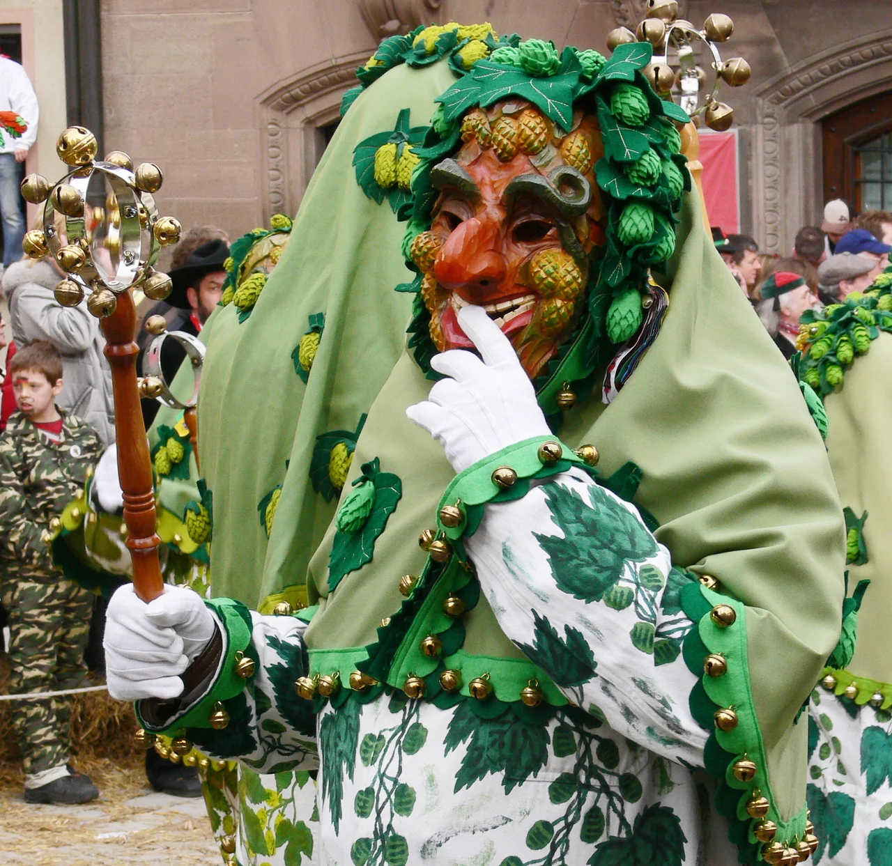
Helvetia keeps two community celebrations that draw outsiders. Fasnacht, on the Saturday before Lent, is the Alpine pre-Lenten carnival. Costumed dancers in elaborate hand-carved wooden masks parade through the village, gather in the Community Hall for a meal and a square dance, and at midnight burn an effigy of Old Man Winter on a bonfire. The masks have been carved by villagers across generations; some are over a century old. Helvetia Day, held on the Saturday closest to October 20, marks the arrival of the first settlers in 1869. It features a historic walk along the original path from where the settlers stepped down to where they camped, a folk dance workshop, square dancing in the hall ($5 admission), and a roll call of family names that have been in the valley since the beginning.
How to Get In and Out
Helvetia is on County Route 46. The nearest larger towns are Buckhannon, about an hour north, and Elkins, about an hour northeast. Both routes are scenic but slow. The road through the Pickens area to the south is similarly mountain country, climbing and descending through the Monongahela National Forest on grades that demand attention. There is no shortcut to Helvetia and no fast way out. That is part of why the village still exists in the form it does - because the back-of-beyond location that disappointed the original settlers also insulated their village from the homogenizing forces that wore down so many other ethnic settlements in Appalachia. To go to Helvetia is to commit several hours to getting there and several hours to getting back, and to spend the time in between in a hollow that has been quietly itself for more than 150 years.
From the Air
Helvetia is at 38.71 N, 80.20 W in Randolph County, central West Virginia, at about 2,500 feet elevation in a high mountain hollow. Best viewed at 3,500-5,500 feet AGL; the village appears as a small cluster of buildings around a green in a deep wooded hollow. Nearest airport: Elkins-Randolph County (KEKN) about 20 nm northeast. The Monongahela National Forest extends in every direction. Watch for terrain hazards if approaching low - the surrounding ridges rise to 3,000-3,500 feet. Best aerial views come from approaching at altitude from the east or southeast.
Nearby Stories
- Battle of Camp Allegheny 7.4 km away
- Weston Colored School 12 km away
- Appalachia 13 km away
- Sinks of Gandy 15 km away
- Clay, West Virginia 20 km away
- Tucker County, West Virginia 22 km away
- Cranberry Wilderness 24 km away
- North Bend Rail Trail 31 km away