
Battle of Camp Allegheny
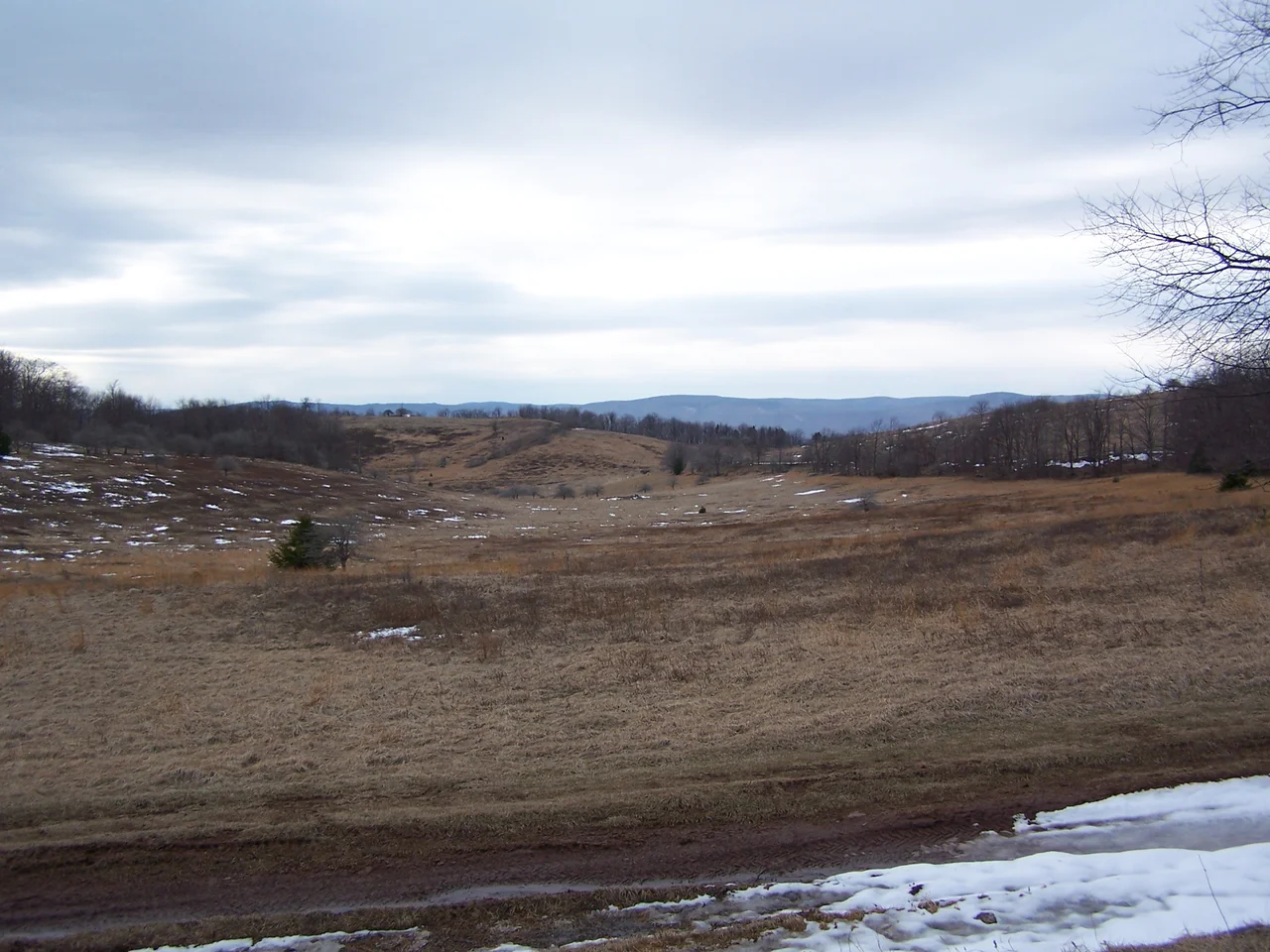
On December 13, 1861, a Union force of about 1,900 men under Brigadier General Robert Milroy climbed Allegheny Mountain to attack a Confederate camp at roughly 4,400 feet of elevation. The temperature was below freezing. Snow lay on the ground. The Confederate force - six regiments under Colonel Edward Johnson - had been entrenching since October, fortifying their position with log huts and earthworks against the coming winter. The attack lasted most of the morning. Both sides maneuvered for advantage on terrain so steep that some soldiers reported being unable to fire uphill effectively. By early afternoon, Milroy ordered a retreat to his camps near Cheat Mountain. The Confederates held their ground. The battle was tactically inconclusive but strategically important: Edward Johnson's defense kept the Staunton-Parkersburg Turnpike in Confederate hands for the rest of the winter.
Why a Camp on a Mountain
The Staunton-Parkersburg Turnpike ran east-west across the Allegheny ridges, connecting the Shenandoah Valley with the Ohio River. It was the only practical wagon road across the central Alleghenies, and whoever controlled it controlled the movement of supplies between the two sides of the mountains. After Robert E. Lee's failed Cheat Mountain offensive in September 1861, the Confederate command needed to hold the high ground east of Cheat to keep Union forces from pushing further into Virginia. Camp Allegheny was sited on the summit of Allegheny Mountain near the Pocahontas-Highland county line, at the crest of the turnpike. Edward Johnson - later nicknamed "Allegheny Johnson" after this battle - took six regiments to the mountain in October and began building winter quarters. The camp included log huts, earthworks, a small cemetery, a church site, and the Yeager farmstead that the Confederates appropriated for headquarters.
Milroy's Morning Attack
Robert Milroy left his Cheat Mountain camps in the predawn hours of December 13 with about 1,900 men, planning a surprise attack. The Union column climbed Allegheny Mountain in deep cold. The element of surprise mostly held - the Confederate pickets were overrun before they could give full warning - but the geography of the camp itself meant that the defenders had time to form a line. Fighting continued for most of the morning. Union troops attempted to flank the Confederate position from multiple directions. Confederate counter-attacks pushed back. The terrain was steep enough that uphill fire was sometimes ineffective. Casualties were not catastrophic by Civil War standards - somewhere between 350 and 450 men killed, wounded, captured, or missing in total - but the cold and the exhaustion of fighting at high altitude in winter took a toll that the numbers do not fully capture.
The Retreat and the Winter That Followed
Milroy ordered the withdrawal in the early afternoon. The Union force retreated down the mountain to Cheat. The Confederates held the high ground and the turnpike. Edward Johnson became Major General Edward "Allegheny" Johnson, the nickname a permanent part of his military reputation. He went on to serve in the Eastern Theater - returning to command after a year convalescing from a wound at McDowell, promoted to major general in February 1863, leading Stonewall Jackson's old division at Gettysburg and during the 1864 Overland Campaign, where he was captured at the Bloody Angle at Spotsylvania on May 12, 1864. The Confederate force at Camp Allegheny remained on the mountain through the winter, in conditions that nearly destroyed the army through frostbite, disease, and desertion as much as through combat. By April 1862, both sides had abandoned the high-altitude camps that had been so hard to hold through a winter at 4,400 feet.
A National Historic District
The Camp Allegheny Historic District was listed on the National Register of Historic Places in 1990. The district encompasses one contributing structure and four contributing sites: the earthworks the Confederates dug, the hut and campground site, the small cemetery where some of the dead from both sides were buried, the location of the church that served as a chapel, and the site of the Yeager farmstead. The earthworks are still visible on the mountain - low ridges and depressions in the forest floor where Confederate soldiers cut their fortifications by hand in October and November of 1861. The cemetery is small and quiet, marked by stones for soldiers whose names sometimes survived and sometimes did not. Ambrose Bierce, who served as a Union officer in the western Virginia campaigns and later wrote about them, included an essay called "A Bivouac of the Dead" that drew partly on his experience of these mountains. The bodies buried at Camp Allegheny were men far from home, fighting in conditions that made even survival a question.
From the Air
Located at 38.47 degrees north, 79.72 degrees west, on the summit of Allegheny Mountain near the Pocahontas County (West Virginia) - Highland County (Virginia) line. The battlefield is at approximately 4,400 feet MSL, near the crest of US Route 250 (the modern descendant of the Staunton-Parkersburg Turnpike). Best identified from VFR altitudes of 6,500 to 9,500 feet AGL where the high ridge stands out. The closest airports are Marlinton (W99) about 14 nautical miles west and Ingalls Field (KHSP) at Hot Springs 20 nautical miles southeast. The area lies within the U.S. National Radio Quiet Zone - check NOTAMs. Watch for mountain wave activity and rapid weather changes.
Nearby Stories
- Pearl S. Buck Birthplace 4.3 km away
- Sinks of Gandy 4.9 km away
- Frontier Culture Museum 5.1 km away
- Helvetia, West Virginia 5.4 km away
- Natural Chimneys 6 km away
- Bath County, Virginia 14 km away
- Yew Mountains 20 km away
- Orkney Springs Hotel 28 km away