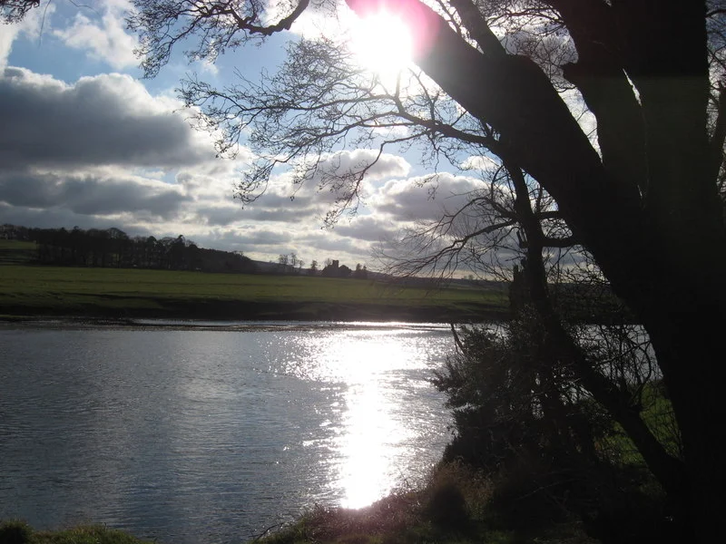

Battle of Carham
Thirty days before the battle, a comet hung over the Tweed. Symeon of Durham would later note its passing as if the sky itself had marked what was coming. When the armies finally met at Carham in 1018, on a stretch of riverbank that today looks no different from a thousand other Border fields, the English of Bamburgh under Earl Uhtred faced a coalition of Scots under Malcolm II and Cumbrians of Strathclyde led by Owen the Bald. The slaughter was bad enough that eighteen priests are said to have died in the carnage, and the Bishop of St Cuthbert, hearing the news, was reported to have died of grief. By dusk, the Tweed had quietly become something it had never been before: a border.
The River That Became a Frontier
Before Carham, the line between English Northumbria and the Scottish kingdom was a smudge rather than a stroke. The earls of Bamburgh ruled a rump of the old Northumbrian realm that stretched from the Firth of Forth down to the Tyne, while the Scottish kings looked south with ambitions of their own. The mutual interest that brought Malcolm II's Scots together with Owen the Bald's Cumbrians remains a matter of inference rather than record. Some historians point to Uhtred's weakening position after Cnut the Great's conquest of England in 1016, which had stripped him of his authority in York and left him a diminished ruler clinging to Bamburgh and the lower Tweed basin. A weakened neighbour is an inviting target. Plunder, prestige, and territory all hung in the balance, and the Scots had not forgotten their own defeat by Uhtred at the hands of the Bamburgh English in 1006.
A Battle Half-Remembered
The strange thing about Carham is how nearly it slipped through the cracks of history. The contemporary Anglo-Saxon Chronicle says nothing about it at all. Almost everything we know comes from Durham, where Benedictine monks like Symeon, writing around 1110, recorded a famosum bellum, an infamous battle, in which a countless multitude of Scots overwhelmed the Northumbrians. The Anglo-Latin annals known as Historia Regum called it ingens bellum, a massive battle, apud Carrum. Even the date is contested: the near-contemporary Chronicle records Uhtred's death two years earlier, in 1016, which would mean either a different leader or a different date. The comet of August 1018, observed by astronomers and chroniclers alike, tilts the evidence toward 1018, with Uhtred most likely in command. History, as Symeon practiced it, was often a matter of choosing which thread to follow.
What a Defeat Buys
Whether Carham gave Malcolm II the region of Lothian outright, or merely accelerated a takeover already underway, is one of those quarrels historians never quite settle. Scottish writers since the nineteenth century have treated the battle as the moment when Lothian became Scottish. English historians once argued the transfer had happened earlier, in the 970s, supposedly through the generosity of King Edgar the Peaceable. More recent scholarship has grown sceptical of any neat causal link, noting the takeover was probably still incomplete until at least the 1070s. What is harder to doubt is that the defeat formed part of a wider crisis for Bamburgh's institutions, both secular and ecclesiastical, in the first third of the eleventh century. The relics of the region were soon moving south to Durham, and a centre of gravity that had once balanced the Tweed was tilting irrevocably.
The Carham 1018 Society
A thousand years on, the battlefield is farmland, the river is the same Tweed running below the same low ridge. There is no monument grand enough to match the consequences. The Carham 1018 Society was founded to investigate, raise awareness, and commemorate what happened here, holding public meetings and tracking archaeological work. The site itself does not announce itself to visitors. You stand on the southern bank looking north at a country that may have been remade by what happened in this exact bend of water. The river is the border now. The border was, in some sense, made here.
From the Air
Located at 55.637°N, 2.321°W along the River Tweed at the modern Anglo-Scottish border. Best viewed at 1,500-3,000 ft AGL in clear weather to take in the gentle agricultural landscape between the Cheviot Hills to the south and Tweeddale to the north. Nearest major airports: Edinburgh (EGPH) approximately 40 nm to the north-west and Newcastle (EGNT) approximately 45 nm to the south-east. Coldstream lies just downstream to the east, with Kelso 8 nm upstream to the west.
Nearby Stories
- Otterburn Training Area 1.3 km away
- Galashiels 1.6 km away
- Battle of Piperdean 2.7 km away
- Bamburgh Castle Lifeboat Station 3.7 km away
- Warkworth Hermitage 9.1 km away
- Seton Palace 11 km away
- Battle of Arkinholm 27 km away
- German submarine U-58 (1938) 260 km away