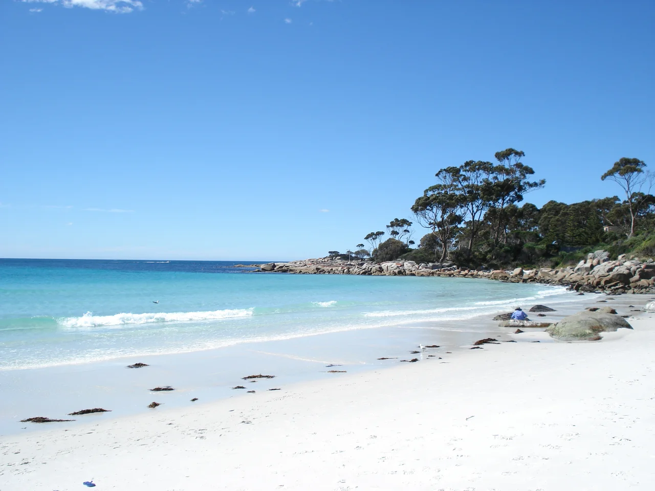

Bay of Fires
The fires that named this place were real. In 1773, the British navigator Tobias Furneaux sailed his ship Adventure up the northeastern coast of Tasmania and saw flames glowing along the beaches at night, the cooking and camp fires of the Aboriginal people who had lived here for thousands of years. He called it the Bay of Fires. The irony is that the coast still seems to be on fire, only now the colour comes from the rocks. Great rounded boulders of granite line the shore, splashed and crusted a vivid burnt orange, and at dawn, above water the colour of glass, they look as though they are quietly burning still.
Fire Made of Lichen
The orange is the bay's signature, and it surprises people to learn it is alive. The granite itself is grey, but it is coated across the splash zone in a hardy coastal lichen that glows a deep tangerine, a slow-growing organism that thrives on salt spray and sun. Set against the squeaking white quartz sand and the clear blue-green water, the effect is almost too saturated to believe, three colours that should clash but instead define one of the most photographed coastlines in the southern hemisphere. The bay runs for some fifty kilometres, from Binalong Bay in the south to Eddystone Point in the north, a long ribbon of pale beaches, sheltered lagoons and those burning rocks.
larapuna and Its People
Long before Furneaux gave it an English name, this coast was larapuna, in the reconstructed palawa kani language of Tasmania's Aboriginal people. It was a gathering place, where family groups remembered today as the Panpe-kanner, Leener-rerter and Pinter-rairer came together along the shore. The middens and stone tools they left are a record of unbroken connection to this country across countless generations. That heritage is not a closed chapter; larapuna remains deeply significant to the palawa community, and the dual name now sits openly alongside the colonial one. To stand on these beaches is to stand on a meeting place that was loved and used for thousands of years before the first European sail appeared on the horizon.
Whalers and Wild Coast
The nineteenth century brought a harder trade. In the 1840s, bay whaling was carried out along this coast, the same brutal industry that stained beaches up and down Tasmania, hunting the whales that once passed close inshore. The nearby town of St Helens began life as a whaling station before settling into its present role as the easygoing gateway to the bay, about 160 kilometres east of Launceston. The whales are protected now, and the coast has been given over to slower pleasures: camping behind the dunes, fishing, surfing, swimming, birdwatching among the lagoons, and simply walking the long empty sand. That mix of protection and quiet recreation is built into the land itself. The northern end of the bay falls within Mount William National Park, a refuge that helped save the Tasmanian Forester kangaroo; the southern stretch, anchored by the bright sands of Binalong Bay, is a conservation area where camping and beachcombing are the order of the day.
The World Takes Notice
For somewhere this remote, the Bay of Fires has drawn an outsized share of attention. In 2005 it was named the world's second-best beach by Conde Nast, and in 2008 the guidebook Lonely Planet crowned it the hottest travel destination on the planet for the year ahead. The accolades brought visitors, but they have not crowded the place; the beaches are long enough and the region quiet enough that you can still walk a curve of sand and meet no one. That is the real draw. In a world running short of empty coastline, larapuna offers kilometres of it, framed in white and orange, exactly as wild as it has always been.
From the Air
The Bay of Fires stretches along the northeastern coast of Tasmania at roughly 41.14 degrees south, 148.31 degrees east, running from Binalong Bay near St Helens north to Eddystone Point. From the air it is a long, scalloped line of brilliant white beaches broken by clusters of orange-tinted granite headlands, with the dark green of Mount William National Park backing the northern end and the Tasman Sea stretching east. Use the town of St Helens and its large tidal lagoon, Georges Bay, as the southern anchor point, and the Eddystone Point lighthouse to mark the northern tip. The nearest sealed airstrip is at St Helens for light aircraft; Launceston (YMLT/LST) is the main regional airport, about 160 km west. Clear, calm mornings give the most vivid contrast between sand, lichen-orange rock and water.
Nearby Stories
- Launceston 49 km away
- Freycinet National Park 63 km away
- Van Diemen's Land 79 km away
- Wybalenna Aboriginal Establishment 106 km away
- Bass Strait 176 km away
- Bundian Way 442 km away
- Parliament House, Canberra 658 km away
- 2003 Fiordland Earthquake 1525 km away