.jpg)
Freycinet National Park
The name sounds like poetry: Wineglass Bay. The truth behind it is bloodier. When whalers worked this stretch of the Tasmanian east coast in the early 1800s, harpooning passing whales and dragging them ashore to be cut up, the bay would run red, the colour of dark wine swirled in a glass. Today the water is clear turquoise and the sand blinding white, regularly voted among the ten best beaches on the planet, and the only hint of that history is the name itself. This is Freycinet, a peninsula of granite mountains and curved beaches jutting into the Tasman Sea, and it has been startling visitors for a very long time.
The Pink Mountains
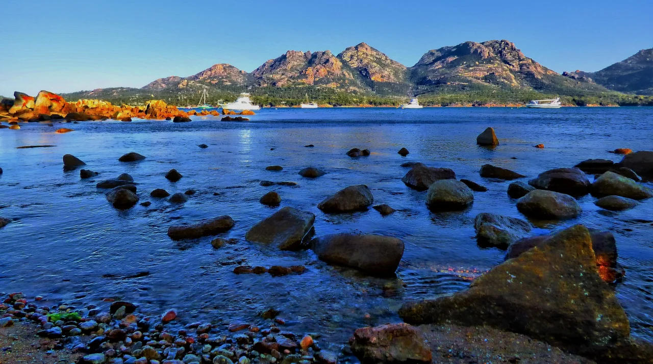
Drive into Freycinet and the first thing to greet you is a wall of mountains the colour of dawn. These are the Hazards, a line of jagged peaks, Mayson, Amos, Dove, Baudin and Parson, rising over the township of Coles Bay. Their warm pink and red tones are not a trick of the light but a property of the rock itself: the granite here is rich in orthoclase, a pink feldspar that stains the whole range rose. The stone is Devonian, hundreds of millions of years old, and it forms the spine of the entire peninsula, breaking down at the coast into the pale sand that rims the bays. The Hazards take their name not from any danger but, by most accounts, from an American whaling captain, Richard Hazard, who worked these waters in the 1820s.
The Most Famous View in Tasmania
There is a moment on the Wineglass Bay track that stops nearly everyone who reaches it. After a steep climb to the saddle between two of the Hazards, the trees part and the bay appears far below, a flawless arc of white biting into deep blue, the whole curve framed by pink rock and dark bush. Many visitors go no further than this lookout, and the view alone is worth the walk. Those who push on descend roughly an hour and a half to the sand itself, reachable only on foot or by boat, never by road. For the truly determined, the rock scramble up Mount Amos, steep and strenuous and best avoided in the wet, delivers the bay laid out whole from above, one of the great rewards in Australian bushwalking.
Sharing the Country
Freycinet is a place to move slowly and watch. Wallabies graze the verges at dusk, wombats trundle through the scrub, and the park asks visitors firmly not to feed any of it, for the animals' own sake. The peninsula was named for the French explorer Louis de Freycinet, who charted this coast in 1802 as part of Nicolas Baudin's expedition to map Van Diemen's Land, and it became a national park in 1916, making it one of the oldest in Tasmania. Beyond Wineglass Bay the rewards keep coming: the boardwalk to the lighthouse at Cape Tourville with its sweeping coastal views, the snorkelling at Sleepy Bay and Honeymoon Bay, and the long unspoiled sweep of the Friendly Beaches, added to the park in 1992.
Come Prepared for Anything
The Tasmanian east coast is gentler than the island's wild west, but it keeps its own rules. The weather here turns fast; a bright, calm morning can become a cold, wind-driven afternoon with little warning, and the rangers urge walkers to carry water, raincoats and basic first aid even on the popular tracks. An umbrella is useless in the wind. The Wineglass Bay lookout walk is the safe, well-formed, well-signed choice for most; the longer circuits over the Hazards reward fitness and care. Roads in are all sealed, so no four-wheel drive is needed, but if you drive at dawn or dusk, slow down. This is wallaby and wombat country, and the animals have the right of way.
From the Air
Freycinet National Park occupies the peninsula at 42.05 degrees south, 148.28 degrees east, on Tasmania's east coast, jutting south into the Tasman Sea below the township of Coles Bay. From the air the peninsula is one of the most recognisable shapes in Tasmania: a slender finger of land with the pink Hazards forming a knot of peaks at its northern end and the unmistakable curve of Wineglass Bay biting into its eastern side. Cape Tourville lighthouse marks the seaward edge. The nearest sealed airstrip is at Friendly Beaches/Coles Bay for light aircraft; the main gateways are Hobart International (YMHB), about 2.5 to 3 hours' drive south, and Launceston (YMLT), a similar distance northwest. Coastal weather can shift quickly, so clear, settled conditions give the best chance of seeing the bay's full colour from above.
Nearby Stories
- Maria Island 31 km away
- Richmond Bridge 45 km away
- Van Diemen's Land 55 km away
- Cataract Gorge 62 km away
- Bay of Fires 78 km away
- Bundian Way 540 km away
- Parliament House, Canberra 756 km away
- 2003 Fiordland Earthquake 1492 km away