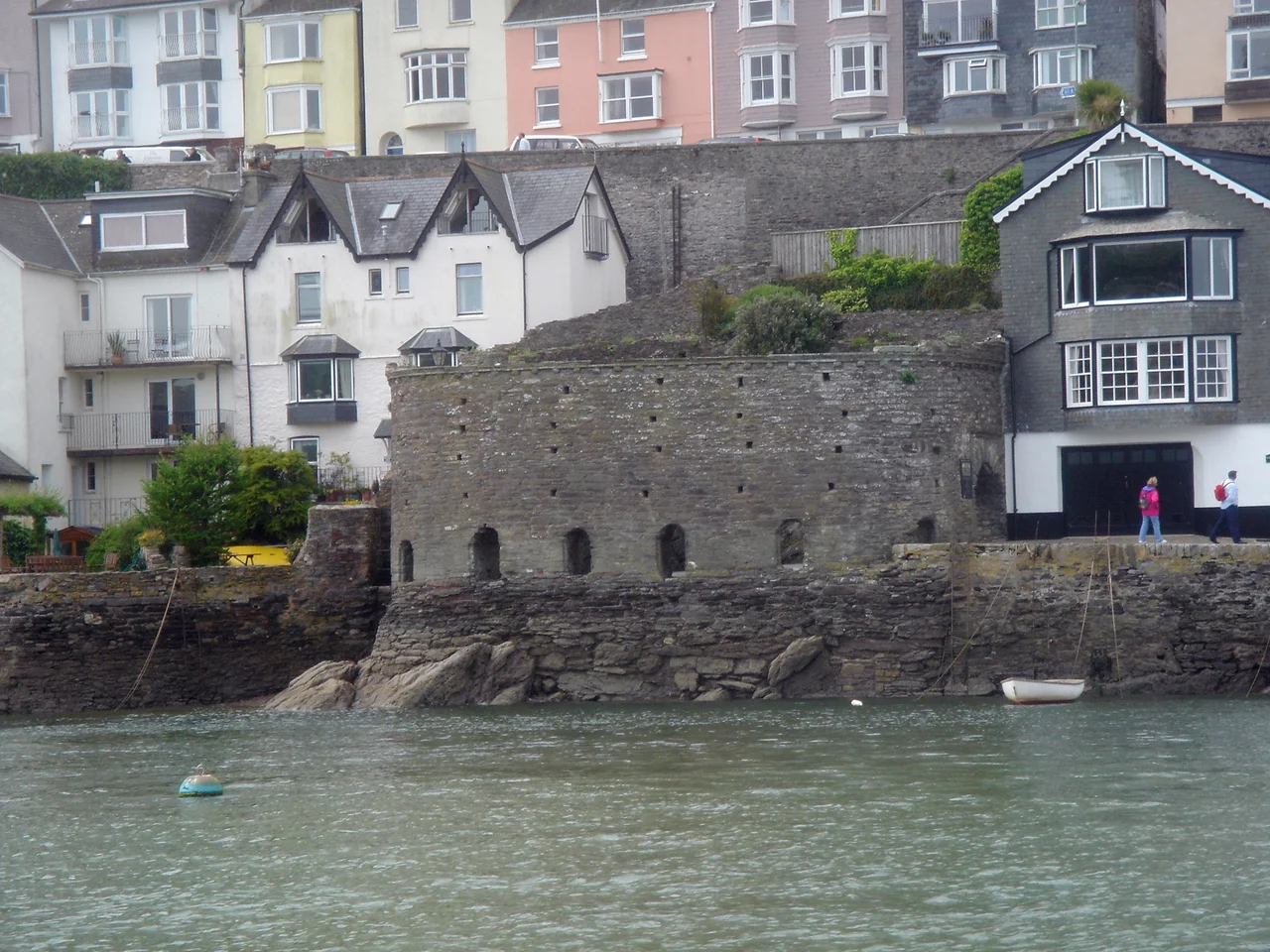

Bayard's Cove Fort
By the time a hostile sail came into view at Bayard's Cove, two larger fortresses had already taken their shots at it. Dartmouth Castle on the west bank and Kingswear Castle on the east were the outer defences, hammering enemy vessels as they tried to push up the River Dart. Bayard's Cove Fort was the last word. Eleven gunports along its waterfront wall stared down the harbour at point-blank range, and anything that survived the run upriver met heavy artillery fired so close it was less a duel than an execution. The Tudors built the fort small, low, and lethal, and it has crouched on its rocky terrace for five centuries while Dartmouth grew up around it.
A Town Worth Defending
Medieval Dartmouth was a serious port. The natural harbour in the estuary of the River Dart could hold up to six hundred vessels, and in the fifteenth century the town prospered handsomely from the wool trade. That prosperity made the town a prize, and the French knew it. After several scares, the town fathers persuaded the Crown to upgrade Dartmouth Castle into a true artillery fort from 1486, then matched it with Kingswear on the opposite bank from 1491. That left a question. If an attacker got past both outer castles, what then? Bayard's Cove Fort was the answer, and the exact moment when the answer was built remains debated. It may have been started in 1509-10, at the start of Henry VIII's reign, on a royal instruction to the water bailiff. Or it may have been begun in 1529, when the town itself feared a joint French-Spanish attack. Either way, by 1537 it was finished.
Quayside Killing Box
The fort was set at one end of a new quay running along the harbour, almost at the water's edge near the entrance to the inner reach of the estuary. It probably began as a simple circular tower, similar to the gun tower at Dartmouth Castle. What survives now is a low blockhouse with a rocky terrace and an eastern wall six feet thick and fifteen feet high, designed to shrug off return fire. Eleven gunports pierced the wall for heavy artillery; one has since been converted into the entrance, another has been blocked. The Earl of Surrey, Thomas Howard, may have referred to the new construction in 1522 when he reported a "blockhouse of stone" guarding Dartmouth's well defended harbour. Two decades later the antiquarian John Leland described it as "a fair bulwark made of late." Inside, a lean-to on the west side once housed the garrison, with a wall-walk and parapet above for musketeers. None of the interior survives. What you see today is a stone shell built around a single, unambiguous purpose: kill ships at close range.
Civil War and Quiet Years
By 1575, the immediate threat had receded enough that the town leased the fort to Thomas Carne, a shipwright, with the condition that it had to be handed straight back if Dartmouth needed defending. Defending came soon enough. In 1643, Prince Maurice besieged the town for the Royalists and discovered, as all later commanders would, that Dartmouth's defences pointed seaward and could be turned by an attack from the hills behind. In January 1646, Sir Thomas Fairfax led a Parliamentary army down the same route and seized the town back, taking Bayard's Cove with its five iron guns. Under the Interregnum, Sir John Fowell was appointed governor to run the local defences and discourage smuggling, and an order in 1650 brought Bayard's Cove back into full service. After Charles II's restoration the fortifications were briefly handed back to the town, but by 1662 they were garrisoned by a royal force of twenty-three men under Sir John, who held his post until 1677.
Storage and Sea Air
Like many small forts that had outlived their threat, Bayard's Cove drifted into a quiet century. The eighteenth century used it for storage. The structure fell into a slow, unspectacular decline, useful but unloved. What saved it was Victorian tourism. As paddle steamers brought visitors to the South Devon coast in the second half of the nineteenth century, Dartmouth discovered that its medieval and Tudor relics had become its main attraction. The fort was restored as part of that rediscovery, returning to a sort of useful afterlife as a place to wander, look at the harbour, and imagine the cannon flash. There was one brief, unromantic moment of frontline service left. During the Second World War, the fort was used as a machine-gun post, watching the same approach it had watched four centuries earlier.
Holding Back the Tide
Today the fort is a Grade I listed building in the care of English Heritage, free to visit, perched right on the working quayside. The rocky terrace on which it sits floods more often than it used to, and the impact of rising seas on the site is now a subject of active research. Walking through one of the converted gunports, you step out onto the harbour wall and see, immediately, what the Tudor engineers saw: the narrow throat of the estuary, the wooded slopes of Kingswear opposite, the line of moored boats where wool merchants once tied up. Bayard's Cove was always a small fort built for one job. It still tells you exactly what that job was.
From the Air
Bayard's Cove Fort sits at 50.348 degrees north, 3.577 degrees west, on the west side of the Dart estuary inside Dartmouth town itself. From the air, look for the river opening into the sea between Dartmouth and Kingswear, with the larger Dartmouth Castle visible to the south at the harbour mouth; the fort is upstream of that, hugging the inner waterfront. Exeter Airport (EGTE) lies roughly 30 nautical miles to the north-northeast. The estuary is narrow and steep-sided, so a coastal track at 2,000-3,000 feet gives the best view, with sea breezes and occasional fog from the Channel to watch for.
Nearby Stories
- St Germans Priory 7.6 km away
- Launceston, Cornwall 9.6 km away
- Castle Drogo 12 km away
- HMS Formidable (1898) 17 km away
- Siege of Lyme Regis 19 km away
- Battle of Plymouth (1652) 40 km away
- German Submarine U-672 48 km away
- Goonhilly Satellite Earth Station 69 km away