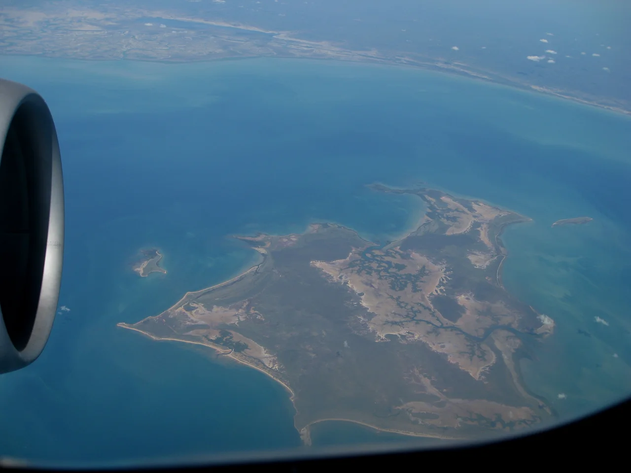

Bentinck Island
The Kaiadilt called this country home for thousands of years, and they did so almost entirely on their own terms. On a low, arid island in the southern Gulf of Carpentaria, they lived by their own law and spoke Kayardild, a language so distinct it would one day astonish the linguists who came to record it. They gathered tjilangind, the small rock oysters, and kulpanda, the arca clams, dug for fresh water in the swamps, and crossed the shallow seas to neighbouring islands on rafts of logs lashed with plaited bark. The wider world barely touched them. They were among the very last Aboriginal peoples in Australia to maintain a fully traditional life with little outside contact, and the story of how that ended is one of the hardest in the country's history.
A Name From a Distant Empire
The Kaiadilt name for their own island is not certainly known today, a loss that says much about what followed. The name on the map came from elsewhere entirely. In 1802 Matthew Flinders sailed the Gulf and labelled the island groups for British grandees, calling this one Bentinck after Lord William Bentinck, who would be appointed Governor of Madras the following year. The choice was personal: within a year Bentinck, along with the Earl of Mornington, would intercede to help free Flinders after the French imprisoned him on Mauritius. So a small island in the Gulf of Carpentaria carries the name of a man who governed on the far side of the Indian Ocean, fixed to it by a favour owed between Englishmen who never knew the place existed.
The Killing on the Beach
Around 1916 a man remembered only as McKenzie came to Bentinck Island and set up a sheep run. He rode the island with a pack of dogs and shot Kaiadilt men on sight, killing at least eleven by the count held in local memory, and he abducted and assaulted Kaiadilt women. In 1918 he organised a hunt, gathering settlers from the mainland and driving the island's people from its northern tip down to the southern beach. Many of the Kaiadilt fled into the sea, where those not shot from the shore drowned. McKenzie was never punished, and the massacre went unrecorded by outsiders for more than sixty years, until the elder Roma Kelly told the linguist Nicholas Evans what had happened. The Kaiadilt had never forgotten. They had simply never been asked.
The Emptying of the Island
Drought gripped the island through the mid-1940s, and in 1948 a cyclonic tidal surge swept salt across the freshwater swamps the Kaiadilt depended on. Presbyterian missionaries moved the survivors, then fewer than a hundred people, to a mission on nearby Mornington Island. The official account calls it a rescue. The Kaiadilt remember it differently. Coreen Reading has spoken of the chain marks still visible on a tree at Oak Tree Point, where, she was told, her people were bound and forced onto boats. At the mission, children were taken from their parents into segregated dormitories while families built humpies nearby. The rupture was so complete that for roughly a decade not one child born to the removed Kaiadilt survived. A people who had endured for millennia came within a generation of vanishing.
The Country, Painted Home
The island was never truly relinquished. In the early 1980s, Nicholas Evans found just forty-five fluent speakers of Kayardild left to document. In 1986 an outstation rose at Nyinyilki on the island's southeast corner, and through the 1990s a small group of elders minding young children lived there, in what came to be called, with affection, the old ladies' camp. Some of those women, back on Mornington Island in the new century, took up paint and founded the Kaiadilt art movement. Its great figure was Mirdidingkingathi Juwarnda Sally Gabori, born around 1924 at Mirdidingki on the island's south side, her second name meaning dolphin, her totem. She began painting at eighty-one and made more than two thousand works in roughly eight years, vast and luminous maps of her lost country, before her death in 2015. She represented Australia at the 2013 Venice Biennale. No one lives permanently on Bentinck now, but the young and able still return to hunt turtle and dugong, and elders work to carry Kayardild forward. The connection holds, even where return cannot.
From the Air
Bentinck Island lies in the South Wellesley group at about 17.06 degrees south, 139.5 degrees east, a low and largely arid island fringed by reefs in the southern Gulf of Carpentaria. From the air it reads as a distinct landmass with the Australian mainland visible beyond it to the south, and the larger Mornington Island sits to the northeast. The old outstation and airstrip at Nyinyilki mark the island's southeastern corner. The nearest scheduled aerodrome is Mornington Island (YMTI), roughly 127 kilometres from Burketown (YBKT) on the mainland coast. As a coastal landmass surrounded by shallow water and reef, it makes a clear navigational waypoint. Visibility is best in the dry season from May to September; the wet season brings cyclones and the tidal surges that have shaped the island's history.
Nearby Stories
- Nicholson River 26 km away
- Bountiful Islands 55 km away
- Old Westmoreland Homestead 69 km away
- Flinders River 75 km away
- Norman River 102 km away
- Lawn Hill crater 143 km away
- Vanderlin Island 233 km away
- Aboriginal Shire of Kowanyama 249 km away