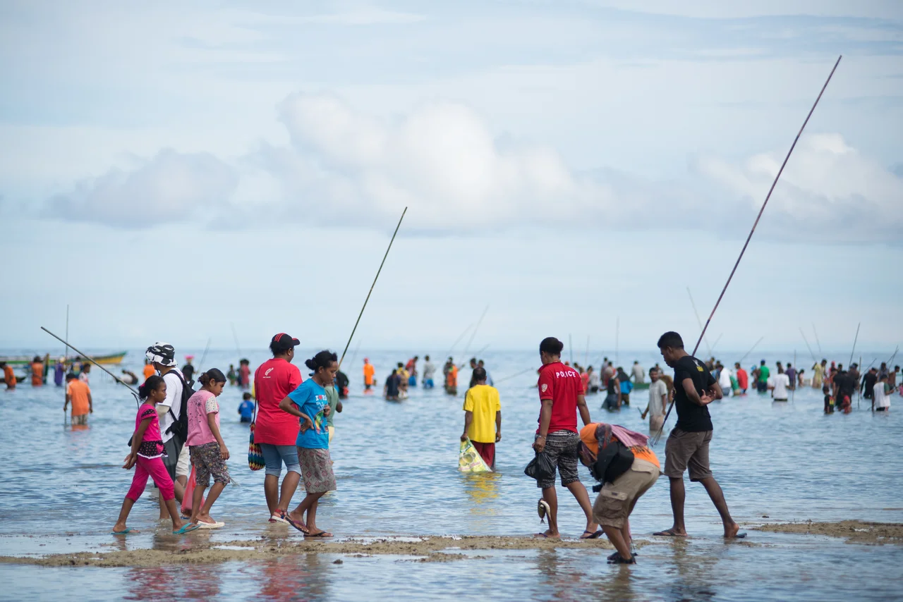
Biak
Once a year in Biak, people heat stones in open fires until they glow, then walk across them barefoot. The ritual is called apen bayeren, and it is one of the set pieces of Festival Biak Munara Wampasi, the island's annual celebration of its artistic and cultural traditions. There is also snap mor, the collective catching of fish stranded in low-tide pools. There is Yosim Pancar, a friendship dance that can last until dawn. And there is the quieter life of Biak City - the biggest settlement on the island - where motorcycle taxis weave through markets, Chinese-Papuan families trace their roots back centuries, and the island's geography as a Pacific stepping stone is still visible in the fishing boats that push off each morning from the south coast.
A City on a South Coast
Biak is the administrative center of Biak Numfor Regency and the main urban concentration on an island that is otherwise thinly settled. Most villages on Biak are small - a cluster of wooden houses, a few fishing boats, a church. Biak City sits on the southern shore facing the Padaido Islands and catches the trade that moves through Cenderawasih Bay. The population reflects the island's history as a crossroads: native Papuans in the majority, alongside long-settled Chinese-Papuan families (the local terms Cina-Biak and Cina-Serui distinguish between those who trace to Biak and those from nearby Yapen), and later arrivals from Java, Sulawesi, and across Indonesia. The main language heard on the street is Indonesian, though the Biak language still structures family life.
Getting Around
Biak has one major airport - Frans Kaisiepo International - and one real road grid. Inside the city, the taxi is the taksi, but it is not what you think: it is a minivan that runs fixed routes, more share-taxi than private hire. The real workhorse is the ojek, the motorcycle taxi, which will take you anywhere one passenger and a helmet can fit. PELNI's KM Sinabung links Biak to the rest of Indonesia by sea, sailing from Surabaya or Makassar through the long arc of eastern Indonesian ports. Cycling works too; some hotels lend bicycles. The island is 72 kilometers long, mostly flat near the coast, and traffic thins out quickly once you leave Biak City.
The Cave and the Monument
On the way out of Biak City toward Bosnik you pass a World War II museum with a cave attached to it. The cave was a hiding place - a single Japanese soldier is said to have held out inside it after the battle ended. The broader context is harder to miss anywhere on the island. The Battle of Biak in mid-1944 killed nearly every Japanese defender and transformed Mokmer, Sorido, and Borokoe airfields into US bomber bases for the push toward the Philippines. The wrecks of that war sit on the seabed in the Padaido Islands today, wrapped in coral, drawing divers from across Asia. Near the museum, a bird park and orchid park showcase Papuan endemic species - cendrawasih (birds of paradise), kasuari (cassowary), and the crowned pigeon known as mambruk.
Padaido and Numfor
The diving is what brings people to Biak if the war history doesn't. The Padaido Islands, scattered south and southeast of Biak, are as close to an untouched reef system as most divers will ever see - undersea caves, coral gardens, and a scatter of World War II wrecks sunk in water clear enough to read a gauge at depth. Numfor Island, to the southwest, and Mapia Islands, far north toward Palau, round out the possibilities for boat trips. The dive season runs year-round given the equatorial climate, though the wet months from December to March can bring squalls that make for bumpy boat rides. Visibility is usually excellent; these waters are part of the Coral Triangle.
Barapen and Ikan Bakar
Biak food lives on its beaches. Ikan bakar - grilled fish, usually bought fresh from that morning's catch and cooked over coconut husks - is the dish to order and the dish most often served. The traditional cooking method called barapen is older and more elaborate: stones heated in a fire, then layered with food in a pit and buried to cook slowly underground. You find barapen at celebrations more than at everyday meals. The Indonesian migrant communities brought their own kitchens with them - Javanese and Sulawesi cooking is widely available, so a meal in Biak City might be nasi padang one night and grilled reef fish the next. The festival foods are the harder-to-find ones, tied to the Wor ceremonies that mark first haircuts, coming of age, and weddings.
From the Air
Biak City sits at 0.945 degrees south, 135.936 degrees east, on the southern coast of Biak Island in Cenderawasih Bay. Frans Kaisiepo International Airport (ICAO WABB) is the main point of entry, about 2 kilometers east of the city center. The island is 72 km long and 37 km wide at its broadest, with the highest point reaching 740 meters in the northwest. From altitude, Biak appears as a long green wedge inside the bay, with smaller Supiori to the north and the scattered Padaido Islands off the south coast. Tropical rainforest climate; expect afternoon buildups.
Nearby Stories
- Owi Airfield 37 km away
- The Battle of Noemfoor: Three Airfields and a Forgotten Cost 51 km away
- 1996 Biak Earthquake 59 km away
- Cenderawasih Bay 141 km away
- Mamberamo River 168 km away
- Mapia Atoll 211 km away
- Spring Rain on Dark Water 355 km away
- Mikura-jima 3859 km away