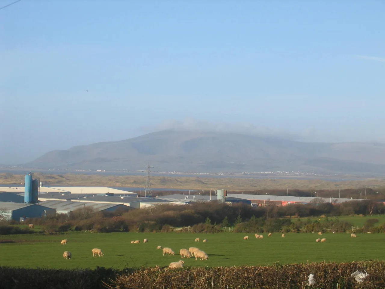

Black Combe
William Wordsworth, who knew a thing or two about views in this corner of England, said that from the summit of Black Combe 'the amplest range of unobstructed prospect may be seen that British ground commands.' On a clear day he was right. The fell sits in the south-west corner of the Lake District, only four miles from the Irish Sea, and stands ten miles away from any higher ground. That isolation is the secret. Climb the 1,970 feet to the peat-covered summit plateau and half the view is glittering sea, with the Isle of Man clearly visible to the west and the hills of Wales and Scotland appearing as shadowy silhouettes on the horizon.
The Hollow That Named the Hill
Look at Black Combe from the south or east and the name explains itself. There is a large, dark-coloured glacial corrie carved into the eastern side of the fell — known as Blackcombe — and it is from this hollow that the whole hill takes its name. Such corries are often called combes in English place names, a word cognate with the Welsh cwm. Adjacent to Blackcombe is a lighter-coloured corrie called Whitecombe, separated from it by the Horse Back ridge, which makes one of the more interesting routes to the summit. Whatever cycle of ice and meltwater shaped these hollows during the last glaciation also gave Black Combe its particular silhouette: not the pointed peak of a Lakeland classic, but a long, broad shoulder of fell rising out of farmland, easily picked out from across Morecambe Bay or even from the top end of the Wirral peninsula between the turbines of Burbo Bank Offshore Wind Farm.
A Station for the Survey
In 1809, the Ordnance Survey was still measuring the country into existence. Their initial trigonometric survey of Britain used Principal Triangles — vast geometric figures linking high points across the landscape, each measured with theodolites that took days to align. Black Combe was one of just five Cumberland stations used to compute those angles. The others were Dent Hill, Scilly Banks (on the outskirts of Whitehaven), High Pike, and Cross Fell. There is a triangulation pillar on the summit today, sheltered by a rough drystone wall that locals have piled up over the years against the wind. 1,286 feet south of the peak stands a large cairn, easily visible with the naked eye from Millom, marking a subsidiary top. In a shallow valley between cairn and summit lies a small tarn. The peat soaks up everything.
Hob Thross and the Cornlaiters
An 1864 text on the folklore of Black Combe records customs that read like a window into another country. Bees were said to sing and the labouring ox to kneel in adoration at midnight on Christmas Eve. The direction a bull lay facing on All Hallows' Eve foretold the prevailing winter wind. Hob Thross, 'a body all ower rough,' was a kind of brownie — a household spirit with private quarters somewhere in the dwellings about Black Combe, though the railway was suspected of having swept him 'away into the limbo of the unproved and the unpractical.' Newly married couples did not buy corn for their first sowing here. They went from house to house begging a handful at each, and were called cornlaiters — 'laiting' meaning seeking. Christmas morning brought hack pudding, made from sheep's heart, suet, and dried fruits. Servants were hired only at Martinmas and Whitsuntide. Money was lent only at Candlemas. And the dead were always waked. Most of those customs are gone now. The fell is the same.
Old Rock, Quiet Walks
Geologically, Black Combe is older than almost anything around it. The rocks formed during the Ordovician period, roughly 460 million years ago — mudstones, siltstones, occasional sandstones and greywackes deposited in deep seas when coastal sediment slides reached the abyssal plain. Faulting has exposed an inlier of these Skiddaw Group mudstones at Black Combe, giving geologists a window into rocks normally buried elsewhere. The nearby Millom Park includes Millom Rock Park, open to the public at all times, with displays explaining what is under your boots. Walkers usually start from St Mary's Church at Whicham to the south, or from St Mary's at Whitbeck to the west, or from the Corney Fell Road that crosses the fells four miles north of the top. The Black Combe Walking Festival runs every June and the Black Combe fell race goes off in early March. The view does not improve. It does not need to.
From the Air
Black Combe is a 1,970-foot fell at the south-west corner of the Lake District National Park, at roughly 54.26N, 3.33W, only four miles from the Irish Sea. From the air, the fell stands clearly isolated from the main Lake District massif to the north-east, with the glacial corries Blackcombe and Whitecombe visible on the eastern flank. The summit triangulation pillar sits on a flat peat plateau. To the south the fell drops to the Duddon estuary and Millom; to the west, open Irish Sea with the Isle of Man clearly visible on good days. Nearest field is Walney Island (EGNL) some 15 nm south. The fell is a useful VFR landmark for navigation along the West Cumbrian coast — visible from Morecambe Bay, the Wirral, and well out to sea.
Nearby Stories
- Ennerdale Water 3.9 km away
- Levens Hall 4.1 km away
- Lowther Castle 14 km away
- Forest of Bowland 15 km away
- Fleetwood 22 km away
- Ramsey Bay 31 km away
- Raeberry Castle 33 km away
- Celtic Array 42 km away