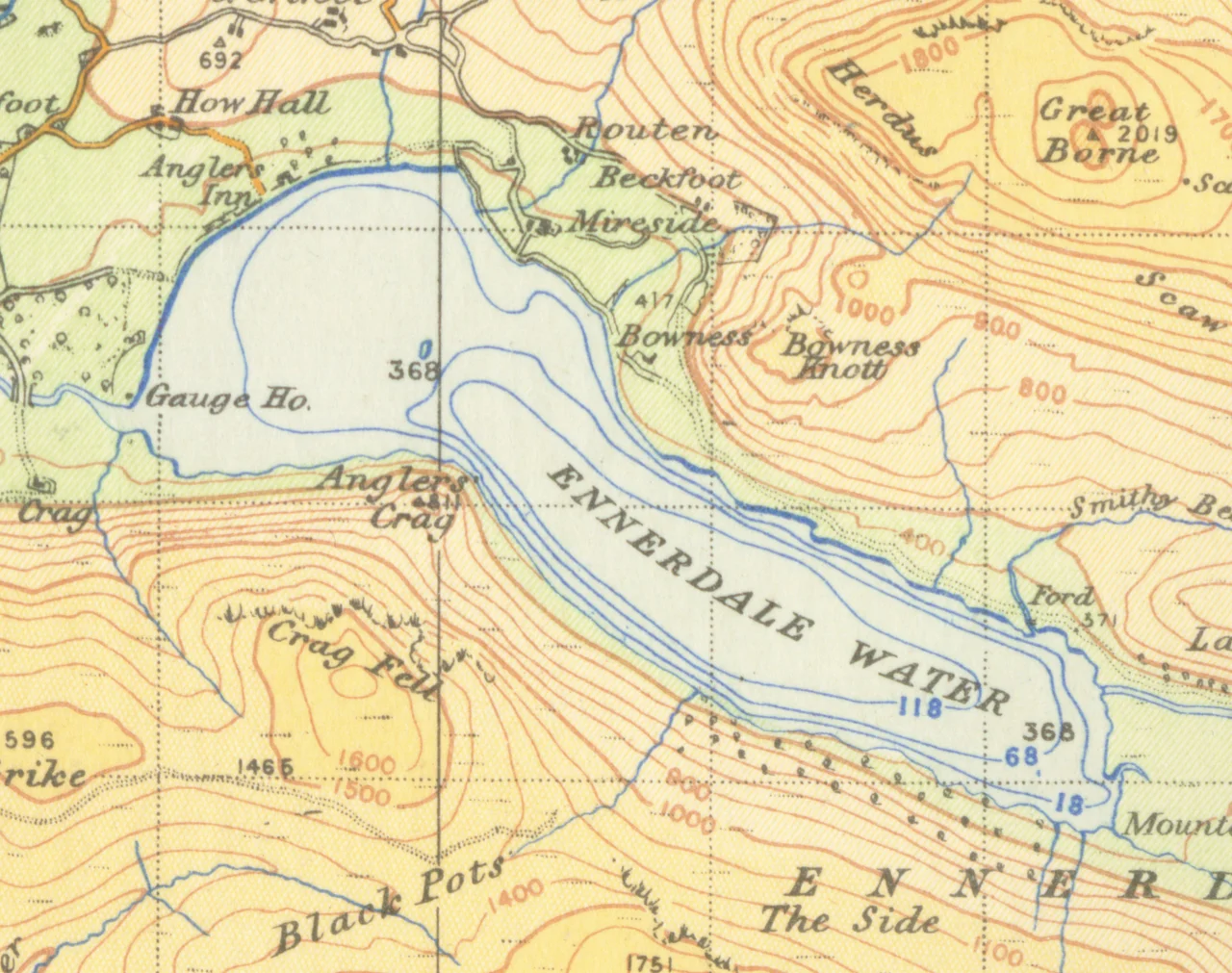

Ennerdale Water
There is no public road up Ennerdale. That single fact, more than any other, explains the lake. Park at the western end near Ennerdale Bridge - a hamlet of two pubs and a few houses - and you must walk in. The valley is managed jointly by the Forestry Commission, the National Trust, and United Utilities, and they have agreed, in essence, to keep the inside quieter than the outside. The result is the most westerly lake in the Lake District National Park, surrounded by Great Gable, Green Gable, Brandreth, High Crag, Steeple, and Pillar, and somehow still uncrowded on a summer afternoon when Windermere is heaving.
Anund's Valley
The name traces back to an Old Norse personal name - Anundr - and the Norse word dalr, valley. 'Anund's valley' has shifted over centuries through Anundar to Ennerdale, and there has been cross-influence with Ehen, the name of the river that drains the lake to the Irish Sea. On 16th-century maps the water itself was called Brodewater - 'broad water' - and only became 'Ennerdale Water' on Ordnance Survey conventions some time after 1784. The lake is a true glacial body, 150 feet deep at its maximum, and a low weir added in 1902 to a probable glacial moraine helps maintain its level. The two halves of the toponym - the Norse settler's name and the Norse word for valley - tell you, before any other history, who was here a thousand years ago.
The Lake That Watered the Coast
For most of the 20th century, Ennerdale supplied drinking water to the Whitehaven area through United Utilities and its predecessors. In 2013 the Environment Agency told United Utilities the abstraction licence would be revoked, to protect the ecology of the lake and the River Ehen below it. After a 2014 public inquiry, the regulator confirmed the decision: West Cumbria's water would come instead through a new pipeline from Thirlmere, and abstraction from Ennerdale would cease by 2022. Construction began in 2017. The lake has been designated a Site of Special Scientific Interest in its own right, and species of interest include the Arctic char, a glacial-relict fish that survives in only a handful of British lakes. The shift represents one of the quietest but most significant environmental restorations of recent decades.
The Girt Dog of Ennerdale
In 1810 something was killing sheep. Not a few; hundreds, in and around the Ennerdale valley. The locals called it the Girt Dog - 'girt' being dialect for 'great' - though descriptions suggested it had the traits of both a dog and a large cat. A hunt eventually tracked it down and killed it. What it actually was has been argued ever since: an escaped exotic, a feral hybrid, a wolf-like crossbreed. The records are imprecise enough that no firm identification is possible. What survives is the story itself, passed down in the valley, of a single animal that for months could not be caught and that left a trail of dead livestock behind it before finally being shot.
Cinema, Coast-to-Coast, and a Proposal
Despite the Lake District's status as a national favourite for film shoots, Ennerdale has largely been left alone. The most notable exception is the closing sequence of Danny Boyle's 28 Days Later (2002), which includes a sweeping panoramic view of the lake. Alfred Wainwright's coast-to-coast walking route passes along the valley, drawing a steady but small trickle of through-walkers. Once a year, in the last week of August, the Ennerdale Show brings locals together for agricultural displays, crafts, and competitions. And in 1973, on the banks of this lake, Bill Clinton first proposed to Hillary Rodham during a trip to England. She did not accept that day. She did, eventually. The valley keeps its surprises for those willing to walk.
The Walk That Stays Quiet
From Ennerdale Bridge, a track leads east along the southern shore of the lake and on into the valley toward Black Sail Hut, one of the most remote youth hostels in England. The fells rise immediately: Pillar to the south, Great Gable closing the valley head, Steeple visible higher up. Compared with the central Lakes, the path is empty. Compared with anywhere else in England, it is dramatic. The lake holds its position as the westernmost in the National Park, the closest of the great lakes to the Irish Sea, and the one the absence of a road has kept most nearly the way it was.
From the Air
Coordinates 54.52 N, 3.376 W. Ennerdale Water lies in a glacial valley running east-west in the western Lake District, with no public road along its length. From the air, identify it by its position as the westernmost large lake in the National Park, with Great Gable (899 m) closing the eastern end of the valley. Recommended altitude 3,500-5,000 ft AGL. The fells around the valley head - Pillar, Steeple, and Great Gable - frequently generate orographic cloud. Nearest airports: Carlisle Lake District (EGNC) to the north-east, Blackpool (EGNH) to the south. The port of Whitehaven and the coast lie a short distance west.
Nearby Stories
- Lowther Castle 5.5 km away
- Black Combe 6.6 km away
- Levens Hall 6.8 km away
- Threave Castle 13 km away
- Ruthwell Cross 18 km away
- Raeberry Castle 24 km away
- RAF Spadeadam 24 km away
- Cashtal yn Ard 33 km away