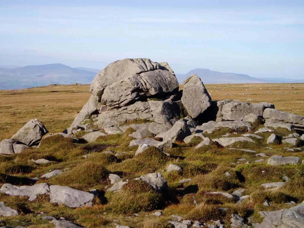

Forest of Bowland
There are no trees here. The word "forest" once meant something different - a place where the king's deer ran and the king's law ran, a hunting reserve rather than a wood. The Forest of Bowland was a royal forest for nearly a thousand years, and the heather moorland and blanket bog that cover its gritstone fells today look much as they did when the Norman lords first rode through. Heather, peat, and silence: 300 square miles of upland Lancashire that the Industrial Revolution somehow missed.
The Bend in the River
Despite centuries of folk etymology, the name has nothing to do with archery or with cattle vaccaries. "Bowland" comes from the Old Norse boga-, meaning a bend in a river - a tenth-century description of the looping path the River Hodder cuts through these uplands. The Norse named it; the Anglo-Saxons inherited it; and by the time William Rufus carved out the feudal Liberty of Bowland sometime after the Domesday Book, the name was already old. The lordship eventually passed to the De Lacys of Pontefract, who folded it into the Honour of Clitheroe, which in turn was absorbed by the Earldom and then the Duchy of Lancaster in 1311. Forest law ran here for more than nine hundred years, finally repealed by statute only in 1971.
The Empty Centre of Britain
Walk four miles north of Dunsop Bridge to the Whitendale Hanging Stones and you stand, by one Ordnance Survey calculation, at the geographic centre of Great Britain. The point is unmarked, unsigned, and reachable only on foot across blanket bog. The Industrial Revolution barely touched Bowland because there was nothing here to industrialise - no coal seams, no streams fast enough to power cotton mills. While Lancashire's southern valleys filled with chimneys and spinning machinery, these fells stayed empty. The visible landmarks are still natural: Ward's Stone at 561 metres, Wolfhole Crag, Fair Snape Fell, and the long horseshoe of hills curling west from Lancaster around to the Trough of Bowland, the high pass that splits the upland in two.
The Hen Harrier
Bowland's official symbol is the hen harrier, a slim grey raptor that quarters low over heather looking for voles. The choice was deliberate and political. By 2013, not a single hen harrier nested anywhere in England - the species had been driven to local extinction, largely by illegal persecution on land managed for grouse shooting. Bowland is one of the few places where dedicated work has clawed back ground. A consortium of Natural England staff, gamekeepers, the RSPB, United Utilities, and the Duchy of Lancaster has rebuilt the population year by year: 22 birds fledged in 2020, 31 in 2021, at least 39 in 2022. The recovery is fragile and still depends on whether grouse moor managers tolerate harriers nesting on their ground.
Restoration
Across nearly 39,000 acres of designated Site of Special Scientific Interest, an unglamorous restoration is underway. Since 2010, more than 755 hectares of degraded blanket bog have been rewetted and replanted with sphagnum moss, slowly undoing decades of drainage and burning. The Abbeystead Estate (owned by the Grosvenors), the Whitewell Estate (owned by the Duchy of Lancaster), United Utilities' water-catchment land, and conservation groups including the Lancashire Wildlife Trust have worked together. The Bowland Visitor Centre in Beacon Fell Country Park is the place to start; St Hubert's Chapel at Dunsop Bridge, named for the patron saint of hunters and built by Bowland's last Bowbearer, is the place to end. Considerable areas were used for military training during the Second World War, and unexploded bombs still surface occasionally on the higher moors.
From the Air
Forest of Bowland centres roughly on 53.95°N, 2.59°W, north-east Lancashire. The AONB covers 300+ square miles of upland fells generally above 1,200 ft, rising to 1,840 ft at Ward's Stone. Bowland Forest Gliding Club (ICAO airport code GB-0339) one mile west of Chipping operates winch-launched gliders - check NOTAMs and avoid the field during launch operations. Nearest larger airfield: Blackpool (EGNH) about 20 nm southwest. The horseshoe of fells around Lancaster, the Trough of Bowland pass, and the broad Ribble Valley are clear visual landmarks. Weather changes fast over the tops; mist can fill the troughs while ridges stay clear.
Nearby Stories
- Battle of Wigan Lane 4.8 km away
- Ponden Hall 8.1 km away
- Leighton Hall, Lancashire 9.4 km away
- Millom 10 km away
- Yorkshire Dales 14 km away
- Macclesfield Canal 15 km away
- Piel Castle 21 km away
- Hoylake Lifeboat Station 24 km away