
Bluestonehenge
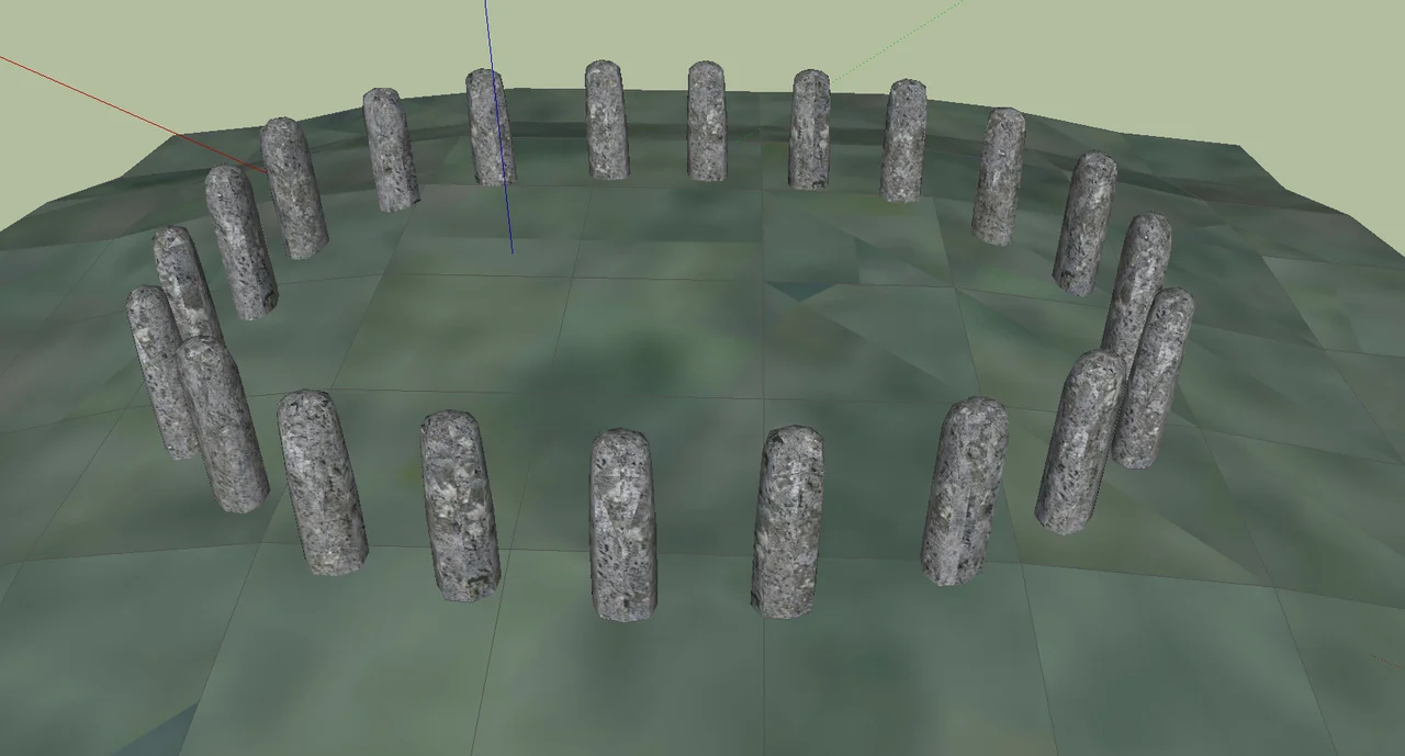
Walk a mile south-east from Stonehenge along the gentle avenue that runs through the grass, and you will reach the bank of the River Avon at a place called West Amesbury. Stop there. Look down. Underneath the grass is the dismantled outline of another stone circle, a sister to Stonehenge that no one knew existed until 2009. Twenty-seven stoneholes, a 33-foot ring, all the bluestone monoliths long gone. It is called Bluestonehenge, and it changes the story of the most famous monument in Britain.
Found by accident
In August 2008 Mike Parker Pearson and the Stonehenge Riverside Project were digging at the western end of the Stonehenge Avenue, the processional route that links the great stone circle to the river. They returned the following August to extend the trench. What they found, just where the avenue meets the Avon, was the ditch of a henge enclosure and inside it a ring of stoneholes. Nothing visible above ground. No stones left in place. But the holes were unmistakable, and traces of bluestone chips lay in the packing, fragments left behind when the monoliths were removed. The team named the new site Bluestonehenge or Bluehenge. Its formal designation is the West Amesbury Henge. The discovery was published in British Archaeology in January 2010.
What 'henge' actually means
Most people picture stones when they hear the word henge, but archaeologists use the term more precisely. A henge is an enclosure of compressed earth with a ditch on the inside of its bank, an inversion that suggests it was built to keep something in, not to keep enemies out. By that strict definition, Bluestonehenge qualifies and Stonehenge does not, because Stonehenge's ditch lies outside its bank. The stones are extras. The earthwork is the structure. At Bluestonehenge the earthwork survives, even though the monoliths that once stood inside it are gone. The estimated 27 bluestones formed a circle roughly 33 feet across. Charcoal in some of the holes hints that fires burned there.
Dating a vanished circle
Radiocarbon dating of antler tools found in the stoneholes gave a date of 2469 to 2286 BCE for when the stones were pulled out and the circle dismantled. The stones themselves were probably raised between about 3000 and 2400 BCE. Two flint chisel arrowheads of a style typical of that period were found in the fill. Tests on an antler pick at the bottom of one hole failed because the sample contained too little collagen, a frequent problem with bone over five thousand years old. The likeliest scenario is that the bluestones were removed and incorporated into the next phase of Stonehenge itself, a mile up the avenue. Bluestonehenge fed its sister.
Land of the living, domain of the dead
Parker Pearson had worked in Madagascar with the anthropologist Ramilisonina, who pointed out a pattern common to traditional societies: stone is for ancestors and the dead, wood is for the living. Apply that template to the Stonehenge landscape and a structure emerges. Durrington Walls, two miles north-east, was built of timber and was thick with the rubbish of feasting, the residue of a place where people lived. Stonehenge, all stone, was a cemetery, the largest known in Neolithic Britain. Bluestonehenge sits exactly where the avenue from the world of stone meets the river, the boundary between the two domains. Parker Pearson's theory is that bodies were brought here, cremated within a circle of bluestone, and then carried on to their final resting place at Stonehenge. There is nothing to see at the site today, just grass and the slow brown water of the Avon, but underneath is the doorway to the dead.
From the Air
Coordinates 51.171 N, 1.799 W. Bluestonehenge lies at West Amesbury, on the west bank of the River Avon where the Stonehenge Avenue terminates. The site is invisible from the air, marked only by gentle pasture and a slight curvature in the riverbank. To navigate, find Stonehenge itself 1.5 nm north-west and follow the line of the avenue south-east across open Salisbury Plain to the river. The A303 passes between Stonehenge and Bluestonehenge. Nearest airports: Boscombe Down (EGDM) is 4 nm south-east; Old Sarum (EGLS) is 8 nm south; Bournemouth (EGHH) is 30 nm south.
Nearby Stories
- Sherborne Castle 4.4 km away
- Highclere Castle 10 km away
- Camper and Nicholsons 11 km away
- Museum of the Great Western Railway 12 km away
- Wells Cathedral 13 km away
- Severn Bridge 17 km away
- Abingdon-on-Thames 21 km away
- 1958 BOAC Bristol Britannia Crash 26 km away