Booby Island Light
Commander George Poynter Heath had been asking for seventeen years. As Queensland's first Portmaster, appointed in 1862, Heath understood the Torres Strait better than most — its treacherous currents, its hidden reefs, the parade of vessels wrecked in waters that connected the Pacific to the Indian Ocean. He first recommended a lighthouse on Booby Island at the Intercolonial Conference of Marine Departments in 1873. Committees deliberated. Nothing happened. Heath raised the issue again in 1885 as trade through the strait increased. Formal approval took four more years. Tenders were called in April 1899, and the brothers John and Jacob Rooney of Maryborough — who had already built Sandy Cape Light, Cape Bowling Green Light, and several others — won the contract. On 24 June 1890, the light was finally exhibited.
The Lens and Its Evolution
The original optic was a second-order Fresnel lens manufactured by Chance Brothers, with a focal radius of 800 millimeters mounted on a rotating pedestal supported by mercury bearings. The light source began as an oil wick burner producing 20,000 candela — modest, but enough to guide ships through the western approach to the strait. In 1917, the burner was replaced with an 85-millimeter vaporized kerosene mantle that boosted intensity to 120,000 candela, a sixfold increase. The conversion to electricity came in 1963, when a 1,000-watt tungsten-halogen lamp pushed the output to one million candela, visible for 26 nautical miles. The light flashed white once every four seconds. By 1991, the power source was converted to solar, the original Fresnel lens and its mercury-bath pedestal were carefully removed and transported to the Thursday Island Museum, and the characteristic was changed to one white flash every ten seconds.
A Conical Tower at the Edge of Australia
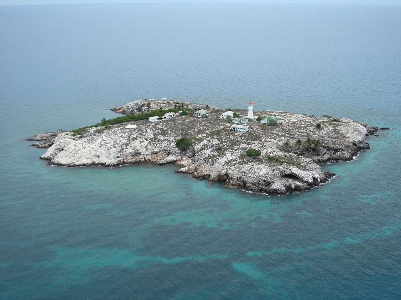
The lighthouse stands 18 meters tall, a conical tower of timber-framed construction with external asbestos sheeting, perched on Booby Island at the very tip of Cape York Peninsula. The focal plane sits 37 meters above sea level, high enough that the beam reaches across the flat tropical waters to ships still far from the reefs. Around the tower cluster the structures of a working light station: a radio equipment building doubling as an office, a powerhouse with three diesel alternators and a fuel store, a tide gauge hut installed in 1970, a radio beacon transmitter building from 1961, and a workshop. The station was fully automated and demanned in 1992. Today it is operated by the Australian Maritime Safety Authority and managed by the Queensland Parks and Wildlife Service. Landing requires a special permit, and both the tower and the island are closed to the public.
Gateway to the Strait
Booby Island Light marks the western entrance to the navigation channel through the Torres Strait, the narrow passage separating Australia from Papua New Guinea. For centuries, ships have threaded through these waters on the route between the Pacific and Indian Oceans, and the strait's shallows, reefs, and strong currents have claimed dozens of vessels. The lighthouse was the last of the major lights constructed along the entire Queensland coast, completing a chain that guided mariners from the southern border of the colony all the way to its northernmost territorial waters. Listed on the Queensland Heritage Register in 1998, it remains an active navigational aid — its solar-powered beam pulsing once every ten seconds through the tropical darkness, a descendant of the oil flame that Commander Heath spent nearly two decades trying to ignite.
From the Air
Coordinates: 10.60°S, 141.91°E, on Booby Island at the western entrance to Torres Strait. Best viewed from 3,000–8,000 ft; the white conical tower with red lantern room is visible against the island's dark rock. Nearest airport: YBHI (Horn Island/Thursday Island). Prince of Wales Island lies 23 km to the east. The island is small and rocky, surrounded by reef-studded waters.
Nearby Stories
- Cape York Telegraph Line 16 km away
- Jardine River 40 km away
- Badu Island 43 km away
- Torres Strait Islands 59 km away
- Moreton Telegraph Station 175 km away
- Wasur National Park 204 km away
- Australia–Indonesia Border 233 km away
- Gulf of Carpentaria 406 km away