Booby Island (Queensland)
So many ships sank near this island in the 19th century that someone started stocking it with provisions. Booby Island — named by Captain Cook for the seabirds that crowded its rocks — sits 45 kilometers northwest of the tip of Cape York Peninsula in the Torres Strait, positioned squarely in the path of every vessel navigating between the Pacific and Indian Oceans. To the Kaurareg people of the western Torres Strait, the island is Ngiangu, named for a giant of their tradition who was forced from a neighboring island. For European sailors, it was something more practical: a landmark, a refuge, and eventually the site of the last major lighthouse built on the Queensland coast.
The Graveyard Strait
The waters around Booby Island are littered with the remains of ships that misjudged the Torres Strait's reefs and currents. The barque Delfshaven, 656 tons, struck a sunken reef near the island on 24 July 1862 while sailing from Newcastle to Java; the undermanned crew launched boats with difficulty and eventually set course for Timor after failing to reach the Australian coast. The iron steamship Kanahooka foundered in a heavy gale south of the island on 19 January 1894, overloaded with guano from Rocky Islet in the Gulf of Carpentaria. She rolled over so fast the crew barely had time to launch boats. The barque Marina was lost in the strait on 28 May 1866 on her way from Sydney to Singapore; the crew landed on Booby Island and were picked up by a passing ship. The schooner Pacific foundered off the island in July 1935. Through it all, the island kept its grim pantry of emergency supplies for the next crew to wash ashore.
The Post Office Cave
Booby Island's shoreline caves hold a remarkable palimpsest of human presence. Indigenous rock art, including depictions of sea creatures, forms the oldest layer. Over it, beginning as early as 1841, European sailors scratched and painted the names of their ships on the cave walls. Lieutenant Chimmo of the HMSV Torch documented the practice in 1857, noting ship names inscribed in what became known as the "Post Office Cave" — a place where passing crews left messages for those who might follow. Lighthouse keepers and their families added their own names after 1890, and during World War II, military personnel from a signals unit stationed on the island to monitor the Pacific left yet another layer. Queensland Museum teams photographed the art and inscriptions in the 1980s and 1990s, revealing a timeline of occupation stretching from indigenous use through colonial navigation to wartime surveillance.
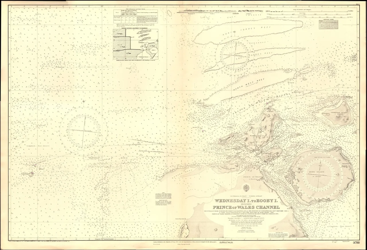
A Speck Between Two Oceans
Viewed from above, Booby Island is barely there — a low, rocky platform 32 kilometers west of Thursday Island and 23 kilometers west of Prince of Wales Island, surrounded by the shallow, reef-laced waters where the Coral Sea meets the Arafura Sea. The lighthouse that has operated on the island since 1890 is an 18-meter conical tower, painted white with a red lantern room, its light flashing once every 7.5 seconds. The island is closed to the public and accessible only by boat with a special permit. But its significance has always been disproportionate to its size. For the Kaurareg, it was a place of spiritual importance. For centuries of mariners, it was the last visible landmark before entering or after surviving the Torres Strait. For the shipwrecked, it was the difference between rescue and oblivion. And for the anonymous sailors, keepers, and soldiers who inscribed their names on its cave walls, it was proof of presence — a way of saying, simply, "I was here."
From the Air
Coordinates: 10.60°S, 141.91°E, in the western Torres Strait. Best viewed from 3,000–6,000 ft; the island is small and low-lying with a visible white lighthouse tower. Nearest airport: YBHI (Horn Island). Thursday Island is 32 km east. The surrounding waters are shallow with visible reef formations. Prince of Wales Island is the nearest large landmass.
Nearby Stories
- Cape York Telegraph Line 16 km away
- Jardine River 40 km away
- Badu Island 43 km away
- Torres Strait Islands 59 km away
- Moreton Telegraph Station 175 km away
- Wasur National Park 204 km away
- Australia–Indonesia Border 233 km away
- Gulf of Carpentaria 406 km away