
Brick Lane
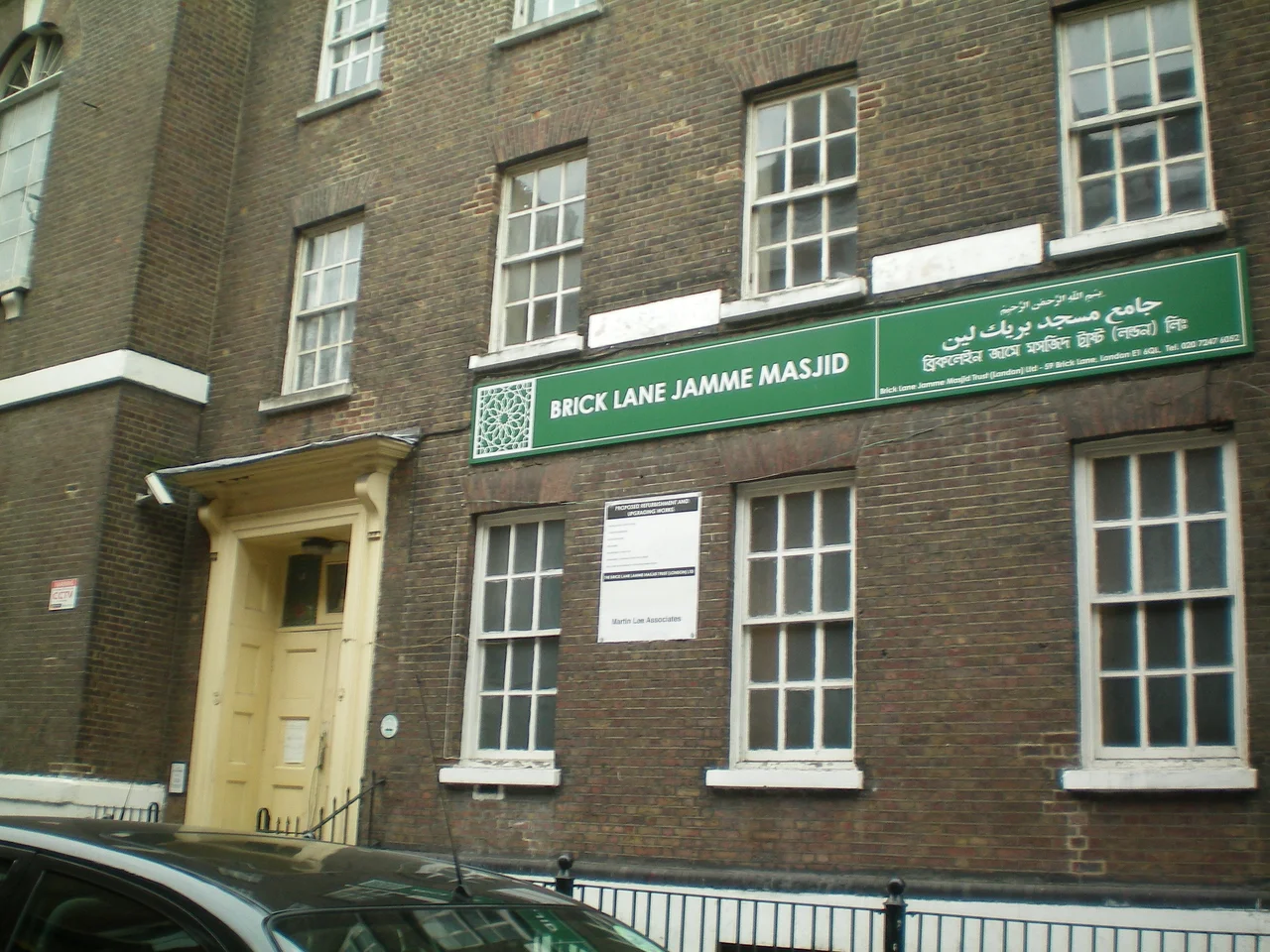
One building on the corner of Brick Lane and Fournier Street has been, in sequence, a Huguenot chapel built in 1742, a Methodist chapel by 1819, a Jewish synagogue by 1898, and a mosque since 1976. No single structure in London traces the shifts of the East End's population more precisely. The building itself didn't change much; the people worshipping inside it did. That quality — layers of different communities occupying the same physical space, each leaving marks that the next group inherits — defines Brick Lane as much as any curry house or market stall.
Bricks, Brewing, and the Street's Name
The street gets its name from the brick and tile manufacturing that began here in the fifteenth century, exploiting the local brick earth deposits. It appears in a sixteenth-century woodcut map of London as a partially developed crossroad at the city's eastern edge. By the seventeenth century, brewing had arrived — Joseph Truman was first recorded brewing here in 1683. His descendants built the Black Eagle Brewery, which became one of London's largest, and the site of that brewery, the Old Truman Brewery, now houses markets, offices, and restaurants. Brick Lane Market first developed in the seventeenth century selling fruit and vegetables outside the city walls. The market, the brewery, and the street were there before any single community claimed them — and they've outlasted every community that has.
Waves of Arrival
Successive communities have shaped Brick Lane, each building on what came before. French Huguenots arrived in the seventeenth century, fleeing religious persecution, and established the weaving and tailoring trades that gave Spitalfields its character. Irish immigrants followed in the nineteenth century. Ashkenazi Jewish families, many fleeing persecution in Eastern Europe, settled here from the mid-nineteenth century through the early twentieth, leaving synagogues, bakeries, and community institutions. The shift came gradually from the 1970s onward, as Bengali Muslim families — predominantly from the Sylhet region of what is now Bangladesh — became the dominant community. The East End had been a port of entry for generations: Bengali seamen working from Chittagong had been stopping over in London for centuries, and their presence eventually drew family migration. By 1997, the area was formally branded Banglatown, and an ornamental arch designed by Meena Thakor was erected near Osborn Street in the red and green of the Bangladeshi flag. The restaurants that have made Brick Lane internationally famous for curry are the most visible sign of this settlement.
The Mosque on the Corner
The building at the corner of Brick Lane and Fournier Street encapsulates five centuries of the street's history in one Grade II* listed structure. La Neuve Eglise, a Huguenot chapel, was built there in 1742. By 1809 it was used by Wesleyan missionaries as the Jews' Chapel. It became a Methodist chapel in 1819. When the Jewish population expanded, it was consecrated in 1898 as the Machzike HaDath, the Spitalfields Great Synagogue. As Jewish families moved out and Bangladeshi families moved in, it was adapted in 1976 as the London Jamme Masjid, the Great London Mosque. The building has served each community that needed it, absorbing different faiths in the same walls without much outward change. This is what 'Brick Lane' means in practice: not just a street, but a set of resources — physical, communal, commercial — that each new wave of arrivals makes their own.
Art, Music, and Literature
Since the late 1990s, Brick Lane has taken on another identity alongside its role as a Bangladeshi cultural center. Art students discovered the area's cheap rents and visual energy. Night clubs opened in the Truman Brewery complex. Street art appeared on every available surface — Banksy, Stik, ROA, Ben Eine, D*Face, and Omar Hassan have all worked here. Music videos have been shot on the street. Monica Ali's 2003 novel Brick Lane placed the area in international literary consciousness; it was shortlisted for the Man Booker Prize, though some members of the local South Asian community felt its portrayal was negative and organized against filming it there. The street has become a destination for tourists, art students, and weekend visitors at the same time that it remains a working neighborhood for the families who have lived here for decades. The tension between those uses is ongoing, unresolved, and essentially Brick Lane.
From the Air
Brick Lane runs at approximately 51.5219°N, 0.0717°W through Tower Hamlets in east London, connecting Bethnal Green Road in the north to Whitechapel High Street in the south. From altitude, the street is visible as a commercial corridor east of Spitalfields and south of Bethnal Green. London City Airport (EGLC) is 9km to the east; the City of London is under 2km to the west.
Nearby Stories
- Stevenage 5.7 km away
- Malling Abbey 5.7 km away
- 1952 Farnborough Airshow Crash 7.7 km away
- Ingatestone Hall 8.2 km away
- Hellfire Caves 9.1 km away
- The Carrington Event: The Solar Storm That Could Happen Again 9.8 km away
- Bletchley Park 16 km away
- Castle Hedingham 23 km away