
Búng Bình Thiên
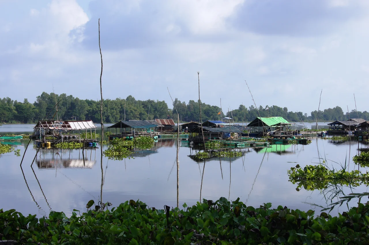
Everything about the Mekong in flood is brown. The Hậu River carries the Himalayas past An Phú in suspension, a churn of silt so thick the water looks like tea with milk in it, and every channel and ditch it feeds turns the same colour. Then, a few hundred metres off the main stream, the water goes blue and stops moving. Búng Bình Thiên holds its colour and its stillness through the entire year, including the months when the river beside it is at its most violent, and the name people gave it is a straightforward description of how unlikely that is: the lake from the sky.
Two Hundred Hectares, Then Eight Hundred
For the dry half of the year the lake is a modest thing - two hundred hectares of surface, about four metres deep, sitting quietly among rice fields roughly thirty-five kilometres up the road from Châu Đốc. Then the monsoon arrives, the Mekong swells, and water pushes in through the connecting channels until the lake covers eight hundred hectares and runs eight metres deep. It quadruples and it doubles, and it does this every single year. The lake links the Bình Di River to the Hậu, and it touches three communes - Khánh Bình, Nhơn Hội and Quốc Thái - so the flood does not merely raise the water level; it redraws where the shoreline is and which fields are now lake bed.
The Filter Nobody Built
The clarity has a mechanism, and it is entirely biological. Water hyacinth, lotus, water lily, algae and submerged weed cover and line the basin, and their combined root mass does three jobs at once. It traps and holds incoming silt before the suspended load can spread. It oxygenates the water column. And it pins the lake bed down so that flood surges passing through cannot stir the sediment back up into the water. A river-fed basin that should be as opaque as the Mekong itself instead behaves like a settling pond with a permanent green filter across the top. Local science has taken enough interest in this to publish on the sediment characteristics of the basin, which is a very unglamorous way of describing something people have found miraculous for two centuries.
A Sword in Dry Ground
The story people tell is that a general of the Tây Sơn chose this spot in the eighteenth century to drill troops and store grain, and found it barren and waterless. A ritual was held, petitioning the gods for rain. The general drove his sword into the earth, and where the blade went in, water came up, and kept coming, and became the lake. Almost the identical legend attaches to the Gia Long Well on Phú Quốc, where the sword belonged to Nguyễn Ánh - the man who destroyed the Tây Sơn and took the throne as Emperor Gia Long. Two mortal enemies, the same miracle, a hundred and fifty kilometres apart. Whatever else the story is doing, it is not being partisan about who deserves to find water.
The Cham on the Bank
The villages around the lake are Cham. Roughly twelve thousand Cham live in this district, concentrated in five settlements including Nhơn Hội, Khánh Bình and Quốc Thái, and they are Sunni Muslim - a distinct tradition from the Bani Cham of central Vietnam. Their presence here dates largely to the mid-nineteenth century, when Cham Muslim families moved down from Cambodia and settled the country around Châu Đốc. The mosque at Nhơn Hội, Masjid Khoy Ri Yah, stands close enough to the water to be reflected in it. Cham households in An Phú still weave cloth on traditional looms, and many people here move between Cham, Vietnamese, Khmer and Malay - a practical inheritance for a community that has lived on a trading river with a border across it for a very long time.
The Border Two Kilometres Away
This is the far northern tip of the Vietnamese delta, and Cambodia is close on more than one side; the Bình Di River, which the lake connects to, is itself part of the international boundary, and the crossing at Long Bình opens onto the Cambodian market town of Chrey Thum. The administrative geography changed underneath the lake in the summer of 2025. Vietnam dissolved its district tier nationwide, so An Phú district ceased to exist, and An Giang province absorbed neighbouring Kiên Giang, with the enlarged province now run from Rạch Giá. The lake will quadruple again in June, as it always does, and the Cham villages on its edge will still be where they were.
From the Air
Centred at 10.92°N, 105.07°E in the far northern Mekong Delta, about 35 km by road north of Châu Đốc and within a few kilometres of the Cambodian border. From 2,000-5,000 ft the lake is one of the most distinctive optical features in the delta: an oval of still, blue-green water set against the milky brown of the Hậu and Bình Di rivers on either side, with a heavy fringe of floating vegetation along its margins. Its size is a season indicator in itself - roughly 200 ha and tightly defined in the March-May dry season, roughly 800 ha with soft, indistinct edges at the September-October flood peak. Surrounding terrain is dead flat at 1-5 m elevation; the nearest relief is the Bảy Núi range about 40 km southwest. Nearest fields: Techo International (VDTI/KTI) about 30 nm north-northwest in Cambodia, Rạch Giá (VVRG) about 50 nm southwest, and Cần Thơ International (VVCT) about 60 nm southeast. Note the international border immediately north and west. Best visibility December through March; monsoon haze and afternoon convection dominate June through October.
Nearby Stories
- Phnom Sorsia 14 km away
- Lê Văn Duyệt 17 km away
- Tuol Sleng Genocide Museum 33 km away
- Cambodian campaign 44 km away
- Battle of Tri Phap 56 km away
- Southern Cardamom National Park 84 km away
- Battle of Prek Klok I 84 km away
- Battle of Loc Ninh 100 km away