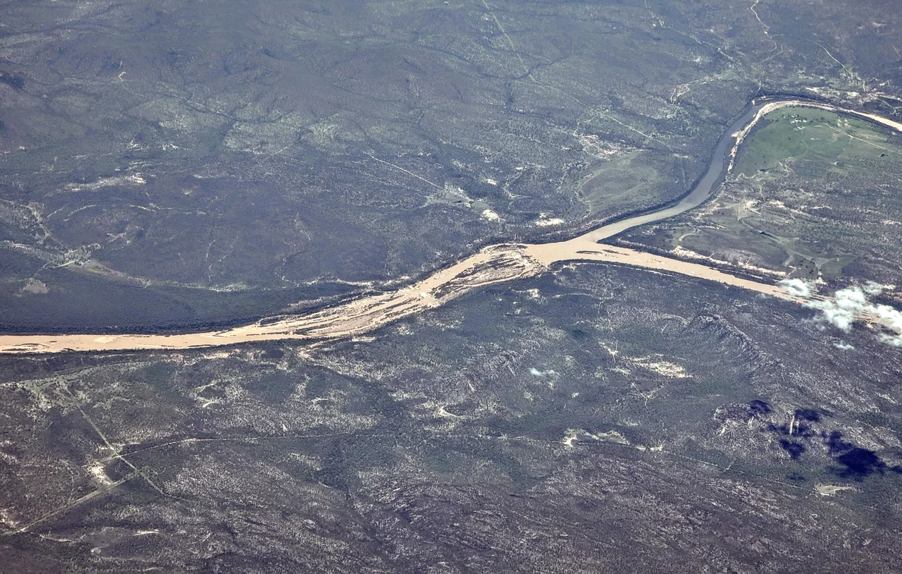

Burdekin River
In 1923, the Burdekin barely moved. For seven months it carried almost no water at all, a chain of stagnant pools baking under the North Queensland sun. Then there are the other years. After two cyclones tore across the catchment in 1958, the river briefly ran with a discharge approaching that of the Yangtze, one of the great rivers of the world. This is the Burdekin's defining trait: it is Australia's largest river by peak flow, and one of the most erratic on the planet. To stand on its banks is to never quite know which Burdekin you are meeting.
A Catchment the Size of a Country
The Burdekin gathers water from roughly 130,000 square kilometres of inland Queensland, a drainage basin larger than England. It begins on the northern slopes of Boulder Mountain in the Seaview Range and runs 886 kilometres to the Coral Sea at Upstart Bay, dropping some 620 metres along the way. Tributaries feed it from every direction: the Clarke, the Basalt and the Dry from the parched interior, the Cape, Suttor and Belyando from the black-soil grasslands of central Queensland. The Belyando alone flows north for over a thousand kilometres before it joins. Most of this country is too unpredictable to farm. The rainfall swings so wildly that, year to year, a crop is as likely to drown as to wither, which is why so much of the basin is given over to low-density cattle grazing instead.
The Years the River Came for the Bridges
When the wet sets in, the Burdekin becomes a force that reshapes the coast. In 1875, the river rose as much as sixty feet in a matter of hours, sweeping away fences, livestock and homes. In 1917, floodwaters buried the rail bridge at Inkerman under eleven feet of water and tore away nearly a third of it. The engineers eventually answered with the Silver Link, a high dual-level bridge near Home Hill begun in 1947 and not finished until 1957, built tall enough to outlast the floods that had defeated everything before it. During the 1974 deluge that followed Cyclone Wanda, the river's discharge peaked at an estimated 25,000 tonnes of water every second, pushing a vast brown plume far out across the Coral Sea.
Holding Back the Flood
South of Charters Towers, the river now slows into Lake Dalrymple, the reservoir behind the Burdekin Falls Dam. Completed in 1987, it is Queensland's largest dam, holding around 1.86 million megalitres at capacity, roughly four times the volume of Sydney Harbour. Its wall stretches 876 metres across the valley. The dam tamed enough of the river's temper to make the lower Burdekin one of northern Australia's great agricultural engines. Below the wall lies an irrigation area of some 80,000 hectares, most of it sugarcane. In the delta around Ayr and Home Hill, growers draw on groundwater that the river itself recharges during the big floods, a natural cycle that local managers guard carefully against saltwater creeping inland.
Two Names, One River
Europeans came late and confused. In 1839, John Clements Wickham charted the river's mouth and named it the Wickham River. Six years later, the explorer Ludwig Leichhardt crossed it far inland and, with no idea it was the same watercourse, named it after Thomas Burdekin, a Sydney merchant who had helped fund his expedition. Leichhardt's name stuck. Long before either man arrived, this was Yuru country, and the Yuru language is still spoken across the land around Home Hill. The river carries its own endemic life too, including a species of eeltail catfish found nowhere else, alongside barramundi, mangrove jack and the freshwater turtles that haunt its lagoons.
From the Air
The Burdekin River reaches the Coral Sea at Upstart Bay near -19.65, 147.5, just southeast of Ayr and Home Hill. From altitude, the silver thread of the lower river fans into the bright geometric patchwork of the cane delta, an unmistakable landmark on the dry tropical coast south of Townsville. Inland, Lake Dalrymple behind the Burdekin Falls Dam shows as a large irregular blue body. Nearest major airport is Townsville (ICAO YBTL), about 80 km northwest; Ayr has a small aerodrome. In the wet season, watch for the brown flood plume bleeding out toward the Great Barrier Reef. Recommended viewing altitude 4,000-7,000 ft for the delta patterns; visibility is best in the dry season, May to October.
Nearby Stories
- SS Yongala 16 km away
- Queen's Hotel, Townsville 16 km away
- SS Gothenburg 26 km away
- Imperial Hotel, Ravenswood 27 km away
- Bowen 29 km away
- Stewart's Creek Gaol 30 km away
- Great Barrier Reef 61 km away
- Ravenswood School of Arts 67 km away