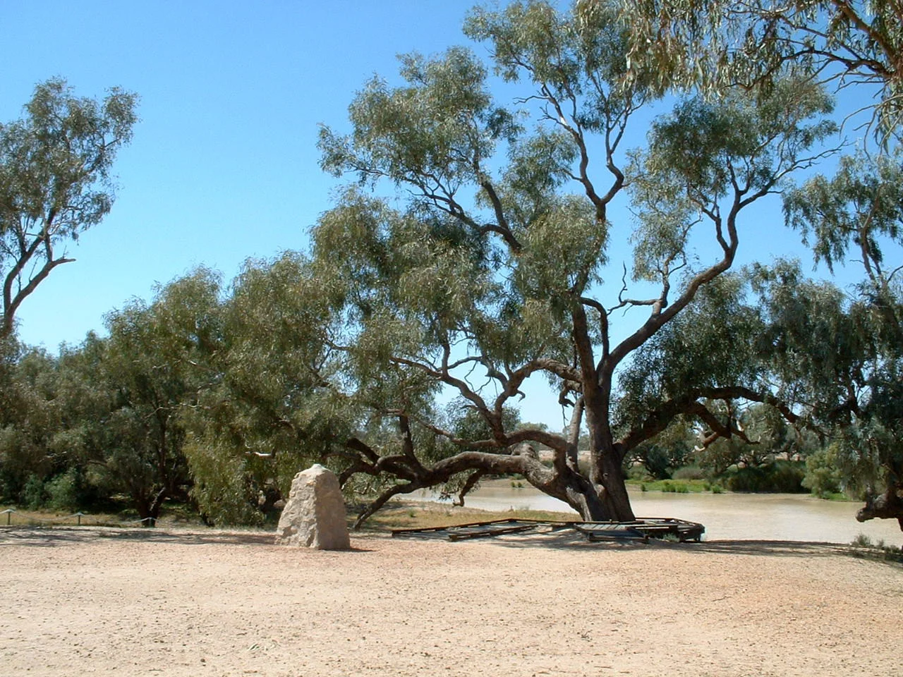

Burke and Wills Dig Tree
Nine hours. That is how close it came. On the morning of 21 April 1861, William Brahe and three companions gave up waiting at the depot on Cooper Creek, buried a cache of food at the foot of a large coolabah, carved DIG into its trunk, and rode for home. That same evening, three skeletal men staggered into the deserted camp from the north. They were Robert O'Hara Burke, William John Wills and John King, returning from the Gulf of Carpentaria, and they had missed their rescuers by part of a single day. The tree still stands at Nappa Merrie on the Queensland border, a living gravestone for one of the cruellest near-misses in the history of exploration.
The Tree and Its Message
The coolabah was one of two that Brahe's party blazed before leaving. Into the bark he cut his depot mark, B over LXV, identifying this as the sixty-fifth camp of the Victorian Exploring Expedition. Brahe recorded in his journal that the party left at ten in the morning, burying fifty pounds each of flour, oatmeal and sugar and thirty pounds of rice near the stockade, with the single word DIG and a direction carved to guide whoever might return. He did not really expect anyone to come; Burke was months overdue, and Brahe assumed the worst. The instruction, by some accounts, read DIG 3FT NW. It was a small, practical act of duty. It became one of the most famous inscriptions in Australia.
The Return and the Silence
When Burke, Wills and King reached the camp that evening, the ashes were said to be still warm. They dug up the buried stores and ate, and they found Brahe's note. But the three men were too weak to chase the departing party across the desert, and a fatal misjudgement followed: rather than wait at the tree, Burke chose to strike southwest down the Cooper toward distant Mount Hopeless. They left their own note in the cache to say so. In a final twist of bad luck, Brahe and another expeditioner, William Wright, doubled back to the tree weeks later on 8 May. They stayed only a quarter of an hour, saw no obvious sign of disturbance, and never reopened the cache. Burke's note lay buried beneath their feet. The two parties never met. Burke and Wills would die on Cooper Creek within weeks.
Layers in the Bark
The tree carries more than one story. When Alfred Howitt returned in 1862 to recover the bodies of Burke and Wills for burial in Melbourne, a member of his team, Alexander Aitken, cut a second DIG message into the other side of the same trunk, pointing to a fresh cache of information about a depot downstream at Cullyamurra waterhole. Names have shifted with the decades. In 1911 a newspaper called it William Brahe's Tree; the Royal Geographical Society of South Australia knew it in 1928 as the Depot Tree. The name that stuck came from Frank Clune's 1937 book Dig. Nearby, a second coolabah known as the Face Tree bears a carved likeness of Burke and his initials, ROHB, added long after his death by an admirer.
A Place That Outlived the Tragedy
The Dig Tree was added to the Queensland Heritage Register in 2003, recognised both as a revered social landmark and as a marker of a harder history. The expedition's reports of grazeable country drew pastoralists into the Channel Country within a decade; the Durack and Costello families pushed into the region by the late 1860s, and just twelve years after Burke and Wills died, the land around the tree had been taken up as Nappa Merrie station. That settlement came at a cost borne by the Yandruwandha people of Cooper Creek, whose generosity had kept King alive and whose lives were upended by the arrival of cattle and fences. Today a boardwalk protects the ancient roots from the footsteps of the many who come to stand here, look up at the weathered blaze, and reckon with how thin the margin between survival and death can be.
From the Air
The Dig Tree stands on the south bank of Cooper Creek at Nappa Merrie, just inside Queensland near the South Australian border, at 27.62 degrees S, 141.08 degrees E. From the air, look for the dark green corridor of Cooper Creek and its waterholes winding through pale Channel Country plains; the site sits where the creek braids near the state line, roughly 60 kilometres east of Innamincka. Nearest airfields are Innamincka (YINN) to the southwest and the Moomba airstrip (YOOM) further southwest; Thargomindah (YTGM) lies well to the northeast in Queensland. Recommended viewing altitude 2,000 to 4,000 feet AGL to pick out the creek's channels; the surrounding gibber and floodplain are featureless and prone to heat haze, so the watercourse itself is the key landmark.
Nearby Stories
- Ballera gas plant 13 km away
- Strzelecki Desert 21 km away
- Malkumba-Coongie Lakes National Park 50 km away
- Wilson River (Queensland) 51 km away
- Arrabury 72 km away
- Dingo Fence 118 km away
- Sturt National Park 144 km away
- Strzelecki Creek 176 km away