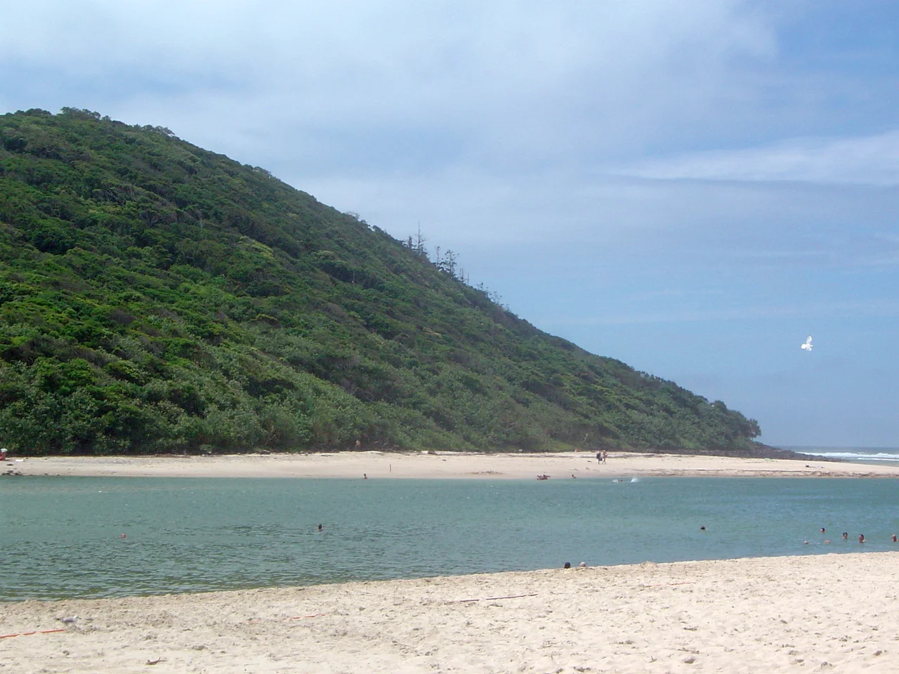

Burleigh Head National Park
Look closely at the basalt columns crowning the headland, and the Kombumerri people will tell you what you are seeing: the fingers of Jabreen. In the first Dreaming, the giant Creator Spirit stepped down from the Milky Way to a land without form. He flung his magical waddy and made the rivers, the mountains, the hills. One day his path led him to the sea, and after a long swim to the horizon and back, he rose to his full towering height and raised his arms to the sky. The flat ground rose with his hands, following his fingertips upward until it stood as a headland, basalt fingers pointing seaward. This is Jellurgal, the Dreaming Mountain, and the small national park wrapped around it holds a great deal more than its 27 hectares would suggest.
The Fingers of Jabreen
For the Kombumerri, the "Salt Water people" who have lived along this coast for more than twenty thousand years, Jellurgal is sacred ground and a place of deep story. The headland was a site of ceremony, and the Dreaming of Jabreen is told as the first Dreaming of all. Knowing this changes how you walk here. The tumbled six-sided basalt columns at the base of the cliff are not just geology; they are the literal fingers of the giant who shaped the world, frozen mid-gesture. The park sits within the country of the Yugambeh-language peoples of the Bundjalung Nation, and the Jellurgal name carries the meaning of the Dreaming Mountain itself. Visit with the awareness that this is living culture, not a relic.
Born of a Vanished Volcano
The science tells a story almost as dramatic as the Dreaming. The headland began to form between 23 and 25 million years ago, when the vast Tweed Volcano was active to the south. Molten basalt poured down the ancient valleys, hardening over softer sedimentary rock. Over millions of years the sea and weather stripped the soft material away, leaving the tough volcanic stone standing 79 metres above the waves. The result is the cliff of black boulders and the famous columns, hexagonal in cross-section, that step down into the surf. The Tweed Volcano is long extinct, its eroded caldera now the great green bowl of the hinterland, but its bones still anchor this coastline against the Pacific.
Rainforest at the Edge of the City
Squeeze a startling range of habitats into one compact park and you get Burleigh Head. Dense subtropical rainforest crowds the summit, giving way to eucalypt forest, coastal heath, tussock grassland, mangroves, and groves of pandanus leaning over the rocks. Rainbow lorikeets shriek through the canopy, feeding on blossom. Lace monitors patrol the leaf litter, echidnas snuffle for ants, and brushtail and ringtail possums move through the trees after dark. The Oceanview track hugs sea level around the rocky shore, linking Burleigh Heads to Tallebudgera Creek, while a rainforest circuit climbs through the forest to the high ground. In December 2014 the coastal track had to close when boulders broke loose and crashed down the slope; it reopened in 2015 once the unstable rock was cleared.
The Wave That Changed Surfing
Off the point, the swell does something rare. It bends around the headland and unzips into a long, hollow, right-hand barrel that peels for hundreds of metres along the rocks. Surfers travel from every corner of the world for it, and Burleigh has been recognised as a World Surfing Reserve, one of a handful of breaks granted that protected status. World-tour events have been held here for decades. On the right swell the wave runs like a freight train, fast and mechanical and merciless, holding its shape across the tides. From the grassy hill above the point, watching the line-up, you see the city's two faces at once: the rainforest at your back, the perfect wave at your feet, and the high-rises of Surfers Paradise shimmering up the beach to the north.
From the Air
Burleigh Head sits at 28.095°S, 153.457°E, on the southern Gold Coast where Tallebudgera Creek meets the Pacific. The dark, rounded basalt headland breaks the long line of golden beach and is easy to spot from the air, with the towers of Surfers Paradise glittering about 12 km to the north. Best viewed from 1,500–3,000 ft for the contrast between rainforest cap and surf-fringed rocks. Gold Coast Airport (YBCG / OOL) at Coolangatta lies roughly 12 km south; Brisbane Airport (YBBN / BNE) is about 90 km north. Coastal sea breezes and summer afternoon storms can reduce visibility; mornings are typically clearest.
Nearby Stories
- Tweed Regional Gallery 7.7 km away
- Purga Aboriginal Cemetery 19 km away
- North Stradbroke Island 21 km away
- Deebing Creek Mission 43 km away
- Bald Rock National Park 105 km away
- HMS Porpoise (1799) 636 km away
- Wreck Reefs 665 km away
- SS Elingamite: Gold, Fog, and a Captain Wrongly Blamed 1833 km away