.JPG)
North Stradbroke Island
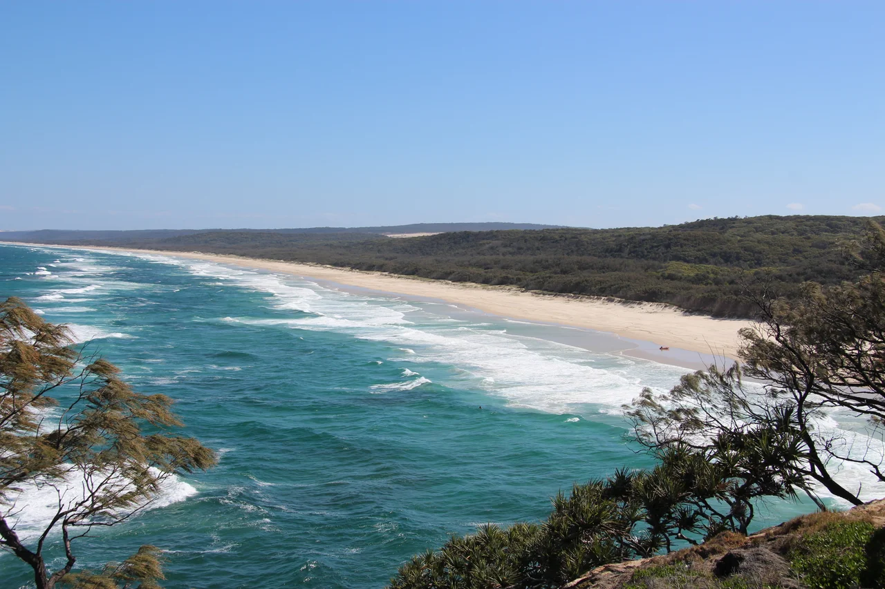
Stand at Point Lookout on a winter morning and the ocean does the talking. Below the headland, humpback whales breach in the channel; manta rays glide like shadows through the swell; turtles surface and sink. For the Quandamooka people, who have read this water for thousands of years, it is simply country. They call the island Minjerribah, and they call the lookout Mulumba. The maps say North Stradbroke Island. The locals just say Straddie. By any name, it is the second-largest sand island on Earth, and after sixty years of being mined out from under its own dunes, it is finally being handed back.
A Whole Island Made of Sand
Almost nothing here is solid rock. Minjerribah is 275 square kilometres of sand piled by wind and current over hundreds of thousands of years, held in place by forest and threaded with more than a hundred freshwater lakes. The strangest of these is Blue Lake, cradled inside Naree Budjong Djara National Park. Spring-fed and astonishingly stable, it has barely changed in 7,500 years, a window onto a wetter Ice Age world that the rest of the continent has long since lost. Down the island's eastern flank runs the Eighteen Mile Swamp, the largest coastal freshwater swamp of its kind anywhere. Long, narrow, and improbably young, it shelters wading birds that migrate here from as far away as Siberia. An island of sand should be a desert. This one holds water like a sponge.
The Quandamooka
The Quandamooka people are the traditional owners of Minjerribah, descended from the Nunukul, Goenpul, and Ngugi. Quandamooka is their word for Moreton Bay itself. When Matthew Flinders came ashore in 1802 looking for fresh water, he left impressed by the islanders' health and their hospitality. The decades that followed repaid that welcome poorly. A British outpost displaced families from Dunwich; missions came and failed; and in 1944, after a twenty-five-year campaign, Aboriginal workers at the Dunwich asylum won equal wages almost two decades before anywhere else in Australia. The island's most famous daughter, the Noonuccal poet and activist Oodgeroo Noonuccal, carried that fight nationwide. In 2011, after a sixteen-year legal proceeding, the Quandamooka's native title over most of the island was formally recognised.
Sixty Years of Dredges
From 1949, the dunes were mined for the dark minerals locked inside their sand, rutile, zircon, ilmenite, the raw materials of paint, plastics, even the glass in tablet screens. At first the work hugged the beach and did little harm. Then in the late 1960s the dredges climbed into the high dunes, levelling hills that had stood for ages and leaving behind a landscape that could be revegetated but never truly remade. Mining and conservation fought for decades, in parliament and the courts. The end, when it came, was decisive: the last and largest operation, the Enterprise mine, closed in 2019, and nearly a quarter of the island was returned to its traditional owners that December. Some 80 percent of Minjerribah is becoming national park, jointly managed by the Quandamooka.
Straddie Now
Today the island runs on different fuel. From Cleveland, ferries carry day-trippers and surfers to three small towns, Dunwich, Amity Point, and Point Lookout, and to thirty-two kilometres of open beach. The North Gorge Walk, a 1.2-kilometre boardwalk loop around the headland at Point Lookout, ranks among the finest coastal walks in southeast Queensland, with whales offshore from June to November. And the culture that survived everything is now front and centre: the annual Quandamooka Festival fills the winter calendar, and QUAMPI, the Quandamooka Arts and Culture Centre, opened in 2025 as a permanent home for the island's art and stories. The dredges are gone. The country remains, and the people who named it are writing what comes next.
From the Air
North Stradbroke Island lies at roughly 27.58 degrees south, 153.47 degrees east, about 30 km southeast of central Brisbane, forming the eastern wall of southern Moreton Bay. From the air it reads as a long sand mass with a surf-pounded outer coast and a sheltered bay side; the rocky outcrop and lighthouse at Point Lookout mark its northeastern tip, and the pale scars of the rehabilitated mine sites are still visible inland. Brisbane Airport (YBBN) sits about 45 km northwest; Archerfield (YBAF) is the nearest general-aviation field. Best viewed from 2,500-4,500 ft on a clear morning, when low sun rakes the dunes and whale spouts may be visible in the channel off the headland. Watch for marine-layer haze over the bay in early morning.
Nearby Stories
- Moreton Island 11 km away
- Dreamworld 17 km away
- North Ipswich Railway Workshops 20 km away
- Woodford Folk Festival 41 km away
- Allan Cunningham Monument 61 km away
- HMS Porpoise (1799) 579 km away
- Wreck Reefs 608 km away
- SS Elingamite: Gold, Fog, and a Captain Wrongly Blamed 1859 km away