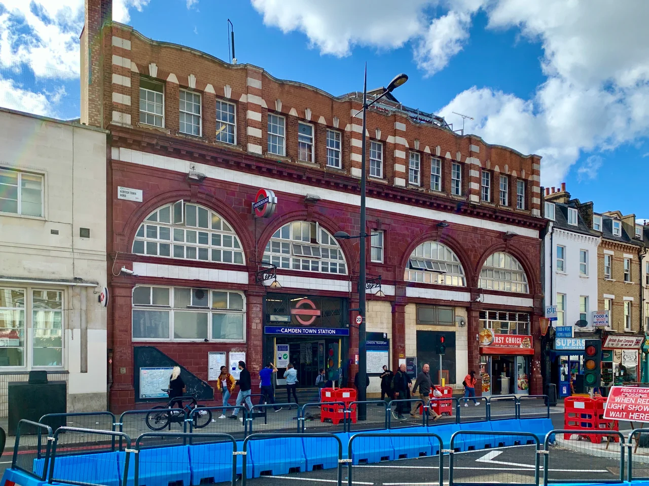

Camden Town Tube Station
On Sunday afternoons, London Underground does something it almost never does: it closes a station to outbound passengers. Not because of a fire alarm or a fault on the line, but because the platform gets too crowded. Too many market-goers, too narrow a platform, too little room to breathe. Camden Town station has been managing this particular crisis since the early 21st century, and it tells you something essential about the place: there is always more demand than the Victorian engineers anticipated.
A V-Shaped Problem
The station's unusual geometry is not an accident — it is a consequence of Victorian frugality. When the Charing Cross, Euston and Hampstead Railway was built in the early 1900s, construction had to stay directly beneath the narrow streets above to avoid paying compensation to landowners. The trouble was that two streets — Chalk Farm Road and Kentish Town Road — meet at an angle of 35 degrees. The only solution was a V-shaped station with the northbound platforms stacked directly above the southbound ones on each branch. American entrepreneur Charles Tyson Yerkes funded the line, and architect Leslie Green designed the surface building in his signature ox-blood terracotta tiles. David Lloyd George, then President of the Board of Trade, opened the station on 22 June 1907.
Eight Tunnels Beneath the High Street
If the V-shape was complicated, the junction beneath Camden High Street is extraordinary. When the City & South London Railway was merged with the original line in the 1920s, engineers needed to connect both northern branches — Edgware and High Barnet — to both southern branches — Bank and Charing Cross — without any conflicting train movements. The result was eight interlocking tunnels threaded together beneath the street, a feat described as one of the most ambitious projects in the history of the Underground. It was accomplished without disrupting existing services. The original lifts, which ran from the apex of the V down to the platforms, were replaced by escalators in 1929. One set of the old lift passages now forms part of the ventilation system; the other still adds to the considerable confusion of passengers trying to navigate the station.
Shelter from the Blitz
On 14 October 1940, a Luftwaffe bomb hit the station. One person was killed. In the months that followed, Camden Town was chosen as one of eight stations on the Northern line to have a dedicated deep-level air-raid shelter constructed alongside the existing tunnels. The shelter, accessible from entrances on Buck Street and Underhill Street, was capable of accommodating 8,000 people across its length — stretching from Hawley Crescent to Greenland Street below the station. These tunnels still exist beneath the markets, sealed now but intact, a reminder of the nights when Londoners descended into the earth to wait out the bombing.
The Station That Cannot Grow Fast Enough
In 2003, a train derailed at the station's complex junction points when a scratch on a newly installed rail allowed a wheel to climb above the track on a tight bend. Seven passengers were injured. The incident highlighted what engineers already knew: Camden Town station is operating at its limits. With only two escalators and platforms built for a quieter era, the station struggles on busy market weekends. Plans have been drawn up repeatedly to expand it — one scheme was cancelled after protests over the demolition of the Electric Ballroom and Buck Street Market. A more recent proposal would build a new entrance on the site of the old Hawley School, tripling the station's capacity without touching the original Leslie Green building. The ox-blood tiles, at least, would survive.
From the Air
Located at 51.539°N, 0.143°W in North London. The station sits directly beneath Camden High Street. Nearest airport for reference is London City (EGLC), roughly 12 miles southeast. The dense urban grid of Camden is visible from altitude, with Regent's Park visible to the south and the hills of Hampstead to the north.
Nearby Stories
- Stevenage 5.7 km away
- Malling Abbey 5.7 km away
- 1952 Farnborough Airshow Crash 7.7 km away
- Ingatestone Hall 8.2 km away
- Hellfire Caves 9.1 km away
- The Carrington Event: The Solar Storm That Could Happen Again 9.8 km away
- Bletchley Park 16 km away
- Castle Hedingham 23 km away