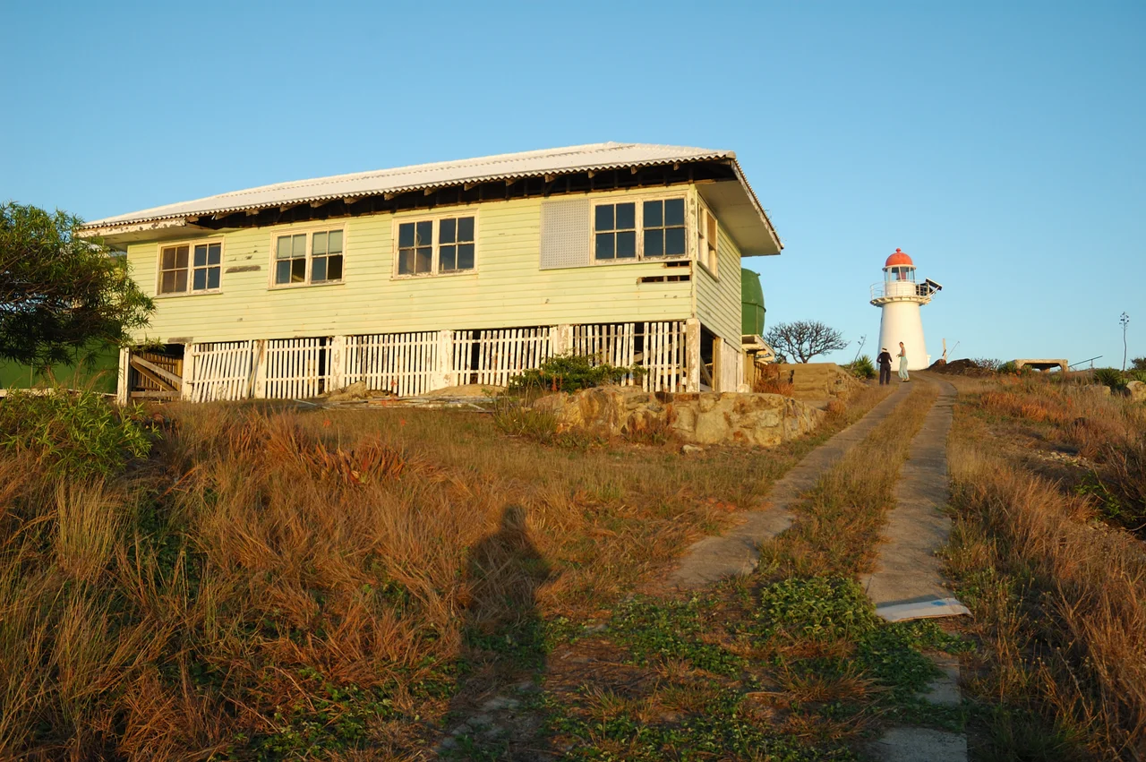

Cape Cleveland Light
Every seventy-five minutes, around the clock, the keeper had to climb to the weights and wind them again. The tower at Cape Cleveland stood only thirty-six feet tall, too short to give the clockwork mechanism much fall, so the chore never ended. Through the night, through the wet-season storms that lash this stretch of the Queensland coast, someone was always awake and winding. That relentless duty has defined this little lighthouse since 1879, perched on a wild granite headland forty kilometres east of Townsville, watching over the entrance to Cleveland Bay.
Why a Light Was Needed Here
James Cook named the cape in 1770 as he charted this coast, possibly honouring John Clevland, a secretary to the British Admiralty, or the English region of his own birth. For nearly a century the headland was just a hazard. Then, in 1865, Cleveland Bay was proclaimed a port of entry, and Townsville began its rise into a major harbour. Ships needed guidance past the rocks. Commander George Poynter Heath of the Queensland Marine Board recommended a light here in early 1878, paired with one at Dent Island. Both were approved that April, and after the original contractor struck personal trouble, John Clark and James Wiseman finished the two stations in December 1879.
Iron Over Timber
The lighthouse was the work of F. D. G. Stanley, the Queensland Colonial Architect, and the thirteenth raised by the colony's government. It was built in a method peculiar to Queensland: a frame of timber, then clad in non-structural plates of riveted galvanised iron, painted white and capped with a copper cupola painted red. The squat circular tower measures just 6.7 metres from base to lantern. Unusually, the rest of the station was laid out to follow the contours of the rocky site rather than in the neat straight rows favoured elsewhere. In 1926 the light was upgraded to a brilliant acetylene gas lamp, and over the decades the lens, cottages and outbuildings were renewed more than once.
A Watchtower in Wartime
During the Second World War, Cape Cleveland took on a second life. Townsville had become one of the largest Allied bases in the South West Pacific, a launching point for the air war over New Guinea, and the headland's commanding view made it a natural observation post. Crews built a watching platform, a radar hut and a powerhouse on the cape. Today only ruins survive: a bunker-like concrete powerhouse, a few foundations, fragments of the lookout. The Queensland sun and salt air have been hard on everything here, and the timber keepers' cottages, last rebuilt in 1953, have weathered toward dilapidation.
The Light That Tends Itself
The keepers are long gone. On 19 September 1987 the light was switched to solar power, and that December the station was demanned after more than a century of human company. The lamp still turns, now a modern rotating beacon flashing every 7.5 seconds, white across the open approaches and red as a warning over Four Foot Rock, visible up to fifteen nautical miles out to sea. The Australian Maritime Safety Authority runs it remotely; the site itself, reachable only by boat or helicopter, is closed to the public. Listed on the Queensland Heritage Register in 1998, the little tower keeps its watch alone, the way it always did through those long winding nights.
From the Air
Cape Cleveland Light sits at the northern tip of the Cape Cleveland headland at -19.183, 147.015, about 40 km east-southeast of Townsville at the southeastern edge of Cleveland Bay, within Bowling Green Bay National Park. From the air the cape is a bold, dark granite promontory thrusting into the blue Coral Sea, a striking contrast to the flat coastal plain behind it; Magnetic Island lies to the northwest. The lighthouse itself is tiny and white, best spotted by the headland's dramatic shape rather than the structure. Nearest airport is Townsville (ICAO YBTL), roughly 40 km west. Recommended viewing altitude 2,000-4,000 ft to appreciate the headland and bay together. Clear, calm mornings give the best water clarity and the cleanest light on the granite.
Nearby Stories
- Bindal People 15 km away
- Herveys Range Heritage Tea Rooms 19 km away
- Cape Upstart National Park 25 km away
- Great Palm Island 28 km away
- SS Gothenburg 44 km away
- Palm Island, Queensland 64 km away
- Venus State Battery 72 km away
- Samarai 985 km away