
Cape Upstart National Park
Cook gave it the bluntest name on the whole coast. Sailing past on 5 June 1770, he watched a great granite headland heave up out of the low, flat shoreline around it, standing alone and abrupt while everything beside it lay nearly level with the sea. It "starts or riseth up singley," he wrote, and so he called it Cape Upstart. The name fits. Between Bowen and Townsville, where the coast is mostly mangrove and sugar flat, this pile of giant weathered boulders rears up like something dropped from another landscape - remote, trackless, and far older in human memory than any English chart.
A Coast of Boulders
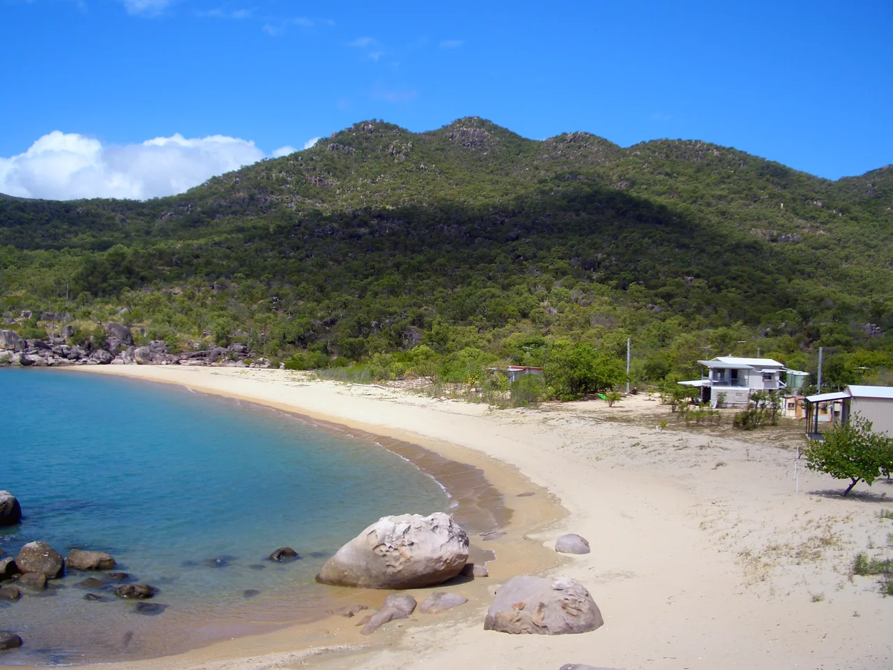
The cape is a chaos of granite. Massive rounded boulders, stacked and tumbled by tens of millions of years of weathering, climb from sandy beaches into rugged hills cloaked in dry coastal woodland. There are no roads in; the park is reached mainly by boat, and its beaches and bays stay quiet for it. Sheltered coves break the wall of stone, and from the water the headland reads exactly as Cook described it - a singular mass rising where the land around it refuses to. It is the kind of coastline that rewards effort, beautiful precisely because so few people make the trip to see it.
Juru Country
Long before any sail appeared offshore, the Juru clan of the Birri-Gubba people lived on this cape, and they had done so for thousands of years. The evidence is written into the dunes as middens, shell heaps built up over countless generations of meals taken from the sea. There are sacred places here too: a women's area at Worrungu Bay, and stone arrangements near Mine Island that outsiders once misread as fish traps. The senior elders were always clear that they were nothing of the kind. They were ceremonial ground, laid out for initiation, and they mattered far more than any practical use a passing surveyor might have imagined.
The Path of the Carpet Snake
Those stone arrangements trace a creation story. In the Gubulla Munda Dreaming of the Juru and Birri-Gubba people, Gubulla Munda the Carpet Snake moved across this country, and as the great snake travelled it shaped the land and the islands where the Juru came to live. The stones at Cape Upstart map those journeys, marking the routes the totem took in the beginning. To stand among them is to read a text written on the ground itself, one that holds the origin of the place and its people in the same lines - a story far older than the name on the chart, and still alive in the keeping of those who belong here.
Twenty Years to Be Heard
The law took a long time to acknowledge what the Juru had never doubted. In 2011, Justice Rares of the Federal Court of Australia recognised that the Juru people held Native Title over Cape Upstart National Park - the end of a twenty-year fight. Peter Prior, known as Gulumba, began the claim in 1992, and his daughter Renarta Prior, known as Gootha, carried it through to completion in 2012, after her father had passed. It was a victory measured in patience: two decades of work to secure formal recognition of a connection to country that stretched back thousands of years. The middens and the stone paths had said it all along. The courts simply caught up.
Shacks on the Foreshore
There is one stranger chapter to the cape. From the early twentieth century, farmers from the Burdekin district downriver began throwing up rough huts along the western foreshore, modest fishing shacks for weekends and holidays. Over the decades the huts grew sturdier and a small permanent population took root, until a scatter of dwellings stood beneath the granite where there is still no road. The result is a curious community at the edge of a wilderness park, reached only by boat or by sea, living in the lee of the same boulders the Juru have known since the Dreaming. Few stretches of Australian coast hold quite this mix - ancient sacred ground, a passing navigator's offhand name, and a knot of holiday shacks - all stacked beneath one improbable wall of stone.
From the Air
Cape Upstart National Park sits at 19.71 degrees south, 147.76 degrees east, on the North Queensland coast between Bowen and Townsville, within the locality of Guthalungra. From the air it is unmistakable: a bold granite headland and tumbled boulder hills rising sharply from an otherwise low, flat coastline of mangrove and farmland, fringed by sandy beaches and sheltered bays - exactly the 'upstart' profile Cook named in 1770. The nearest major airport is Townsville (YBTL / TSV) to the northwest; Whitsunday Coast Airport at Proserpine (YBPN / PPP) lies to the southeast. Recommended viewing altitude is 2,500 to 5,000 ft along the coast. The park has no road access, so expect undeveloped terrain below. Watch for sea breezes and convective cloud over the headland on hot, humid afternoons.
Nearby Stories
- Bindal People 22 km away
- SS Gothenburg 28 km away
- Great Barrier Reef 36 km away
- Imperial Hotel, Ravenswood 44 km away
- Airlie Beach 45 km away
- Cape Cleveland Light 48 km away
- Strathmore Homestead 55 km away
- Hayman Island 63 km away