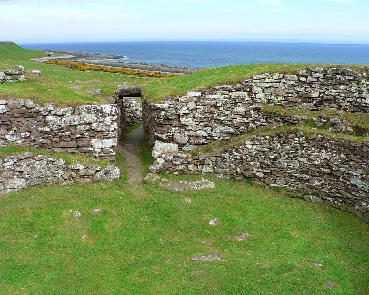

Càrn Liath Broch
A whale bone club. That is one of the objects Iron Age people left behind at Càrn Liath, the broch that has stood beside the modern A9 road for roughly two thousand years. The dig also turned up pottery, flint, stone hammers, mortars, pestles, querns for grinding grain, shale rings, long-handled bone combs, a silver fibula brooch, steatite cups carved from soapstone imported from Shetland, and an iron blade. People lived here. They cooked, ground corn, fastened cloaks with imported brooches, drank from soapstone cups, and used a whale-bone club for some purpose lost to us now. Four kilometres northeast of Golspie, with the North Sea behind it and the Sutherland hills rising west, Càrn Liath is a quiet astonishment.
Tower of the Picts
Brochs are unique to Iron Age Scotland - drystone towers, built without mortar, with double walls separated by hollow galleries and intramural stairs that climbed inside the wall thickness. The best-preserved examples, on Mousa in Shetland or at Dun Carloway on Lewis, still stand close to their original height of 40 feet or more. Càrn Liath is more modest. The external diameter is about 19 metres; the internal chamber about 10 metres across. The wall thickness leaves room for the characteristic broch features - a small guard cell on the right of the entrance passage, the foundations of a mural staircase. Built sometime between roughly 200 BC and 100 AD, it would have dominated the coast: a stone tower visible from the sea, a defensible refuge, a statement that someone important lived here.
Before the Broch
The 1986 excavation revealed something unexpected. Càrn Liath was not the first settlement on this spot. The site had been occupied in the Bronze Age, centuries before the broch was built. A cist burial - a stone-lined grave - was found beneath the later structures, containing a food vessel of the type buried with the dead in the second millennium BC. Whoever built the broch chose to build it directly on top of a place that already mattered. They may not have known why; the Bronze Age memories would have been a thousand years old by then. But the location had history before it had a tower.
The Village Around the Tower
The broch did not stand alone. The 1986 dig uncovered the foundations of many outbuildings in the enclosure surrounding it - some clearly built later, in the centuries after the broch fell out of use, but some possibly contemporary with the tower itself. The picture that emerges is of a small Iron Age settlement: the broch as the principal dwelling and defensive structure, lesser buildings clustered around it for livestock, storage, secondary households, workshops. The finds confirm the daily texture of that life. Querns mean grain was being ground here, so cereal was being grown or imported. Steatite from Shetland means trade routes were operating along the coast. The whale-bone club means someone, sometime, took advantage of a stranded whale - a windfall that could feed a community for weeks.
Disappearing Walls
Càrn Liath has been slowly worn down over the centuries. In 1909, the entrance passage was still clearly visible on the east side of the broch. By 1960, no structural features were discernible above ground - the tower's lower courses had been buried under collapse and turf. The 1986 excavation cleared much of this away, and today the site is in the care of Historic Environment Scotland, with a car park and information board for visitors who stop on the A9. Walk through the entrance passage and you can still see the guard cell on the right, the curve of the inner wall, the hollow heart of a 2,000-year-old Highland tower.
From the Air
Càrn Liath sits at 57.99°N, 3.91°W on the Sutherland coast, 4 kilometres northeast of Golspie, immediately beside the A9 road on a low rise above the shoreline. From cruise altitude over Inverness (EGPE), 55 miles south, follow the A9 corridor up the east coast past Tain, across the Dornoch Bridge, through Dornoch and Embo. Golspie sits at the foot of Ben Bhraggie - the hill with the controversial statue of the 1st Duke of Sutherland on its summit, visible from miles. The broch lies between Golspie and Brora; Dunrobin Castle sits between them, its conical French-style turrets unmistakable. Best viewed at 1,500-2,500 ft AGL in clear weather; the broch site is most visible from oblique angles when shadows pick out the circular wall.
Nearby Stories
- North Coast 500 5.8 km away
- Pluscarden Abbey 7.7 km away
- Fort George, Highland 8.2 km away
- Conon Hydro Scheme 12 km away
- Caithness and Sutherland Peatlands 19 km away
- Moray Firth 19 km away
- Hill o' Many Stanes 24 km away
- Kylesku Bridge 28 km away