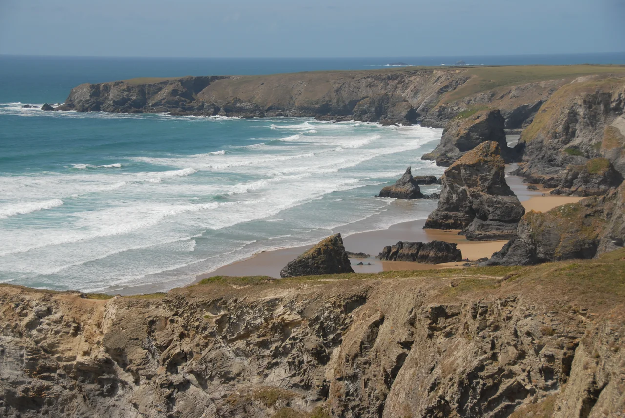

Carnewas and Bedruthan Steps
There is a Cornish folk tradition that a giant named Bedruthan used the rock stacks below the cliffs here as stepping stones to wade north across the bay. It is almost certainly nineteenth-century invention - a piece of romantic naming for Victorian tourists - but the stacks themselves look the part. Five great pinnacles of Middle Devonian slate stand offshore at low tide, sea-cut and weather-rounded, in a line that draws the eye north along the cliff toward Park Head. Carnewas, the Cornish name for the headland, means 'rock-pile of the summer dwelling'. The combined name has been on Ordnance Survey maps since the nineteenth century. The thing itself has been there for tens of millions of years.
Born of Slow Slates
The bedrock at Bedruthan is Middle Devonian slate, roughly 386 to 377 million years old, laid down as fine mud on the floor of a tropical sea that no longer exists. The slate beds run more than 2,000 metres thick here. Marine erosion has eaten away the weaker rock - softer mudstone and siltstone of the Bedruthan Formation - and left the harder slate standing as the stacks you see today. At the end of Park Head, beyond the stacks, the rock changes to dolerite, a subvolcanic intrusion that came up through fissures in the slate and now forms the dark, blunt headland. Fossils of fish, corals and trilobites have been found in the Eifelian slates on Samaritan and Pendarves Islands. One specimen of Pteroconus mirus dates the formations more precisely - though, in the cautious phrasing of geologists, the dating remains problematic.
Three Forts and a Longstone
People were watching this coast long before tourism. Bronze Age burial mounds sit on the headlands north of Bedruthan. Three Iron Age promontory forts crown the surrounding cliffs - Redcliff Castle directly overlooking the steps, another at Park Head a mile north, and a third at Griffin's Point two miles south. Cliff castles like these are thought by archaeologists to have been permanently occupied, defended on three sides by sheer drops and on the fourth by ramparts and ditches. The interior of Redcliff Castle has largely been eaten by the sea. In 2009, a nine-foot menhir or longstone - a single standing stone of unknown date - was discovered lying on its side in a boundary hedge near the coast path. It had been there, in plain sight, for who knows how long. Cornwall is full of objects that are obvious once you notice them, and invisible until you do.
Samaritan Island
The stack closest to the southern end of the beach is called Samaritan Island. It is named for the Good Samaritan, a ship wrecked there in October 1846 with the loss of nine lives. One source dates the wreck to 1850, but the name and the dead are real either way. The signs at the top of the steep steps down to the beach warn visitors plainly: do not swim. Rip currents run hard along this stretch, the tide comes in faster than people think, and submerged rocks lurk where the eye sees only sand. Carnewas mine, just inland, began in 1855 chasing a lead lode accessible from the tideline at low water. It pulled silver, copper-antimony and a little nickel from the cliffs until 1863, reopened for iron ore from 1868 to 1874, and produced over 6,000 tons of hematite before closing for good. Mine shafts still pock the cliffs at Trenance Point.
Dark Sky, Painter's Sky
In 2014 the area was granted Dark Sky discovery site status by the Science and Technology Facilities Council, an organisation that requires darkness, accessibility and a good unobstructed view of the Milky Way before it hands the title out. The clifftops here meet all three. Twenty miles inland the lights of Newquay and Padstow throw a glow against the southern horizon, but stand at Bedruthan after midnight and the Milky Way crosses overhead almost as clearly as it does in remote moorland. The same darkness is part of why painters have come here since the Victorian era - the cliffs, the stacks, the light, the moving weather. The South West Coast Path runs along the headland, and the National Trust maintains a shop and café at Carnewas. The Trust does not own the stacks themselves; they belong, as they always have, to the sea.
Closed Stairs, Open Cliffs
A rockfall in February 2020 damaged the lower steps that allow access to the beach at low tide, and the stairway has been closed since. The Trust manages the cliffs above; the beach below is no longer reachable from the steps. For most visitors this does not matter - the view from the clifftop is what people come for. Spring squill and sea pink hold the thin soil between gusts. The wind here is reliably westerly, and the clifftops support only low plants - bird's-foot trefoil, kidney vetch, sheep's-bit and sea campion - that can survive the salt blast. From the higher coast path on a clear day you can see all the way north to Trevose Head, lighthouse and all. The stacks stand below in their unbroken line. The giant did not need them. Geology and time did the rest.
From the Air
Bedruthan Steps sits at 50.49°N, 5.03°W on the north Cornish coast, halfway between Padstow and Newquay. Newquay Cornwall Airport (EGHQ) is just six miles south-south-west - the most prominent man-made feature within view. From a few thousand feet the stacks appear as a chain of dark pinnacles in pale sand at low tide, or as islands at high tide. Park Head, the dolerite headland just to the north, is the obvious visual anchor. Approach along the coast from the south for the most dramatic view; mid-afternoon light makes the slate stacks stand sharply against the surf.
Nearby Stories
- Jamaica Inn 2.8 km away
- Bude 3.3 km away
- Truro 3.5 km away
- Pendeen Lighthouse 13 km away
- Eddystone Lighthouse 24 km away
- HMHS Glenart Castle 35 km away
- Morvah 42 km away
- Hook Lighthouse 173 km away