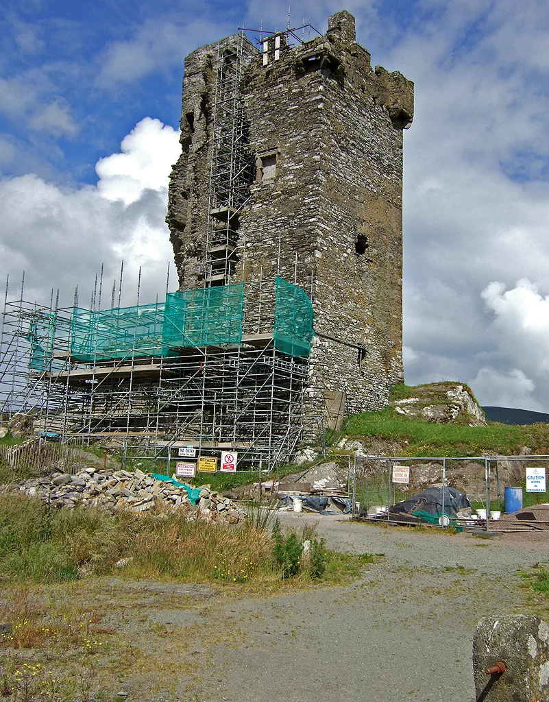

Castle Donovan
It stands on a great outcrop of rock by the bank of the River Ilen, sixty feet of pale limestone, the spiral staircase inside still climbing intact while the western wall around it long ago fell away. Castle Donovan was a tower house of the Clann Cathail sept of the O'Donovans, built or augmented in the sixteenth century, blown up in retaliation by Cromwell's soldiers in the late 1640s, and left as a ruin watching the valley near Drimoleague ever since. By the time the Office of Public Works finished its conservation work in 2014, the tower had been uninhabited for nearly four hundred years.
The Clann Cathail Sept
Before any English garrison arrived, the lands around the upper Ilen were O'Donovan country. The O'Donovans were one of the great native families of southwest Munster, descended through the Eoghanachta line that had once supplied kings to Cashel. By the sixteenth century they had divided into several septs - branches of the family with their own territories. The Clann Cathail held this valley. Their original name for the castle was Sowagh; only later did it come to be known as the Castle of O'Donovan, or Castle Donovan, after the Manor of which it was the seat. Donal of the Hides, Lord of Clancahill from around 1560 until his death in 1584, is credited with building or substantially augmenting the tower. His son Donal II carried out further work some decades later, though by then the family had relocated to Rahine Manor on the coast, where Atlantic trade was more profitable than upland farming.
What Cromwell's Soldiers Did
By the late 1640s, the Irish Confederate Wars had been grinding through Munster for years. Donal III O'Donovan had taken the Stuart side, supporting Charles I and his cause; he had also been implicated in the rebellion and massacres of 1641, when the rising of Catholic Irish against settlers and English authority spilled over into the killing of Protestant civilians whose deaths haunted English politics for the next two decades. When Oliver Cromwell's New Model Army swept through Ireland in 1649-50, it carried with it a determination to break the power of Catholic landowners and the strongholds they held. The tradition is that Cromwell's soldiers placed gunpowder against Castle Donovan and blew it up. The damage was specific: a small gouge in the southwest corner, but with deep cracks radiating through the masonry. The tower was left structurally unsafe, and the O'Donovans, who in any case had moved out long before, never returned to live in it.
Two Centuries of Slow Collapse
After the explosion, the tower stood, but its days as a building were finished. The bawn - the surrounding fortified wall - and the outbuildings disappeared into stone-robbed fields. In 1828, a traveller identified only as J.F.W. visited what he called the vale of Castle Donovan and made a drawing that still showed several outbuildings then intact. His account, published in the Dublin Penny Journal in November 1834, captured the place in a phase of its long ruin. The cracks deepened with each century. Eventually, more than two hundred years after the gunpowder, the entire western wall - except for the still-intact spiral staircase tucked inside it - collapsed. Most of the southern wall went with it. What remains today is over two-thirds of the original tower, but the silhouette from certain angles tells the story: the building has lost a face. Between 2001 and 2014, the Office of Public Works carried out conservation work, stabilizing what was left as a listed National Monument. The tower will not fall further. It will not, however, be rebuilt.
From the Air
Castle Donovan stands at 51.69 degrees north, 9.28 degrees west, in a valley near Drimoleague in County Cork, close to the bank of the River Ilen. The tower appears from the air as a distinct stone shaft on its rocky outcrop, set against the green pasture of the upper Ilen valley. Drimoleague is the nearest village. From cruising altitude the surrounding landscape is recognizable as classic West Cork - small fields enclosed by stone walls and hedgerows, with the rugged uplands of the Mizen and Sheep's Head peninsulas visible to the south and west. Nearest international airport is Cork (EICK), about 70 km east; Kerry (EIKY) lies to the northwest.
Nearby Stories
- Cloghan Castle, Lough Hyne 1.2 km away
- Headford Ambush 2.2 km away
- Caragh Lake 2.6 km away
- Bandon, County Cork 3.9 km away
- Ardgroom 4.6 km away
- Horse Racing in Ireland 13 km away
- The Sinking of the Lusitania: The Torpedo That Changed the War 20 km away
- HMHS Llandovery Castle 23 km away