
Ardgroom
The Irish name Dhá Dhrom means simply 'two ridges'. The two ridges in question are Dromárd and Drombeg, a pair of low gravelly hills left here by a retreating glacier at the end of the last ice age, around twelve thousand years ago. The English name Ardgroom evolved later, and slightly misleadingly, but the geology behind the place name is honest. Walk out from the village in any direction and you find yourself on glacial debris: rounded boulders dumped by a melting ice sheet, a freshwater lough nearby in Glenbeg, and beyond all of it the Slieve Miskish Mountains rising behind the coast. Somewhere in that landscape, between three and four thousand years ago, people built a stone circle that is still mostly upright.
Eleven Stones, Nine Still Standing
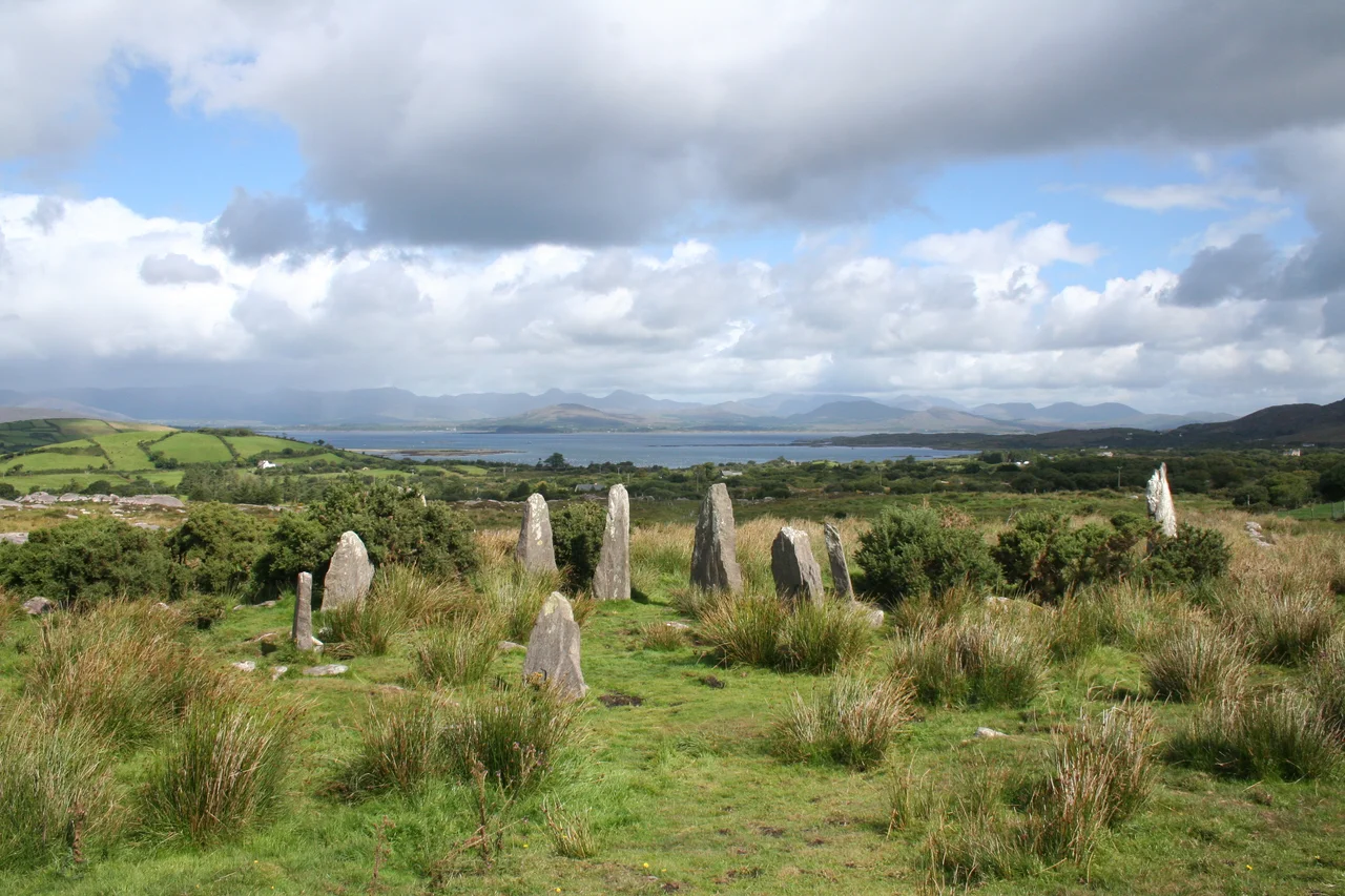
The Ardgroom stone circle, sometimes called Canfea after its townland, stands about a mile east of the village, off the old Kenmare road. Eleven stones form the original ring; nine of them are still upright, an outlier stands a short distance away in what archaeologists call an alignment position. The circle is unusual for a feature its members notice immediately: the stones taper toward points, like worn fangs set into the hillside. Most Beara circles use blockier, flatter slabs. The taper at Ardgroom may be deliberate, or it may simply reflect the local stone, but in late afternoon light, when the sun rakes the ring from the west, it gives the whole structure a sharper silhouette than most of its cousins.
What the Builders Were Doing
Stone circles on the Beara peninsula belong, in the broadest sense, to the same Bronze Age tradition that runs across Ireland and Britain. They were almost certainly not pure observatories, although some appear oriented to solstice sunrises or moon-sets. They were almost certainly not pure temples, although ritual was part of their use. The best modern guess is that they served local communities as gathering places, calendar markers, and signs of ownership of the surrounding land, with the religious and the practical wound up together in ways modern eyes find hard to separate. The Ardgroom circle's outlier stone, set apart from the main ring, may have functioned as a foresight; a sunrise sighted across it would hit a particular point on the visible hill ridge at a particular date. Whether anyone took that sighting any more, no one knows.
And Plenty More Nearby
About a mile northeast of the main circle lie the remains of another, less complete stone circle. There are at least two ring forts in the immediate vicinity, plus a scatter of standing stones and short stone rows. The Beara peninsula is one of the densest archaeological landscapes in Ireland, a place where every kilometre of country lane seems to pass a megalithic monument of some sort. Most of them are unsignposted; you find them by knowing where to look or by trusting a local who points across a fence and says, 'That one, over there.' A village of Ardgroom's size, with one shop, a post office, a petrol pump, and one pub called The Village Inn, sits at the centre of more prehistory than any of its residents will ever finish exploring.
Living Above Kenmare River
Ardgroom looks out across the Kenmare River, a long sea inlet rather than a true river, with the mountains of the Iveragh Peninsula rising on the far shore. To the south the land climbs into the Slieve Miskish range; to the west the Beara peninsula narrows toward Eyeries and eventually Dursey Island and the open Atlantic. The village pub is the social centre, the post office handles a lot of conversation as well as letters, and the petrol station serves the kind of farming community that still moves cattle along narrow roads and still pulls trout from Glenbeg Lough. The stone circle, eleven tapered stones in a quiet field, is older than every other thing in the parish, and it is treated with the casual respect such a thing is owed in a country where deep time is part of the view.
From the Air
Ardgroom sits at 51.74 N, 9.89 W on the north side of the Beara peninsula in County Cork, overlooking the Kenmare River estuary. Best viewed at 2,000-4,000 ft. The village is small, hugging the coast between the Slieve Miskish Mountains and the inlet. Glenbeg Lough is visible to the southeast. The Iveragh Peninsula rises across the Kenmare River to the north. Nearest airport is Kerry (EIKY), 30 nm north-northeast. Weather on the Beara peninsula can be wetter than the Kerry coast; clear days reveal one of Ireland's densest concentrations of stone circles and megalithic monuments.
Nearby Stories
- Farranfore–Valentia Harbour line 3.3 km away
- Heir Island 4.1 km away
- Inishvickillane 4.4 km away
- Kealkill stone circle 8.7 km away
- Headford Ambush 10 km away
- Dunlough Castle 13 km away
- SM U-68 27 km away
- Sao Miguel 1923 km away